Download
1 / 63
640 likes | 756 Views
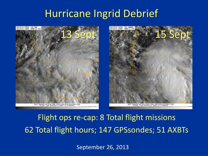
Hurricane Ingrid Debrief. 13 Sept. 15 Sept. Flight ops re-cap: 8 T otal flight missions 62 Total flight hours; 147 GPSsondes ; 51 AXBTs. September 26, 2013. Agenda. Missions Overview ( Reasor ) Science Discussions G-IV : TDR ( Gamache ) N42: TDR (Rogers)

E N D
Hurricane Ingrid Debrief 13 Sept 15 Sept Flight ops re-cap: 8Total flight missions 62 Total flight hours;147GPSsondes; 51 AXBTs September 26, 2013
Agenda • Missions Overview (Reasor) • Science Discussions • G-IV: TDR (Gamache) • N42: TDR (Rogers) • N43: TDR/OW/Shear (Uhlhorn/Chang/Reasor) • NASA HS3 Coordination (Rogers/Dunion/Chang) • Additional Field Program Issues • HWIND/Modeling/HEDAS (Murillo/Zhang/Aksoy/Aberson)
Missions Overview • Purpose: Collect P-3 TDR data for assimilation into the operational HWRF model, and further test the G-IV TDR system and flight patterns. • Target: TD10/TS Ingrid on 13 Sept in the s. Bay of Campeche; Hurricane Ingrid (5PM) on 14 Sept; barely-Hurricane Ingrid on 15 Sept • Background: P34/93L moved off the w. Yucatan coast on 12 Sept with a 60% (80%) chance of development in 2 (5) days. A ‘go’ decision required the center to be far enough off the s. Bay of Campeche coastline.
Missions Overview • 13 Sept: G-IV (9AM) circumnavigation pattern; N43 (2PM) figure-4 pattern • 14 Sept: N42 (2AM) figure-4 pattern; G-IV (9AM) circumnavigation pattern; N43 (2PM) figure-4 and OW pattern • 15 Sept: N42 (2AM) figure-4 pattern; G-IV (9AM) circumnavigation pattern; N43 (2PM) figure-4, circumnavigation, and OW pattern (recover in Corpus Christi, TX)
Missions Highlights • Scientifically interesting case of intensification from TD to Hurricane under sustained moderate westerly vertical wind shear. 13th 14th 15th
Missions Highlights • NOAA flights referenced in NHC discussions: • 13 Sept (5PM): THE CENTRAL PRESSURE ESTIMATED FROM A DROPSONDE FROM THE NOAA G-IV JET EARLIER TODAY WAS 999 MB. • 13 Sept (8PM): DATA FROM NOAA AND AIR FORCE RESERVE HURRICANE HUNTER AIRCRAFT INDICATE THAT INGRID HAS STRENGTHENED...AIRCRAFT DATA ALSO INDICATE THAT THE WIND FIELD HAS EXPANDED IN SIZE. • 14 Sept (2PM): SATELLITE IMAGES AND INFORMATION FROM THE METEOROLOGIST ONBOARD THE NOAA JET SUGGEST THAT AN EYE COULD FORMING. • 14 Sept (11PM): THE NOAA P-3 REPORTED SEVERAL SFMR WINDS IN THE 70-75 KT RANGE AFTER CORRECTING FOR THE INFLUENCE OF RAIN...AND DATA FROM TWO DROPSONDES NORTHEAST OF THE CENTER FROM THE NOAA AIRCRAFT ALSO SUGGEST SURFACE WINDS IN THE 70-75 KT RANGE...MICROWAVE IMAGERY SHOWED THE FORMATION OF A PARTIAL EYEWALL...WHICH WAS ALSO NOTED BY PERSONNEL ON THE NOAA AIRCRAFT. • 15 Sept (11AM): NOAAAND AIR FORCE RESERVE AIRCRAFT JUST COMPLETED SEVERAL HOURS OF INVESTIGATION OF INGRID...AND FOUND LITTLE TO INDICATE THAT THE CYCLONE IS STILL A HURRICANE. • 15 Sept (5PM): VISIBLE SATELLITE IMAGES AND DROPSONDE DATA FROM A NOAA G-IV MISSION INDICATE THAT THE CENTER OF INGRID REMAINS NEAR THE WESTERN EDGE OF THE DEEP CONVECTION DUE TO MODERATE WESTERLY SHEAR. • 15 Sept (11PM): AROUND 21-22Z...A NOAA AIRCRAFT MEASURED A CENTRAL PRESSURE OF 987 MB.
Missions Highlights • G-IV and P-3 QC’d TDR data transmitted to the ground in real time • 6-hourly TDR sampling of the TC core region between the N42 and N43 flights • G-IV circumnavigation pattern flown at 60, 90, and 120 nm radius (~4-8xRMW) from TC center • Ground-based sonde processing and TDR job file creation tested • TC-in-shear pattern tested during N43’s last flight
Science Discussions • G-IV TDR (Gamache) • N42 TDR (Rogers) • N43 TDR/Shear (Uhlhorn/Reasor) • Ocean Winds (Chang)
20130914N1 20130913N1 20130915N1
G-IV analyses during Ingrid • 20130913N1-20130915N1 • Job files made by Gamache at home all 3 days (as well as for NOAA43) • Job files accessed by NOAA 49 • Joe Greene ran analysis on 20130913N1 and 20130914N1, Alan Goldstein on 20130915N1 • Analyses and superobs sent in real time • Timing problem between fore and aft continued to create artificial tilt in aft sweeps—seen in all three flights • Data transferred successfully to EMC on all 5 missions (based upon AOC ftp site information)
G-IV analyses during Ingrid • 20130914N1 • StartRawCopy (rsync) not run initially • hrd49 froze up before last analysis finished and transmitted—as G-IV was on approach • 20150915N1 • Decided not to start processing until first circle finished • Processing not finished before landing—about 20 min on ground • Gamache researching more parallel processing with Goldstein’s collaboration
Takeaway points • Remote jobfile creation works—but could be sped up to require less ground-aircraft interaction—Alan suggested AOC learning jobfile_display • Either analysis must be faster or can’t do whole large-circle analyses..maybe both—G-IV is a challenge—twice the data in same amount of time and returns to base 30-40% faster. • Progress happening on java jobfile_display so others without linux can set up jobs on the ground. • G-IV TDR angle problems continue—still being addressed by King Air subcontractor.
NOAA Flight 130914H1 Tropical Storm Ingrid LPS: R. Rogers Radar: H. Chen Dropsonde, AXBT: J. Zhang • MISSION GOALS • TDR/RAPX mission into T.S. Ingrid • MISSION SUMMARY • storm getting better organized • deep convection on northeast side of storm; mostly stratiform on southwest side • wind asymmetry rotates between 1 and 7 km • vortex nearly vertically aligned • MSLP measurements ~989 hPa, peak SFMR winds ~60 kt • 11 sondes and 10 AXBT’s dropped
Long-range radar image (dBZ) from Alvarado radar site valid 0530 UTC Sept 14
Environmental conditions at time of take-off 850-200 hPa vertical shear (kt) valid 06 UTC Sept. 14 SSMI Total Precipitable Water (mm) valid 06 UTC Sept. 14
Satellite imagery during mission Visible at 1245 UTC Infrared at 1245 UTC 91 GHz MW at 1149 UTC
Locations of deep convection 2-km winds (m/s) and 16-km reflectivity (dBZ) reflectivity (dBZ) B A height (m) A B
Doppler-derived winds and drops 1 km 7 km
NOAA Flight 130915H1 Hurricane Ingrid LPS: R. Rogers Radar: H. Chen Dropsonde, AXBT: J. Zhang • MISSION GOALS • TDR/RAPX mission into Hurricane Ingrid • MISSION SUMMARY • storm showing classic shear structure • precipitation only on one side – the east, or downshear side • open eyewall on the right side of the shear, spiral band wrapping through the downshear side • vigorous convection only in upwind portion of the spiral band, and limited amount in northern eyewall • peak SFMR winds ~65-70 kt on northeast side, pronounced across-storm asymmetry • radar shows tilt of ~30-40 km toward northeast between 2 and 8 km • 17 sondes and 10 AXBT’s dropped
Environmental conditions at time of take-off 850-200 hPa vertical shear (kt) valid 06 UTC Sept. 15
Satellite imagery prior to mission attempted eye formation?
Satellite imagery during mission Visible at 1255 UTC Infrared at 1255 UTC 91 GHz MW at 1207 UTC
Reflectivity and Doppler-derived winds Reflectivity at 4 km (dBZ) and wind vectors at 2 km (m/s) Reflectivity at 10 km (dBZ) and 2-km winds (black) and 8-km winds (red)
TS Ingrid - 20130913I1 • 10 Sondes • 10 AXBTs • W/S legs cut due to proximity to Mexico
H Ingrid - 20130914I1 • 17 Sondes • 10 AXBTs • Figure-4, Ocean Winds racetracks • 5 penetrations
H Ingrid - 20130915I1 • 26 Sondes • 10 AXBTs • Figure-4, Circumnavigation at ~2RMW, Ocean Winds racetracks, coordination with AV-1 unsuccessful • 7 penetrations
N43: TC in Shear (15 Sept) • Initial figure-4 helps define RMW and TC center • Circumnavigation pattern at 2xRMW yields another look at core wind/reflectivity and provides azi-height thermo. structure of PBL via sondes • G-IV data 6-h earlier provides larger-scale context • Hypothesis regarding TC weakening in shear: The shear-induced vortex tilt asymmetry outside the eyewall organizes convection there into a wave-1 pattern. Mid-level low-θe air is transported into the PBL via downdrafts (tied to the wave-1 convective asymmetry), and is then brought into the eyewall within the inflow layer.
Vortex Tilt 2 KM 6 KM S
Sonde-based Azi-Height Vt and Vr Vt 1 KM Vr 1 KM
NASA HS3 Coordination • 13 Sept – AV6 cancelled • 15 Sept – AV1 aborted in pattern N43 mission
Additional Issues • N42 TDR: jobfile_display window minimized when fields were clicked (temporary solution was to create job files on the ground) • Long ferries limited the time in pattern. Re-evaluate the decision not to recover in Corpus Christi on 13 Sept. • Others? [Or postpone until after HWIND/Modeling/HEDAS discussion...]
H*Wind during Ingrid • 12 analysis from 9/12-16/13 • 33 analysis performed in 2013
Ingrid only, including satellite data HEDAS improved upon HWRF track forecasts 58% of the times HEDAS improved upon HWRF intensity forecasts 43% of the times