Download
1 / 30
300 likes | 511 Views
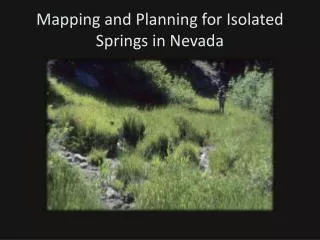
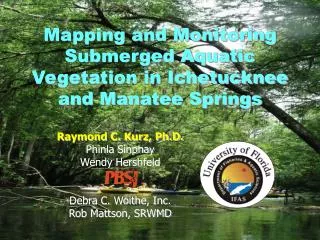
Mapping and Monitoring Submerged Aquatic Vegetation in Ichetucknee and Manatee Springs. Raymond C. Kurz, Ph.D. Phinla Sinphay Wendy Hershfeld Debra C. Woithe, Inc. Rob Mattson, SRWMD. Project History. Administered by SRWMD Funded through grant from FDEP for Florida Springs Initiative

E N D
Mapping and Monitoring Submerged Aquatic Vegetation in Ichetucknee and Manatee Springs Raymond C. Kurz, Ph.D. Phinla Sinphay Wendy Hershfeld Debra C. Woithe, Inc. Rob Mattson, SRWMD
Project History • Administered by SRWMD • Funded through grant from FDEP for Florida Springs Initiative • Component of baseline data collection (water quality, vegetation, flow) for springs – use to manage resource effectively • Assist with development of MFLs • Project began in February 2003, completed first phase in June 2003, second phase in June 2004
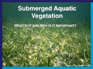
Objectives • Phase 1 (2003) • Map SAV in Ichetucknee and Manatee Spring Runs • Monitoring (SAV, periphyton, canopy, physicochemical, light, flow) • SAV-associated Macroinvertebrate Sampling • Recreational Use Impact Assessment • Phase 2 (2004) • Remap high use areas in Ichetucknee Springs • Conduct shading analysis, flow, depth mapping • Conduct surface water quality sampling and additional macrophyte/periphyton sampling
Ichetucknee Springs Manatee Springs Suwannee River Study Areas
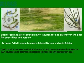
Mapping Methods • March-May 2003 and 2004 • GPS in open canopy areas • Transect mapping in heavily canopied areas (% coverage by species along 100 ft transects) – tied to GPS • Used USGS DOQQ aerial as basemap • Shoreline photointerpreted from aerial, widths verified using measuring tape • Only SAV points mapped in Manatee Springs due to sparse coverage of SAV – points converted to polygons using field notes/sketches
Mapping Methods • Use of handheld computer linked with GPS hardware and GIS software • ArcPad 6.0 (ESRI) • PDOP < 6.0 • <5 m horizontal accuracy • Target minimum map unit 30 sq. ft. • QC checks for horizontal accuracy using known benchmark • Overall map accuracy of 94%
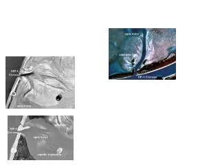
Manatee Springs Suwannee River
Manatee Springs Predominantly Sagittaria kurziana
Manatee Springs No SAV USFWS Caging Experiment
US 27 Headspring Ichetucknee State Park Rice Marsh Floodplain
Historical Change *all 1979 values estimated– original mapping was performed by Dutoit via transect method, cutoff points for reaches were estimated
Remapping of High Use Areas (2004) • Determine if SAV impacted by summer of 2003 recreational usage • Focus on shallow areas and exit/entry points
ShadingFlowDepth Mapping • Field measurements at multiple transect locations • Tree height • Canopy cover • Water depth • Flow velocity
Shading Analysis • Spatial Analyst “hillshade” command
SAV – Depth/Flow/Shade Relationships • Sagittaria appears fairly independent of depth, flow, reach, or tree canopy shade • Chara has a positive trend of increasing coverage with increasing depth, flow and tree canopy shade • Vallisneria coverage appears to increase with increasing amounts tree canopy shade, while it is less strongly related to increasing depth and flow • Zizania only occurred in depths shallower than 1 m (typically emergent)
Conclusions • SAV in Manatee Springs likely varies seasonally due to river inundation, manatee grazing • SAV in Ichetucknee Springs has increased dramatically since 1979 study • Small loss in SAV cover (2%) between 2003 and 2004 high use areas, likely due to human activities (installation of new dock and safety cable across river) in lower reach • Does not appear to be a strong relationship between SAV and canopy cover