Download
1 / 79
940 likes | 1.2k Views
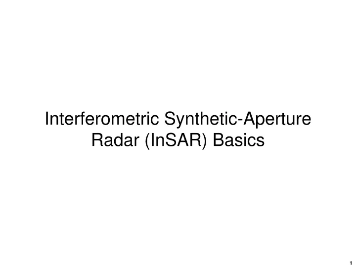
Interferometric Synthetic-Aperture Radar (InSAR) Basics. Outline. SAR limitations Interferometry SAR interferometry (InSAR) Single-pass InSAR Multipass InSAR InSAR geometry InSAR processing steps Phase unwrapping Phase decorrelation Baseline decorrelation Temporal decorrelation

E N D
Outline • SAR limitations • Interferometry • SAR interferometry (InSAR) • Single-pass InSAR • Multipass InSAR • InSAR geometry • InSAR processing steps • Phase unwrapping • Phase decorrelation • Baseline decorrelation • Temporal decorrelation • Rotational decorrelation • Phase noise • Persistent scatterers
SAR limitations • All signals are mapped onto reference plane • This leads to foreshortening and layover
Shadow, layover, and foreshortening distortion SEASAT Synthetic Aperture RadarLaunched: June 28, 1978Died: October 10, 1978orbit: 800 kmf: 1.3 GHz PTX: 1 kW: 33.8 s B: 19 MHz: 23 3 PRF: 1464 to 1647 Hzant: 10.7 m x 2.2 m x = 18 to 23 m y = 23 m Figure 5-4. Example of radar image layover. Seasat image of the Alaska Range showing the top of a mountain imaged onto the glacier at its foot (center). Shadows are also present on many of the backslopes of these steep mountains. Illumination is from the top [from Ford et al., 1989].
SAR limitations – foreshortening • Foreshortening: - < < ( is local slope). • Dilates or compresses the resolution cell (pixel) on the ground with respect to the planar case.
SAR limitations – layover • Layover: ( is the local slope) • Causes an inversion of the image geometry. Peaks of hills or mountains with a steep slope commute with their bases in the slant range resulting in severe image distortion.
SAR limitations – shadow • Shadow: - /2 ( is the local slope) • A region without any backscattered signal. This effect can extend over other areas regardless of the slope of those areas.
Interferometry • interferometry—The use of interference phenomena for purposes of measurement. • In radar, one use of interferometric techniques is to determine the angle of arrival of a wave by comparing the phases of the signals received at separate antennas or at separate points on the same antenna.
SAR interferometry – how does it work? A2 B Radar A1 Antenna 1 Antenna 2 Return could be from anywhere on this circle Return comes from intersection Interferometric SAR Single antenna SAR
SAR interferometry – how is it done? B is the interferometric baseline Single pass or Simultaneous baseline Two radars acquire data from different vantage pointsat the same time Repeat pass or Repeat track Two radars acquire data from different vantage points at different times
Single-pass interferometry Single-pass interferometry. Two antennas offset by known baseline.
Interferometric SAR – geometry • The key to InSAR is to collect complex SAR data from slightly offset perspectives, the separation between these two observation points is termed the baseline, B. • This baseline introduces for each point in the scene a slight range difference that results in a phase shift that can be used to determine the scatterer’s elevation. • From trigonometry (law of cosines) • Furthermore for R » B • [Note that B amplifies R] • For scatterers in the reference plane is known ( = o), otherwise is unknown • Finding R enables determination of and z(x)
Interferometric SAR– radar phase • Radar phases • Since is measured, R can be determined • Example • Let = 10 cm (f = 3 GHz)measure to /100 (3.6º)equivalent to 0.1 mm or 0.3 ps resolution Multipass baseline Transmit and receive on antenna A1Transmit and receive on antennaA2
Interferometric SAR– radar phase • For single-pass InSAR where transmission is on antenna A1 and reception uses both A1 and A2: • And Simultaneous baseline Transmit on antenna A1Receive on both A1 and A2
Radar interferometry – geometry • From geometry we know • but is undetermined if the scatterer is not on the reference plane. • To determine we use • where a = 1 for single-pass and a = 2 for multipass • So that
Radar interferometry – geometry • From • we find • and • where a = 1 for single-passa = 2 for multipassa = 2 for single-pass, ping-pong mode • Precise estimates of z(x) require accurate knowledge of B, , and as well as R and h
SAR Interferometry • InSAR provides additional information via phase measurements • This additional information enables a variety of new capabilities • Topography measurement • Vertical surface displacement (uplift or subsidence) • Lateral surface displacement (velocity) • Change detection (via phase decorrelation)
SAR Interferometry • Multi-pass interferometry • Two pass • Two scenes, one interferogram topography, change detection surface velocity (along-track interferometry – temporal baseline) • Three pass • Three scenes, two interferograms topography, change detection, surface deformation
Differential interferometry – how does it work? • Three-pass repeat track • Two different baselines • Same incidence angle • Same absolute range • Parallel ray approximation used to detect changes • If the surface did not change between observations, then
Interferometric SAR processing • Production of interferometric SAR images and data sets involves multiple processes. • Independent SAR data sets must be collected • Complex SAR images are produced • SAR images must be registered with one another • Interferometric phase information extracted pixel-by-pixel • Coherence is analyzed • Phase is unwrapped (removes modulo-2 ambiguity) • Phase is interpolated • Phase is converted into height • Interferometric image is geocoded • To produce surface velocity or displacement maps, successive pairs of InSAR images are processed to separate elevation effects from displacements.
Phase coherence • Lack of coherence caused by decorrelation • Baseline decorrelation Sufficient change in incidence angle results in scatterer interference (fading effect) • Temporal decorrelation Motion of scatterers between observations produces random phase • Windblown vegetation • Continual change of water surface • Precipitation effects • Atmospheric or ionospheric variations • Manmade effects • Rotational decorrelation Data collected from nonparallel paths • Phase unwrapping to obtain absolute phase requires reference point
SAR Interferometry • The radar does not measure the path length directly, rather it measures the interferometric phase difference, , that is related to the path length difference, R • The measured phase will vary across the radar swath width even for a surface without relief (i.e., a flat surface or smooth Earth) • increases as the sine of • If o is the incidence angle in the absence of relief and z is the elevation of a pixel at the same Ro, then the change in incidence angle induced by the relief is
SAR Interferometry • It follows that • phase due to phase due to smooth Earth relief • Removing the phase component due to the smooth Earth yields a “flattened interferogram”
Ambiguity height • The interferometric ambiguity height, e, which is the elevation for which the flattened interferogram changes by one cycle, is • The ambiguity height is like the sensitivity of the InSAR to relief. • From this relationship we know • A large baseline B improves the InSAR’s sensitivity to height variations. • However since the radar measures interferometric phase in a modulo 2 manner, to obtain a continuous relief profile over the whole scene the interferometric phase must be unwrapped. • To unambiguously unwrap the phase, the interferometric phase must be adequately sampled. • This sampling occurs at each pixel, thus if the interferometric phase changes by 2 or more across one pixel a random phase pattern results making unwrapping difficult if not impossible. • The problem is aggravated for positive terrain slopes (sloping toward radar)
Phase unwrapping Phase z Phase 0 0 x x x ACTUAL ELEVATION PROFILE WRAPPED PHASE UNWRAPPED PHASE • Formerly phase unwrapping was an active research area, now Matlab has a built-in function (unwrap.m) that does this reliably for most cases.
Baseline decorrelation • To illustrate this consider two adjacent pixels in the range dimension – pixel 1 & pixel 2 – on a surface with slope . • The interferometric phase for these two pixels is • For small r (small slant range pixel spacing) • and from geometry we know • so that
Baseline decorrelation • Limiting to 2 results in a critical baseline, Bc such that if B > Bc the interferometric phases will be hopelessly unwrappable. • This phenomenon is know as baseline decorrelation. • B denotes the perpendicular component of baseline B • where a = 1 for single-passa = 2 for multipassa = 2 for ping-pong mode [i.e., Tx(A1)–Rx(A1 , A2); Tx(A2)–Rx(A1, A2);repeat]
Perpendicular Baseline • Perpendicular Baseline, B Parallel-ray assumption Orthogonal baseline component, B,is key parameter used in InSAR analysis B = B cos( - )
Baseline decorrelation • While Bc represents the theoretical maximum baseline that will avoid decorrelation, experiments show that a more conservative baseline should be used.
Correlation • The degree of coherence between the two complex SAR images, s1 and s2, is defined as the cross-correlation coefficient, , or simply the correlation • where • s2* is the complex conjugate of s2 • E{ } is ensemble averaging • (incoherent) 0 < < 1 (coherent) • is a quality indicator of the interferometric phase,for precise information extraction, a high value is required.
Decorrelation effects • Factors contributing to decorrelation include: • Spatial baseline • Inadequate spatial phase sampling (a.k.a. baseline decorrelation) • Fading effects • Rotation • Non-parallel data-collection trajectories • Fading effects • Temporal baseline • Physical change in propagation path and/or scatterer between observations • Noise • Thermal noise • Quantization effects • Processing imperfections • Misregistration • Uncompensated range migration • Phase artifacts
Noise effects • Random noise (thermal, external, or otherwise) contributes to interferometric phase decorrelation. • Analysis goes as follows: • Consider two complex SAR signals, s1 and s2, each of which is modeled as • where c is a correlated part common to the signal from both antennas and the thermal noise components are n1 and n2. • The correlation coefficient due to noise, N, of s1 and s2 is
Noise effects • Since the noise and signal components are uncorrelated, we get • Recall that the signal-to-noise ratio (SNR) is |c|2/|n|2yields • For an SNR of , the expected correlation due to noise is 1 • For an SNR of 10 (10 dB), N= 0.91 • For an SNR of 4.5 (6.5 dB), the N = 0.81
Noise effects • Noise also increases the uncertainty in the phase measurement, i.e., the standard deviation of the phase,
Noise effects Note that the slope as 1 A 6.5 dB SNR yields a 50 standard deviation and a correlation of about 0.8
Noise with another decorrelation factor • Now consider two complex SAR signals, s1 and s2, each of which is modeled as • where c is a correlated part common to the signal from both antennas, di is the uncorrelated part due to spatial baseline decorrelation (exclusive of noise), and the thermal noise component is ni. • The correlation of s1 and s2 for an infinite SNR is
Noise with another decorrelation factor • Now re-introducing noise we get • and since SNR is (|c|2 + |d|2 )/|n|2
Decorrelation and phase The decorrelation effects from the various causes compound, i.e., where scene denotes long-term scene coherence N represents decorrelation due to noise H includes system decorrelation sources including baseline decorrelation, misregistration, etc. The probability density function (pdf) reveals some statistical characteristics of the interferometric phase. For strong correlations ( 1) the phase difference is very small and only a few outliers exist. Bamler, R. and D. Just, “Phase statistics and decorrelation in SAR interferograms,” IGARSS ’93, Toyko, pp. 980-984, 1993.