Download
1 / 15
150 likes | 267 Views
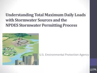
Geospatial Best practices for Architects April 11, 2007, Workshop. Developing an Enterprise Geospatial Segment Architecture Data Lessons -EPA. Presented by Wendy Blake-Coleman Environmental Protection Agency. Topics. Definition of Activity

E N D
Geospatial Best practices for Architects April 11, 2007, Workshop Developing an Enterprise Geospatial Segment Architecture Data Lessons -EPA Presented by Wendy Blake-Coleman Environmental Protection Agency
Topics • Definition of Activity • Developing an Enterprise geospatial data architecture • Guiding Principles for Developing a Geospatial Data Architecture • Relationship to the Geospatial Segment of the Agency’s Enterprise Architecture • Examples • Region 4 Data Consolidation • OAQPS • GeoData Gateway • Challenges/Lessons Learned U.S. Environmental Protection Agency: April 11, 2007
Definition of Activity • Background • Baseline data inventory provided insight into existing geospatial data status and accessibility • Key Areas Identified to Address • Data Quality • Data Access • Central Services • Data Partnerships • Current Efforts • National Geospatial Data Policy (NGDP) – August 2005 • Target Geo Segment of the Agency EA – In Progress • State-EPA Partnerships to Share Geospatial Data U.S. Environmental Protection Agency: April 11, 2007
EPA Geospatial Segment • The segment encompasses all architectural layers U.S. Environmental Protection Agency: April 11, 2007
Guiding Principles • Business Processes are Key • Start with business use of data to determine needs • Governance and Stewardship • Distributed warehouse and data mart approach requires a new approach toward geospatial data stewardship across the agency • Strong emphasis on metadata creation, access and maintenance • Data Quality • High quality locational and attribute information is critical • Focusing on data quality and consolidation can be more cost effective • Infrastructure • SOA requires investment in reliable and robust infrastructure U.S. Environmental Protection Agency: April 11, 2007
Example 1: Centralizing Data - Region 4’s Geospatial Vector Data Sets Data Consolidation Comparison U.S. Environmental Protection Agency: April 11, 2007
Example 2: Geo-enabling EPA Warehouses – OAR’s AirQuest Example • GeoEnabling the AirQuest Data Warehouse and Providing Access in multiple formats (WMS, WFS, ArcSDE, etc.) Geospatial Data Delivery Capabilities Data Tables: AirQuest Maps: AQMaps • Each system has a capability the other system needs U.S. Environmental Protection Agency: April 11, 2007
Current Design: Consolidate Data Sets and Geo-enable through ESRI Tools U.S. Environmental Protection Agency: April 11, 2007
Overview of Target • EPA Needs to Implement Geo Data Architecture at the Enterprise Scale • Beyond metadata: Develop governance and procedures to implement key phases of the geospatial data lifecycle • Support “a single version of the truth” for geo assets of Agency-wide importance • Host and steward program-specific sets in program/regional/lab geo-enabled warehouses U.S. Environmental Protection Agency: April 11, 2007
Example 3: Central Services Provided at EPA’s National Computer Center Enterprise Data Services Offered to Agency Personnel U.S. Environmental Protection Agency: April 11, 2007
Providing Access to Data Across the Agency: Region 4, OAQPS, and others EPA’s Metadata Management Procedure under the NGDP is complete and ready for formal approval U.S. Environmental Protection Agency: April 11, 2007
Geospatial Data Discovery on the Exchange Network U.S. Environmental Protection Agency: April 11, 2007
Data Partnerships Are Key U.S. Environmental Protection Agency: April 11, 2007
Challenges/Lessons Learned • Governance and oversight are key • Centralization is not possible without reliable and robust infrastructure • Will not obtain full benefit of a geo-data architecture without reengineering business processes • Data quality and sustainable funding are critical U.S. Environmental Protection Agency: April 11, 2007
Questions? • Wendy Blake-Coleman • (202) 566-1709 • blake-coleman.wendy@epa.gov U.S. Environmental Protection Agency: April 11, 2007