Download
1 / 11
110 likes | 647 Views
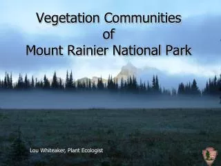
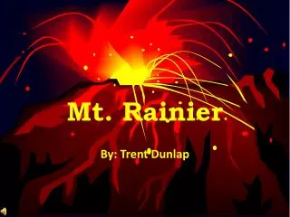
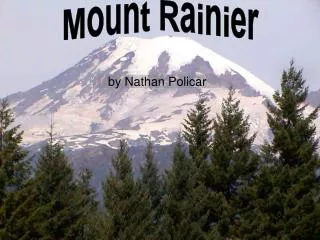
Mount Rainier. The Mountain. Location. Latitude:46.87 N Longitude:121.758 W. Mt. Rainer, Washington. Elevation. Towers 8,000 ft. Mount Rainier is a stratovolcano / composite. 4,392 meters. (14,411 feet ). History and Hazards. Of Mount Rainier.

E N D
The Mountain Location Latitude:46.87 N Longitude:121.758 W Mt. Rainer, Washington Elevation Towers 8,000 ft. Mount Rainier is a stratovolcano / composite. 4,392 meters (14,411 feet)
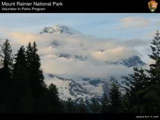
History and Hazards Of Mount Rainier • Mount Rainier is covered with lots of ice and snow. • Its main cone of the stratovolano formed 730,000 years ago. • It is the third most volumious of the Cascade Range.
Mount Rainier has a history of massive debris avalanches and debris flows. A mudflow caused by steam explosions was one of the largest in the world. Mount Rainier & other similar volcanoes in the Cascade Range erupt much less than Hawaiian volcanoes but, are more destructive. ACTIVE VOLCANO History & Hazards
Geologic History • In the past 200 yrs. Mt. Rainier has had 2 eruptions in the year 1882. • Mt. Rainier creates its own weather. • It has 5 major rivers and tributaries that run through it. • Its cone is 9 miles long.
This region is one of the most geologically young and tectonically active in North America. Cascade Range
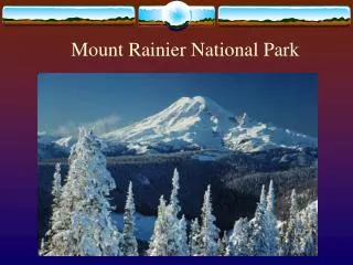
Glaciers are among the most conspicuous and dynamic geologic features on Mount Rainier in Washington State. They erode the volcanic cone and are important sources of stream flow for several rivers . • For example, during the last ice age, from about 25,000 to about 15,000 years ago, glaciers covered most of the area now within the boundaries of Mount Rainier National Park and extended to the perimeter of the present Puget Sound Basin. • TheCarbon, Cowlitz, Emmons, and Nisqually Glaciers
Debris flows are coarser and less cohesive than mudflows. Lahar is an Indonesian word describing mudflows and debris flows that originate from the slopes of a volcano. • Debris Flows, Mudflows, and Lahars • Lahars are commonly initiated by: • large landslides of water-saturated debris, • heavy rainfall eroding volcanic deposits, • sudden melting of snow and ice near a volcanic vent by radiant heat or on the flanks of a volcano by pyroclastic flows, or • breakout of water from glaciers, crater lakes, or from lakes dammed by volcanic eruptions
Other Information Mt. Rainier has little population but, has a trail where people can come and hike from spring till summer. Mount Rainier has converging plates.
Bibliography • Google.com • Volcano World http://volcano.und.edu • Simon and Schuster’s New Millenium Encyclopedia