Download
1 / 27
340 likes | 892 Views
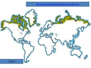
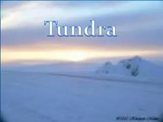
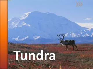
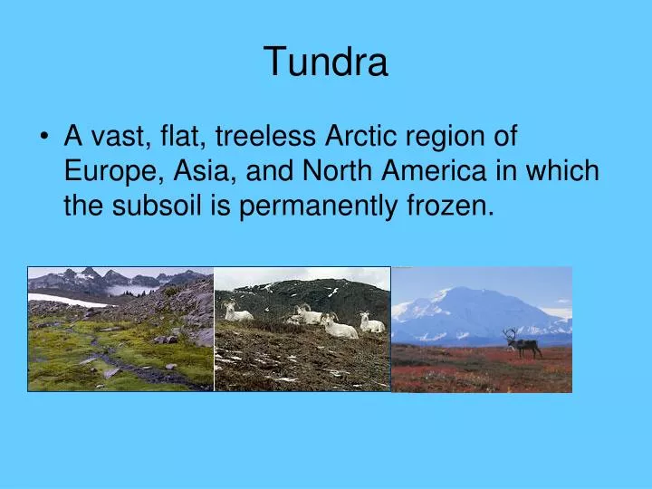
Tundra. A vast, flat, treeless Arctic region of Europe, Asia, and North America in which the subsoil is permanently frozen. Taiga. Sometimes swampy coniferous forest of high northern latitudes, esp. that between the tundra and steppes of Siberia and North America. Russia’s Geography.

E N D
Tundra • A vast, flat, treeless Arctic region of Europe, Asia, and North America in which the subsoil is permanently frozen.
Taiga • Sometimes swampy coniferous forest of high northern latitudes, esp. that between the tundra and steppes of Siberia and North America.
Russia’s Geography In our study of Russia, SWBAT locate, describe and determine the impact of its geographic features by analyzing maps and photographs, reading selections and by applying a variety of thinking skills to draw conclusions. (Goals 1-4) As we go through this presentation, you will need to take notes. The topic is “Russia’s Geography”. Whatever is in blue needs to be copied as notes.
Essential Question:How does Russia’s geography impact life there?How does its geography affect movement and the economy?
RUSSIA’S DIMENSIONS • SPANS 11 TIME ZONES • TWICE THE SIZE OF THE US OR CHINA
Topic: Russia’s Geography • World’s largest country, lies on the continents of Europe and Asia • Gigantic size and harsh climates make transportation difficult • Ural Mountains form border between Europe and Asia • European Russia is warmer than Asian Russia • 75% of population live in European Russia
Siberia • Large part of land that crosses northern and central Russia into Asia • People have to travel from village to village by helicopter because it is so large and is covered by ice • Siberia has the largest supply of minerals • World’s coldest place is in Siberia. Oymyakon (How cold do you think it is)?
Bodies of Water • Russia touches many inland bodies of water such as Black Sea, Caspian Sea, and Lake Baikal • Lake Baikal: World’s deepest freshwater lake, holds almost 20% of the world’s supply of unfrozen freshwater
Volga River The Volga River carries almost ½ of Russia’s river traffic and provides water for irrigation and hydroelectric power. (map on page 383)
Topic: Russia’s EconomyMap page 374 • Russia has large deposits of coal, oil, and gas • Southwestern area can produce high yields of grains • Fishing industry is one of the largest in the world • Forests of Siberia provide plenty of timber • However, Russia’s economy is not strong due to years of communist control of farms and factories which denied people the experience of creating jobs, starting businesses, and making money • St. PetersburghNorthwestern ports, major city
Moscow is the political, economic, and transportation center of Russia
Knowledge(Write this level above your map.) • Label the bordering bodies of water (Arctic Ocean, Caspian Sea, Baltic Sea, Bering Sea) • Label the following geographic features on your map: Ural Mountains, Volga River, Siberia • Label the major cities of Moscow and St. Petersburg • Label European Russia and Asian Russia above each section of your map. • Maps on pages 371-379
Comprehension(Label and complete below your map.) • Describe and illustrate Russia’s natural resources. (page 374 or 386) • Describe where the majority of cities are located in Russia (European or Asian side). Why do you think more are not located in the Northeastern part? • Why does Siberia have extremely cold weather?
Fold you map in half vertically (like a hot dog) and then horizontally (like a hamburger).
Application(Label the first blank box on the back.) • Find the city of Yakutsk in eastern Russia. How would life in Yakutsk compare or contrast to life in St. Petersburg?. (p. 379) • Develop a web that shows the relationship between Russia’s main resources and its main economic activities. (p. 386) • Generate a proposal for a new company to build a factory in Russia. Be specific (which region of Russia, near what geographic features, cities, etc.) and identify where the factory should be built and what resources and modes of transportation are available.
Analysis(Label the second box.) • Explain how western and eastern Russia are similar and different using a Venn diagram. (p. 382) • Create a flow-chart which details what has caused two of Russia’s environmental problems. (p. 387) ______ Environmental Problem CAUSE:
Synthesis(Label the third box.) • Plan a trip on the Trans-Siberian Railroad. Plot your route and determine the amount of time the journey will require. Describe some of the cities you will see along the way. (394-395) • Pick a geographic feature or city in Russia. Create a series of four clues that will help others figure out your place. Each clue must pertain/relate to a different map.
Evaluation(Label the fourth box.) • Which cities in Russia are the most densely populated? How does their location explain this? • Examine page 385 and then explain which region probably provides the best farmland.