Download
1 / 31
310 likes | 471 Views
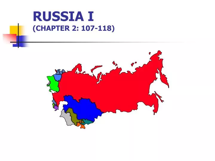
RUSSIA I (CHAPTER 2: 107-118). MAJOR GEOGRAPHIC QUALITIES. IMMENSE TERRITORIAL STATE NORTHERNMOST LARGE AND POPULOUS COUNTRY IN THE WORLD A FORMER WORLD COLONIAL POWER A COMPARITIVELY SMALL (<150 MILLION) AND CONCENTRATED POPULATION CONCENTRATED DEVELOPMENT MULTICULTURAL STATE

E N D
MAJOR GEOGRAPHIC QUALITIES • IMMENSE TERRITORIAL STATE • NORTHERNMOST LARGE AND POPULOUS COUNTRY IN THE WORLD • A FORMER WORLD COLONIAL POWER • A COMPARITIVELY SMALL (<150 MILLION) AND CONCENTRATED POPULATION • CONCENTRATED DEVELOPMENT • MULTICULTURAL STATE • MINIMAL PORTS
RUSSIA’S DIMENSIONS • SPANS 11 TIME ZONES • GULF OF FINLAND TO ALASKA (WEST TO EAST), AND WELL ABOVE THE ARCTIC CIRCLE TO SALT LAKE CITY (NORTH TO SOUTH) • TWICE THE SIZE OF THE US OR CHINA • SIBERIA: “SLEEPING LAND”
SIZE, LOCATION AND SPACE RELATIONSHIPS • LATITUDINAL EXTENT • Northernmost point: Rudolf Island in Franz Joseph Land (82o) • Southernmost point: Grozny in west and Vladivostok in east (44o) • LONGITUDINAL EXTENT • More than twice its maximum north-south extent and extends through 11 time zones • Russia makes up 76.6% of the total territory of the former USSR (17,075,400 km--almost twice the size of the US).
80º 60º 40º 20º
GROWTH OF THE RUSSIAN EMPIRE
FORWARD CAPITAL Capital city positioned in actually or potentially contested territory, usually near an international border, confirms the state’s determination to maintain its presence in the region
80o Arctic Circle Alaska 60o 40o Hawaii LOCATIONAL IMPACT ON RUSSIA’S CLIMATE
CLIMATOLOGY • CLIMATE • AVERAGE WEATHER CONDITIONS FOR A GIVEN AREA OVER AN EXTENDED PERIOD OF TIME • WEATHER • REFERS TO THE ATMOSPHERIC CONDITIONS AT A SPECIFIC PLACE AND TIME • CLIMATOLOGY • A BRANCH OF PHYSICAL GEOGRAPHY • CONCERNED WITH: • SPATIAL ARRANGEMENT OF CLIMATE OVER THE SURFACE OF THE EARH • PROCESSES WHICH CONTRIBUTE TO THE DISTRIBUTION
RUSSIAN CLIMATE • Affected by 3 natural conditions: -- Latitudinal Position -- Continental Position -- Location of major mountains
CLIMATE AS A RESTRICTIVE ELEMENT • AGRICULTURE • Short growing seasons • Drought prone • Erosion (accelerated via snow melt) • SETTLEMENT PATTERNS & TRANSPORTATION • INDUSTRY • High energy consumption • Specialized equipment and facilities • Extractive • permafrost • spring and fall mud • special equipment and facilities - $$$
PHYSIOGRAPHIC REGIONS • RUSSIAN PLAIN • EASTWARD CONTINUATION OF NORTH EUROPEAN LOWLAND • CORE AREA (MOSCOW BASIN) • URAL MOUNTAINS • 2,000 MILES LONG (NORTH-SOUTH) • YIELD A VARIETY OF MINERALS • WEST SIBERIAN PLAIN • WORLD’S LARGEST UNBROKEN LOWLANDS • PERMAFROST
PHYSIOGRAPHIC REGIONS(continued) • CENTRAL SIBERIAN PLATEAU • SPARSELY POPULATED, TEMPERATURE EXTREMES, PERMAFROST • YAKUTSK BASIN • MOUNTAINOUS, HIGH RELIEF • EASTERN HIGHLANDS • RANGES, RIDGES, PRECIPITOUS VALLEYS, VOLCANIC MOUNTAINS, LAKE BAYKAL • CENTRAL ASIAN RANGES • RISE ABOVE THE SNOW LINE, GLACIATED • CAUCASUS MOUNTAINS • EXTENSIONS OF THE ALPINES
RUSSIAN PLAIN
THE URAL MOUNTAINS • The north-south length covers 2500 kms. • The highest points are in the Northern Urals-2000 meters in places. • The Central Urals are the lowest section and include several key crossing places. • The Southern Urals are wider and consist of a number of parallel north-south ridges and intervening valleys. • Ural forests and minerals have been the basis for industrialization and boast at least twenty different commercially usable minerals.
WEST SIBERIAN PLAIN • The world’s largest unbroken lowland • Includes the Ob and Irtysh River Basin • Permafrost • Major Cities: • Omsk • Novosibirsk
CENTRAL SIBERIAN PLATEAU • Sparsely settled • Inaccessible • Restrictive climate • Permafrost • Natural resources
CENTRAL ASIAN RANGES
CAUCASUS MOUNTAINS