Download
1 / 54
550 likes | 678 Views
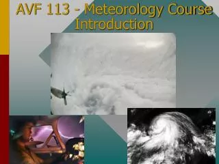
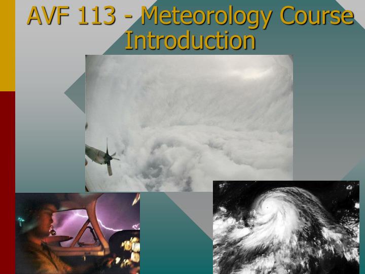
AVF 113 - Meteorology Course Introduction. INSTRUCTOR. Mr. Joe MacDougall Diploma in Aviation Mount Royal College/University (Calgary, AB) Bachelors of Science in Aeronautics from the University of North Dakota St. Louis University/Parks College Owner AvCanada www.avcanada.ca

E N D
INSTRUCTOR • Mr. Joe MacDougall • Diploma in Aviation Mount Royal College/University (Calgary, AB) • Bachelors of Science in Aeronautics from the University of North Dakota • St. Louis University/Parks College • Owner AvCanadawww.avcanada.ca • Weather Modification Pilot • Canadian Airline Transport • FAA Commercial Multi-Instrument & SES, CFI, CFII, MEI • BBCC Assistant Chief Flight Instructor
MOST CHALLENGING CROSS COUNTRY • CYYC-SAME (MENDOZE ARGENTINA MDZ) • Via Fargo ND (KFAR), Albany Georgia (KABY), St. Petersburg Florida (KSPG), Lakeland Florida (KLAL), Fort Pierce Florida (KFPR), then over Cuba to Montego Bay Jamaica (MBJ MKJS), Bogotá Columbia (SKBO), Rio Bronco Brazil (SBRB), Cuiaba Brazil (SBCY), Iguazzu Brazil (SBFI), Mendoza Argentina (SAME)
Route between CYYC (Calgary, Alberta, Canada) and SAME (Mendoza, Mendoza, Argentina): • Distance along great circle: 6414.5 statute miles, 5574.1 nautical miles, 10323.1 kilometers
TEXTS • You will be using two texts this quarter: • Aviation Weather AC 00-6A and • Aviation Weather Services AC00-45G
COURSE OUTLINE AND GRADING POLICY • Please read the course outline. In this document you will find the grading policy for this course.
Course Objectives: • Understanding of basic weather theory • Cause and effect relationships • Recognize critical weather situations • Be able to identify typical weather phenomenon • Be able to obtainweather information • Prepared for FAA oral exam for topics relating to meteorology
AOPA & Duat/s • Throughout the course there will be several homework assignments that you will be required to complete from the AOPA website. • You will need to prove to me that you can login to www.duat.com or www.duats.com before January 24th, 2013 if you are in the flight program. • Students who are not in the flight program or who have not completed AVF 112 please raise your hand.
IntroductionWhy study the Weather? • It effects everyone • Your knowledge may save your life at one point or another in your aviation career • Go-No go decision (most important thing you can learn) • After your airborne it’s a terrible feeling wishing that you were on the ground. • Therefore it can not be purely academic, we have to relate it to flight safety. • For your safety and the safety of those with you, learn to recognize potential trouble and make sound preflight and flight decisions before it is to late. This is the real purpose of the first half of this course.
CLASS CONTENT • EARTH FACTS • Review of METAR’s, TAF’s, FA, FD, PIREPS
EARTH • What do you think the dimensions of the Earth are? • Radius • Circumference • Distance from the Pole to Equator
EARTH • What do you think the dimensions of the Earth are? • Radius = 3,438 n.m. • Circumference = 21,625 n.m. • Distance from the Pole to Equator = 5,397 n.m.
ATMOSHERIC LAYERS • 99.9% of the total atmospheric mass is below 164,000 ft (about 27 n.m.). At this altitude the density is about one-thousandth of sea levels density. Very close to the top but there is no well-defined upper surface to the atmosphere. • 90% of mass is below 53,000 ft • 50% of mass is below 18,000 ft
Earth Facts • If the earth were a beach ball the atmosphere would be as thin as a piece of paper • If the Earth was an apple the atmosphere would be similar to the skin of the apple. • It took approx. 4.6 Billion years for the atmosphere to form.
Meteorological History • The term goes back to Greek Philosopher Aristotle 340 BC • He wrote a book called Meteorlogica which was referenced for 2000 years. • Thermometer was invented late 1500’s • Barometer invented in 1643 • The 1800’s saw a scientific approach being developed and the use of weather maps introduced
Meteorological History • 1920’s saw Airmasses and Fronts • 1940’s Balloon wx observations gave a more 3 dimensional view • 1950’s computer aided wx • 1960’s Tiros I wx satellite
Meteorological Today • Today, complex computer models tied with satellite data improve accuracy • A large part of this data is available from a FSS (1-800-WX-Brief) or on the internet • In the second half of this course and today we are going to cover weather reports, forecasts etc. from AC00-45F
The METAR format was introduced 1 January1968 internationally and has been modified several times since. North American countries continued to use a Surface Aviation Observation (SAO) for current weather conditions until 1 June1996 when this report was replaced with an approved variant of the METAR agreed upon in a 1989 Geneva agreement. http://en.wikipedia.org/wiki/METAR#History METAR History
The word METAR originated from the French, "message d’observationmétéorologiquerégulière pour l’aviation," and is thought to be a contraction from the french words, MÉTéorologique ("Weather") Aviation Régulière ("Routine"). The Federal Aviation Administration (FAA) defines a METAR as an aviation routine weather reportin the Aeronautical Informational Manual and may therefore consider it erroneous to attempt to redefine METAR with incorrect terminology such as METeorological Aerodrome Report.[2] The FAA and National Oceanic and Atmospheric Administration (NOAA) specifically define a METAR as an aviation routine weather report, which is an approximate translation of the historical French description. METAR Naming
METAR= AviationRoutineWeatherReport In 1996 US convertedtothe ICAO and theWorldMeterologicalOrganizationform of aviationweatherreporting. Each country isallowedtomakemodificationstothecodeto use in that particular country In the U.S. visibilityis in statute miles, runway visual range in feet, windspeed in knots, and altimetersetting in inches of mercury METAR
Elements of a METAR 1. Type of Report 2. ICAO station identifier 3. Date and time of report 4. Modifier (as required) 5. Wind 6. Visibility 7. RVR 8. Weather 9. Sky conditions 10. Temp/DPT 11. Altimeter 12. Remarks METAR
METAR (Section 3 AC 00-45F) • METAR KGNV 201933Z COR 24015KT 3/4SM R28/2400FT +TSRA BKN008 OVC015CB 26/25 A2985 RMK TSB32RAB32 • METAR KPIT 091955Z COR 22015G25KT 3/4SM R28L/2600FT TSRA OVC010CB 18/16 A2992 RMK SLP045 T01820159
METAR AND TAF • KMWH 042152Z 00000KT 1/2SM R32R/6000VP6000FT UP FG BKN004 OVC020 01/01 A3009 RMK AO2 RAE49UPB49 SLP202 P0007 T00110011 • KMWH 042202Z 0422/0518 01004KT 3SM -RA BR OVC015 TEMPO 0422/0424 1SM RA BR BKN005 OVC030 FM050000 35004KT 5SM RA BR OVC015 FM050200 VRB04KT P6SM BKN006 OVC010 • KEPH 042153Z AUTO 01006KT 3SM -SN BR FEW004 BKN021 OVC031 00/00 A3008 RMK AO2 SLP197 P0004 T00000000
METAR (226 & 200AFD) • METAR’s are issued normally 5-10minutes before the hour every hour • Ceiling is defined as the lowest broken or overcast layer or vertical visibility into a surface based obstruction • Indefinite ceiling VV006 • Temperature below zero prefixed with a M
METAR (226 & 200AFD) • A01-Automated station with out precipitation discrimination • A02- with precip discrimination • VC in vicinity of airport 5-10 SM • METAR’s are reports (a moment of time) not a forecast
TAF (AC 00-45F 7.2) • Usedtobecalled a FT nowcalled a Terminal Aerodrome Forecasts • Is a forecast of theexpectedweatherconditions at anairportduring a specificperiod (usually 24hrs NOW some are 30hrs) • Issuedfour times a dayfor 24 hrs periods (00Z, 06Z, 12Z, 18Z) • http://aviationweather.gov/notice/taf30.php
TAF • Exampleoldformat: • TAF KOKC 051130Z 051212 14008KT 5SM BR BKN030 WS018/32030KT TEMPO 1316 1 1/2SM BR FM1600 16010KT P6SM SKC BECMG 2224 20013G20KT 4SM SHRA OVC020 PROB40 0006 2SM TSRA OVC008CB =
TAF NEW FORMAT • KMWH 020338Z 0204/0224 01005KT P6SM OVC110 FM020600 23006KT 5SM -RA BR BKN008 FM020800 18005KT 2SM -RASN BR OVC007 FM021000 30007KT 1SM BR BKN007 OVC025 FM021800 27012G22KT P6SM SCT020 BKN150 = • KMWH 042202Z 0422/0518 01004KT 3SM -RA BR OVC015 TEMPO 0422/0424 1SM RA BR BKN005 OVC030 FM050000 35004KT 5SM RA BR OVC015 FM050200 VRB04KT P6SM BKN006 OVC010
TAF (DECEMBER 2ND 2009) • Example SPOKANE: • KGEG 020335Z 0204/0224 23010KT 6SM -SN BR BKN005 OVC010 FM020600 20009KT 3/4SM -RASN BR BKN009 OVC015 FM021300 23013KT 3SM -SHSN SCT008 BKN015 FM021500 23015G25KT P6SM VCSH SCT020 BKN150 FM021700 NSW SKC =
FA AVIATION AREA FORECAST (Section 7) • FA is a forecast of general weatherconditionsoveranareathesize of severalstates. • Itisusedto determine forecast en routeweather and tointerpolateconditions at airportsthat do nothaveTAF’sissued. • FA’s are issued 3 times a dayfor 6 differentareas in the U.S.
FA AVIATION AREA FORECAST (269) • FA is comprised of four sections: • 1 Communication and product header section • 2. A precautionary statement section • 3. Synopsis section • 4. VFR Clouds/WX section
FA AVIATION AREA FORECAST • Theareawe are in isthe SFO San Francisco area • 1. Communication and Productheader • Identifiesthe office forwhichthe FA isissued, the date and time of issue, theproductname, thevalid times, and thestates and/orareascoveredbythe FA • 2. Precautionarystatements. Threestatements are in allFA’s
FA AVIATION AREA FORECAST (269) • See airmet sierra for IFR conds and mtn obscn. • TSTMS IMPLY PSPL SVR OR GTR TURBC SVR ICG LLWS AND IFR CONDS. • NON MSL HGTS ARE NENOTED BY AGL OR CIG.
FA AVIATION AREA FORECAST • Synopsis - brief summary of the location and movement of fronts, pressure systems, and circulation patterns for an 18-hr. period • VFR Clouds and Weather - contains a 12 hr. specific forecast, followed by a 6 -hr outlook giving a total forecast of 18hr • (duat)
In-Flight WX advisories • Are forecasts that advise en route aircraft of the development of potentially hazardous weather • Three different kinds of in-flight wx advisories • 1. Convective SIGMET (WST) • 2. SIGMET (WS) • 3. AIRMET (WA)
In-Flight WX advisories • All heights are MSL unless stated CIG • Convective SIGMET (WST) - Are issued for any of the following • A severe thunderstorm due to 1. Surface winds greater than or equal to 50kt, 2. Hail at the surface greater than or equal to 3/4 in. in diameter, 3. Tornadoes, 4. Embedded thunderstorms, 5. Line of thunderstorms, or 6. TS greater or = to VIP intensity level 4 affecting 40% or more of an area 3000 square miles.
In-Flight WX advisories • Convective SIGMET (WST) - implies severe or greater turbulence, severe icing, and low-level wind shear • Issued for eastern (E), central (C), and western (W) United States. • Bulletins are issued hourly at H+55 • Each new bulletin is identified with a number • The text of the bulletin’s forecast is valid for up to 2 hours. (Pg 281)
In-Flight WX advisories • SIGMET (WS)- advises of nonconvective weather that is potentially hazardous to all aircraft • 1. Severe icing, 2. Severe or extreme turbulence or clear air turbulence not associated with a TS • 3. Dustorms, sandstorms, or volcanic ash lowering surface visibilities to below 3SM • 4. Volcanic eruption • The maximum forecast period is 6 hrs.
In-Flight WX advisories • Identified by alphabetic designators which inlude November through Yankee but exlude Sierra and Tango • First issuance of a SIGMET with be labeled UWS (urgent weather SIGMET)
In-Flight WX advisories • Example • UWS 051710 • SIGMET PAPA 1 VALID UNTIL 052110 • AR LA MS • FROM STL TO 30N MEI TO BTW TO MLU TO STL OCNL SVR ICING 90 TO 130 EXPCE. • FRZLVL 80 E TO 120 W. CONDS CONTG BYD 2100Z
In-Flight WX advisories • AIRMET (WA)- are advisories of significant weather phenomena but describe conditions at intensities lower than those which trigger SIGMETs. • Are bulletins issued on a scheduled basis every 6 hrs. Issued for: moderate icing, Moderate turbulence, sustained surface winds of 30 kt. Or more, IFR clouds and visibilites affecting over 50% of the area at one time, extensive mountain obscurement
In-Flight WX advisories • AIRMET - havefixedalphanumericdesignators of: • ZULU formoderateicing & FreezingLevel • TANGO formoderateturbulence, LLWS, strongwinds • SIERRA for IFR and mountainobscuration • Pg 284 example
WINDS ALOFT FORECAST FD/FB • Forecasts are madetwice a daybasedon 00Z and 12Z data for use duringspecific time intervals • Can bebothanobservationor a forecast. • Validfor a specific time • Giveswinds at 3000ft, 6000ft, 9000ft, 12,000ft, 18,000ft, 24,000ft, 30,000ft, 34,000ft etc. • examplewinds and temperature at 9,000ft are written as • 2725+00 = winds 270 degrees true and 25 knotstemperature 0 degrees C
WINDS ALOFT FORECAST FD • No winds are forecast within 1500ft of station elevation, also no temperature are forecast for the 3,000ft level or for any level within 2,500 ft of station elevation. Above 24000 no negative C • If wind speed is over 100 knots (or from 100-199knots) the wind speed will have 50 added to the direction • Example wind 230 degrees T at 150 knots =7350 • Wind less than 5 kt codedas 9900 light and variable
PIREPS UA • PIREPS (UA) - observationsfrompilots in thecockpit. Providetheonlymeans of directlyobservingcloud tops, icing, and turbulence. • Transmitted in a prescribedformat
PIREPS UA • /OV = LOCATION, • /TM = TIME, • /FL = ALTITUDE/FLIGHT LEVEL, • /TP = AIRCRAFT TYPE, • /SK = SKY COVER, • /WX = FLIGHT VISIBILITY AND WEATHER, • /TA = TEMPERATURE, • /WV = WIND, • /TB = TURBULENCE, • /IC = ICING, • /RM = REMARK
PIREPS UA • Theletter “UUA” identifyanurgent PIREP • Example • SEA UA /OV SEA105045/TM 0245/FL170/TP B738/TB MOD 170-120/RM DURGD • SFF UA /OV SFF045008 /TM 0336 /FL050 /TP BE20 /TA M04 /IC MOD RIME
WX 1/5/2003 • KMWH 052252Z 02005KT 10SM OVC009 05/03 A3057 RMK AO2 SLP363 T00500028 $ • KPSC 052253Z AUTO 00000KT 10SM CLR 11/03 A3056 RMK AO2 SLP351 T01110033 • KGEG 052256Z 16003KT 10SM FEW012 BKN017 OVC200 04/01 A3054 RMK AO2 SLP358 T00390011 • KEAT 052311Z AUTO 07005KT 3SM BR OVC001 01/00 A3057 RMK AO2 • KELN 052253Z AUTO 00000KT 10SM CLR 01/M01 A3052 RMK AO2 SLP351 T00061011 • KSEA 052256Z 36003KT 10SM SCT130 BKN150 10/06 A3045 RMK AO2 SLP313 T01000061
1/5/2004 • METAR KMWH 052152Z 36010KT 10SM CLR M14/M19 A3073 RMK AO2 SLP442 T11391194 • METAR KEPH 052153Z AUTO 36006KT 10SM CLR M13/M20 A3071 RMK AO2 SLP438 T11331200 $