Download
1 / 61
1.13k likes | 2.04k Views
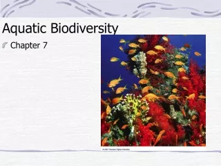
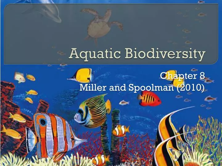
Aquatic Biodiversity. Chapter 8 Miller and Spoolman (2010). Core Why Should We Care about Coral Reefs?. Coral reefs form in clear, warm coastal waters of the tropics and subtropics. Among the oldest, most diverse, and most productive ecosystems.

E N D
Aquatic Biodiversity Chapter 8 Miller and Spoolman (2010)
Core Why Should We Care about Coral Reefs? • Coral reefs form in clear, warm coastal waters of the tropics and subtropics. • Among the oldest, most diverse, and most productive ecosystems. • Formed by massive colonies of tiny animals called polyps. • Secrete crust of limestone (CaCO3) around their soft bodies. • Elaborate network of crevices, ledges, and holes. • Symbiosis with Zooxanthellae, which live in the tissues of polyps.
Coral reefs occupy only 0.2% of the ocean floor, but provide important ecological and economic services. • Moderate atmospheric temperatures • Act as natural barriers protecting coasts from erosion (protect 15% of world’s coastline) • Provide habitats • Support fishing and tourism businesses • Provide jobs and building materials • Studied and enjoyed • Degradation and decline • 15% of coral reefs destroyed • Another 20% damaged by coastal development, pollution, overfishing, warmer oceans • Coral bleaching • Increasing ocean acidity • Decline of coral reefs should serve as a warning about threats to the health of the oceans, which provide crucial ecological and economic sevices.
Figure 8.1A healthy coral reef in the Red Sea covered by colorful algae (left) and a bleached coral reef that has lost most of its algae (right) because of changes in the environment (such as cloudy water or high water temperatures). With the colorful algae gone, the white limestone of the coral skeleton becomes visible. If the environmental stress is not removed and no other alga species fill the abandoned niche, the corals die. These diverse and productive ecosystems are being damaged and destroyed at an alarming rate.
8-1 What Is the General Nature of Aquatic Systems? Concept 8-1A Saltwater and freshwater aquatic life zones cover almost three-fourths of the earth’s surface with oceans dominating the planet. Concept 8-1B The key factors determining biodiversity in aquatic systems are temperature, dissolved oxygen content, availability of food and availability of light and nutrients necessary for photosynthesis.
Figure 8.2The ocean planet. The salty oceans cover 71% of the earth’s surface. Almost all of the earth’s water is in the interconnected oceans, which cover 90% of the planet’s mostly ocean hemisphere (left) and half of its land–ocean hemisphere (right). Freshwater systems cover less than 2.2% of the earth’s surface (Concept 8-1A).
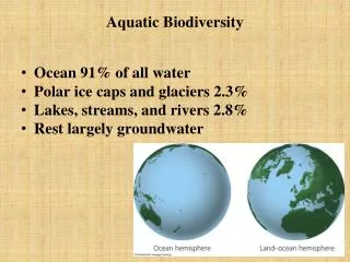
Most of the Earth Is Covered with Water • Global ocean is single continuous body of water divided into four large areas. • Atlantic • Pacific • Arctic • Indian • Freshwater makes up less than 2.2% of earth’s surface.
Aquatic equivalents of biomes are called aquatic life zones. • Distribution of many aquatic organisms is determined in large part by the water’s salinity. • aquatic life zones are classified into two major types: • Saltwater, or marine (oceans, estuaries, coastal wetlands, shorelines, coral reefs, and mangrove forests) • Freshwater (lakes, rivers, streams, and inland wetlands) • Aquatic systems play vital roles in the earth’s biological productivity, climate, biogeochemical cycles, and biodiversity, and they provide us with fish, shellfish, minerals, recreation, transportation routes, and many other economically important goods and services.
Figure 8.3Natural capital: distribution of the world’s major salt water oceans, coral reefs, mangroves, and freshwater lakes and rivers. Question: Why do you think most coral reefs lie in the southern hemisphere?
Most Aquatic Species Live in Top, Middle, or Bottom Layers of Water • Major types of aquatic organisms • Plankton – drifters • Phytoplankton • Zooplankton • Ultraplankton • Photosynthetic bacteria may be responsible 70% of PP near ocean surface • Nekton – swimmers • Benthos – bottom dwellers • Decomposers
Key factors that determine the distribution of organisms in an aquatic life zone • Temperature • Dissolved oxygen content • Availability of food • Availability of light and nutrients needed for photosynthesis in the euphotic, or photic, zone • Depth of euphotic zone in lakes and oceans can be reduced by turbidity – cloudiness caused by algal blooms or excessive silt. • Excessive nutrient loading – cultural eutrophication • Clearing land causes erosion and silt with runoff • In shallow systems: open streams, lake edges, and ocean shorelines, nutrients are usually available • In most areas of open ocean, nitrates, phosphates, iron, and other nutrients are in short supply limits NPP.
8-2 Why Are Marine Aquatic Systems Important? Concept 8-2 Saltwater ecosystems are irreplaceable reservoirs of biodiversity and provide major ecological and economic services.
Oceans Provide Important Ecological and Economic Resources • Enormously valuable ecological and economic services: estimated at $12 trillion annually (Figure 8-4) • Oceans still poorly understood. • Huge reservoirs of biodiversity • Many ecosystem types • Variety of species, genes, and biological and chemical processes • Important for sustaining life. • Marine life is found in three major life zones: coastal, open sea, and ocean bottom (Figure 8-5).
Figure 8.4Major ecological and economic services provided by marine systems (Concept 8-2). Question: Which two ecological services and which two economic services do you think are the most important? Why?
Figure 8.5Natural capital: major life zones and vertical zones (not drawn to scale) in an ocean. Actual depths of zones may vary. Available light determines the euphotic, bathyal and abyssal zones. Temperature zones also vary with depth, shown here by the red curve. Question: How is an ocean like a rain forest? (Hint: see Figure 7-17, p. 156.)
Coastal zone • Warm, nutrient rich, shallow water that extends from the high-tide mark on land to the gently sloping, shallow edge of the continental shelf. • < 10% of world’s ocean area but contains 90% of marine species • Most commercial fisheries • Most ecosystems—estuaries, coastal wetlands, mangrove forests, and coral reefs—have high NPP. • ample supplies of sunlight and plant nutrients, which come from land.
Estuaries and Coastal Wetlands Are Highly Productive • Life in these coastal ecosystems is harsh • Significant daily and seasonal changes in • Tidal and river flows, temperature, salinity and runoff of pollutants such as eroded sediments and chemicals form land. • May be composed of only a few plant species that can withstand rapidly changing environmental factors, athough such species are highly productive. • Estuaries • Where rivers meet the sea • Partially enclosed bodies of water where sea water mixes with freshwater as well as nutrients and pollutants from streams, rivers, and runoff from land (Figure 8-6).
Figure 8.6View of an estuary from space. The photo shows the sediment plume (turbidity caused by runoff) at the mouth of Madagascar’s Betsiboka River as it flows through the estuary and into the Mozambique Channel. Because of its topography, heavy rainfall, and the clearing of forests for agriculture, Madagascar is the world’s most eroded country.
Coastal wetlands • Coastal land areas covered with water all or part of the year • River mouths, inlets, bays, sounds, salt marshes (Figure 8-7) in temperate zones, and mangrove forests in tropical zones. • Some of the earth’s most productive ecosystems high nutrient inputs, rapid circulation from tidal flows, and ample sunlight penetrates shallow water. • Seagrass beds • Another component of coastal marine biodiversity. • 60 species of plants that grow in shallow marine and estuarine areas along most continental shorelines. • Support a variety of species • Stabilize shorelines and reduce wave impacts.
Figure 8.7Some components and interactions in a salt marsh ecosystem in a temperate area such as the United States. and decomposers. The photo shows a salt marsh in Peru.
Mangrove forests • Magroves—69 tree species that can grow in salt water (Figure 8-8) • Tropical equivalent of salt marshes. • 70% of gently sloping, sandy and silty coastlines in tropical and subtropical regions. • Provide important ecological and economic services • Maintain water quality • Food, habitat, and nursery sites for aquatic and terrestrial species • Reduce storm damage and coastal erosion • Historically, sustainably supplied timber and fuelwood to coastal communities • Between 1980 and 2005, and estimated 20% of mangrove forests were lost mostly due to coastal development. • polluted drinking water, salt water intrusion • reduced protection from storms • reduced biodiversity
Figure 8.8Mangrove forest in Daintree National Park in Queensland, Australia. The tangled roots and dense vegetation in these coastal forests act like shock absorbers to reduce damage from storms and tsunamis. They also provide a highly complex habitat for a diversity of invertebrates and fishes.
Rocky and Sandy Shores Host Different Types or Organisms • Moon and sun cause ocean tides that rise and fall every 6 hours • Intertidal zone – the area of shoreline between low and high tides. • Organisms here are adapted to extreme conditions: waves, varying water levels, varying salinity • Organism hold on to something, dig in, and/or hide in protective shells • Rocky shores (Figure 8-9, top) • Pounded by waves • Organisms occupy different niches in response to daily and seasonal changes in temperature, water flows, and salinity.
Figure 8.9, TopLiving between the tides. Some organisms with specialized niches found in various zones on rocky shore beaches.
Sandy shores or barrier beaches (Figure 8-9, bottom) • Support other types of organisms; most survive by burrowing, digging, and tunneling in sand • Shorebirds have specialized feeding niches (Figure 4-13, p. 93) • Barrier Islands (Figure 8-10) – low, narrow, sandy islands that form offshore, parallel to some coastlines. • South Padre Island • Undisturbed barrier beaches generally have one or more rows of natural sand dunes in which the sand is held in place by plant roots. • First line of defense against storm surges and heavy wave action from storms. • Such areas are valuable for real estate development.
Figure 8.9, BottomLiving between the tides. Some organisms with specialized niches found in various zones on barrier or sandy beaches.
Figure 8.10Primary and secondary dunes on gently sloping sandy barrier beaches help protect land from erosion by the sea. The roots of grasses that colonize the dunes hold the sand in place. Ideally, construction is allowed only behind the second strip of dunes, and walkways to the ocean beach are built so as not to damage the dunes. This helps to preserve barrier beaches and to protect buildings from damage by wind, high tides, beach erosion, and flooding from storm surges. Such protection is rare in some coastal areas because the short-term economic value of oceanfront land is considered much higher than its long-term ecological value. Rising sea levels from global warming may put many barrier beaches under water by the end of this century. Question: Do you think that the long and short-term ecological values of oceanfront dunes outweigh the short-term economic value of removing them for coastal development? Explain.
Coral Reefs Are Amazing Centers of Biodiversity • Marine equivalent of tropical rain forests • Habitats for one-fourth of all marine species Figure 8.11 Natural capital: some components and interactions in a coral reef ecosystem.
The Open Sea and Ocean Floor Host a Variety of Species • Open sea is marked by a sharp increase in depth at the edge of the continental shelf. • Divided into three vertical zones based on light penetration and temperature (Figure 8-5). • Euphotic zone • Brightly lit upper zone where phytoplankton carry out some 40% of the world’s photosynthesis. • Nutrient levels are low, except at upwellings. • DO levels are high • Large fast-swimming predatory fish: swordfish, sharks, and bluefin tuna.
Bathyal zone • Dimly lit middle zone does not contain photosynthesizing producers. • Zooplankton and smaller fishes which migrate to feed at the surface at night. • Abyssal zone • Dark and very cold, with little DO • Abundant with life even though there is no photosynthesis to support it. • Marine snow • Deposit feeders such as worms • Filter feeders such as clams and sponges • Avg. NPP per unit area is low, but make larger overall contribution to earth’s overall NPP. • NPP, higher at upwellings
8-3 How Have Human Activities Affected Marine Ecosystems? Concept 8-3 Human activities threaten aquatic biodiversity and disrupt ecological and economic services provided by saltwater systems.
Human Activities Are Disrupting and Degrading Marine Systems • A four year study by U.S. National Center for Ecological Analysis and Synthesis • Examined 17 different human activities • 41% of the world’s oceans, heavily affected • No area left completely untouched • In 2006, 45% of world’s population lives near the coast. • destruction and degradation of natural resources and services (Figure 8-4). • Projected to be 80% in 2040
Major threats to marine systems • Coastal development • Runoff of non-point source pollution: fertilizers, pesticides and livestock waste • Point source pollution such as sewage from cruise ships and oil tanker spills • Habitat destruction from coastal development and trawler fishing • Overfishing • Invasive species • Human enhanced climate change causing sea level rise: destroys coastal habitats, coastal cities and coral reefs • Climate change: warming oceans and decreasing pH • Pollution and degradation of coastal wetlands and estuaries
Case Study: The Chesapeake Bay—an Estuary in Trouble Figure 8.13Chesapeake Bay, the largest estuary in the United States, is severely degraded as a result of water pollution from point and nonpoint sources in six states and from the atmospheric deposition of air pollutants.
Case Study: The Chesapeake Bay—an Estuary in Trouble • Largest estuary in the US • Polluted since 1960 • Population increased significantly to 16.6 million in 2007 • The estuary receives wastes from point and nonpoint sources • Bay has become a huge pollution sink; only 1% of waste is flushed to the Atlantic Ocean • Phosphate and nitrate levels too high • Large algal blooms and oxygen depletion • 60% of phosphates come from point sources • 60% of nitrates come from non-point sources
Overfishing of oysters, crabs, and important fishes • Combined with pollution and disease, has caused populations to fall since 1960. • 1983, U.S. Implemented the Chesapeake Bay Program • Integrated coastal management, including citizens’ groups, communities, state legislatures, and federal government • Land-use regulations in six states to reduce ag and urban runoff • Banned phosphate detergents • Closely monitoring industrial discharges • Restoration of wetlands and sea grasses
Native oyster problem • Chesapeake Bay Program has achieved some success • Between 1985 and 2000 • Phosphorus, -27% • Nitrogen, -16% • Sea grasses coming back • There has been a drop in federal funding
8-4 Why Are Freshwater Ecosystems Important? Concept 8-4 Freshwater ecosystems provide major ecological and economic services and are irreplaceable reservoirs of biodiversity.
Water Stands in Some Freshwater Systems and Flows in Others • Standing (lentic) bodies of freshwater • Lakes • Ponds • Inland wetlands • Flowing (lotic) systems of freshwater • Streams • Rivers • Cover only 2.2% of earth’s surface but provide important ecological and economic
Figure 8.14Major ecological and economic services provided by freshwater systems (Concept 8-4). Question: Which two ecological services and which two economic services do you think are the most important? Why?
Formation of lakes • Large natural bodies of standing freshwater formed when precipitation, runoff, streams or groundwater fills depressions in the earth’s surface. • Four zones based on depth and distance from shore • Littoral zone • Limnetic zone • Profundal zone • Benthic zone
Figure 8.15Distinct zones of life in a fairly deep temperate zone lake. Question: How are deep lakes like tropical rain forests? (Hint: See Figure 7-17, p. 156)
Some Lakes Have More Nutrients Than Others Figure 8.16The effect of nutrient enrichment on a lake. Crater Lake in the U.S. state of Oregon (left) is an example of an oligotrophic lake that is low in nutrients. Because of the low density of plankton, its water is quite clear. The lake on the right, found in western New York State, is a eutrophic lake. Because of an excess of plant nutrients, its surface is covered with mats of algae and cyanobacteria.
Some Lakes Have More Nutrients Than Others • Oligotrophic lakes • Low levels of nutrients and low NPP • Eutrophic lakes • High levels of nutrients and high NPP • Mesotrophic lakes • Cultural eutrophication leads to hypereutrophic lakes
Freshwater Streams and Rivers Carry Water from the Mountains to the Oceans • Surface water • Runoff • Watershed, or drainage basin – the land area that delivers runoff, sediment, and dissolved substances to a stream, • Three aquatic life zones in the downhill flow of water • Source zone • Transition zone • Floodplain zone