Download
1 / 79
790 likes | 801 Views
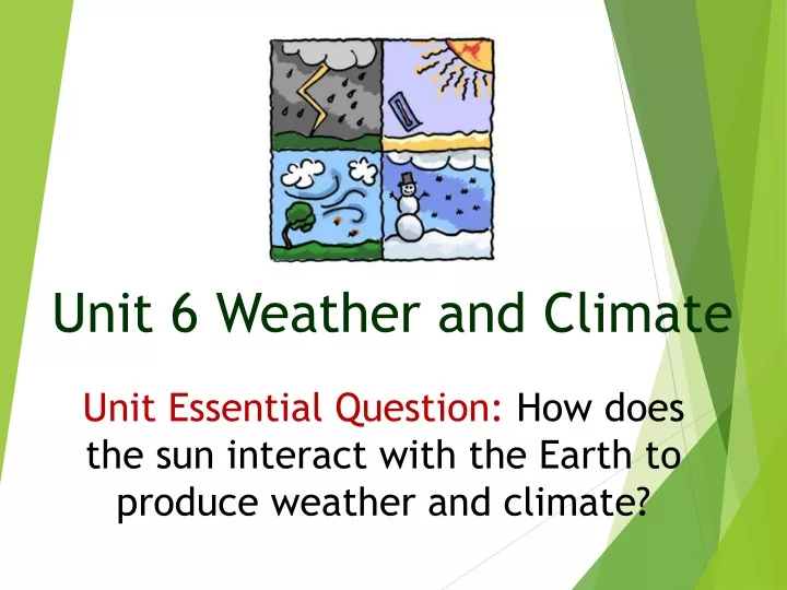
Unit 6 Weather and Climate. Unit Essential Question: How does the sun interact with the Earth to produce weather and climate?. LEQ: How do weather and climate differ?. Concept #1: Weather and Climate. What is weather?.

E N D
Unit 6 Weather and Climate Unit Essential Question: How does the sun interact with the Earth to produce weather and climate?
LEQ: How do weather and climate differ? Concept #1: Weather and Climate
What is weather? • In simple terms, weather is what is taking place in the air around you at a certain place and time. • Weather takes place in the troposphere, which is the lowest layer of Earth’s atmosphere. • The atmosphere is the envelope of gases that surrounds the planet.
Important facts to remember about weather: • It is powered by the sun. • It changes from day to day. • The daily condition of the atmosphere, or weather, of a particular area is based on: • Temperature (Heat) • Moisture (humidity, clouds, precipitation) • Wind (moving air, air masses, fronts) • Scientist who predict the weather are called meteorologists.
What is climate? • Climate is the name for the general conditions of temperature and precipitation for an area over a long period of time. • The climate of a region is described according to two basic factors: • temperature • precipitation
Factors that affect temperature of a region’s climate: • Four natural factors that affect the temperature at a particular location: • Latitude • Altitude (elevation) • Distance from large bodies of water • Ocean Currents
Factors that affect the temperature of a region’s climate: Latitude What is latitude? • It is the measure, in degrees, of the distance north and south of the equator. How does latitude affect climate? • Areas close to the equator, or zero degrees latitude, receive the direct rays of the sun. These direct rays provide the most radiant energy. • Areas near the equator have a warm climate. Polar regions have a cold climate.
Factors that affect the temperature of a region’s climate: Latitude • Based on Latitude, Earth’s surface can be divided into three main temperature zones (see map on the following slide): • Tropical Zone • Temperate Zone • Polar Zone
Earth’s temperature zones:Tropical Zone • Location: area near the equator, between 23.5 degrees north and 23.5 degrees south. • Sunlight: receives the most all year round • Climate: warm
Earth’s temperature zones:Temperate Zone • Location: between the tropical and polar zones. • Sunlight: strikes it more directly • Climate: ranges from hot or warm in the summer; cool or cold in the winter
Earth’s temperature zones:Polar Zone • Location: extends from 66.5 degrees north to 90 degrees north AND 66.5 degrees south and 90 degrees south. • Amount of sunlight: always strikes at a lower angle. • Climate: cold
Factors that affect climate: Elevation • Elevation, or altitude, is the distance above sea level. • As elevation increases, the air becomes less dense , has fewer gas molecules, and temperature decreases. • Mountain ranges, can play an important role in the amount of precipitation an area receives. • A mountain range acts as a barrier to prevailing winds. The windward side of a mountain has a wet climate. • On the leeward side, relatively dry air moves down the side of the mountain, which results in very little precipitation on the opposite side.
Factors that affect the temperature of a region’s climate: Large bodies of water • Large bodies of water, such as lakes and oceans, can affect the temperature of an area because the temperature of the water body influences the temperature of the air above it. • Temperatures of nearby lands are less extreme.
Factors that affect the temperature of a region’s climate: Ocean Currents • Ocean currents help transfer heat to the atmosphere. • Some warm ocean currents move water from the equator towards the poles and warms the air above it. The warm air moves over to the nearby land. • At the same time, cold currents bring cold water from the polar zones towards the equator. As it moves, it brings cool air. • Marine climates are influenced by ocean currents. • The Gulf Stream is an ocean current that carries warm water along the eastern coast of the United States. • The California Current travels toward the equator carrying cold water along the west coast of the United States.
Factors that affect the amount of Precipitation an area receives impact the climate of that region. • Prevailing Winds: directional winds that usually blow in a region such as the prevailing westerlies and the polar easterlies, which affects weather in the United States. • Presence of Mountains • Seasonal Winds: sea and land breezes over a large area that change direction with the season such as monsoons.
Prevailing winds affect the amount of precipitation • Weather patterns are influenced by movement of air masses. • Movement of air masses rely on prevailing winds, which are the directional winds that move in a particular region.
3. The temperature of the air mass determines the amount of moisture it carries. Warm air masses hold a lot of moisture while cold air masses do not. 4. The direction from which the air mass comes will also determine the amount of moisture it carries. Winds blowing inland from oceans and lakes carry more water vapor than winds that blow over land.
Mountain ranges affect the amount of precipitation 1. A mountain range acts as a barrier to prevailing winds. The windward side of a mountain has a wet climate.
2. On the leeward side, dry air moves down the side of the mountain resulting in very little precipitation on the leeward side.
Seasonal winds affect the amount of precipitation 1. Monsoons happen during the summer in South and Southeast Asia when the land gradually gets warmer than the ocean. 2. Sea breezes blow inland constantly bringing to the land warm, humid air.
3.As the warm air rises over land, it cools, condenses to clouds, and produces heavy rains. 4. Monsoon regions receive very little rain in the winter because the land cools becoming colder than the ocean. 5. Since wind moves from areas of high pressure (cold wind from the land) to areas of low pressure (warmer ocean), it carries very little moisture.
Scientists classify Earth into six broad climate regions based on temperature and precipitation received in that region: Tropical Rainy Dry Temperate Marine Temperate Continental Polar Highlands
Tropical Rainy Climate Region • Temperature: • Temperate wet: 18 degrees Celsius or higher • Temperate dry: always hot • Precipitation: • Temperate wet: heavy rainfall year-round, about 72 cm • Temperate dry: heavy rainfall in the wet season, more than 59 in. • Usual Weather: • Temperate wet: hot and humid • Temperate dry: has distinct dry and wet seasons • Places: Temperate wet – windward side of Hawaiian Islands: Temperate dry - southern tip of Florida and Makindu, Kenya
Dry Climate Region • Temperature: may be hot or cold • Precipitation: • Semiarid – less than ½ inch (about 25-50 cm) per year • Arid – less than 25 cm • Usual Weather: • Semiarid – little rainfall, very dry • Arid – very dry, little rainfall • Places: • Semiarid – Great plains in the United States • Arid – Parts of California
Temperate Marine Climate Region • Temperature: Averages 10 degrees Celsius or higher in the warmest months, and between -3 degrees Celsius in the coldest months. • Precipitation: Moderate all year in marine west coast climate, about 16-68 inches per year. • Usual weather: Three sub-types of Temperate Marine Climate – • Mediterranean: warm, dry summers; rainy winters • Humid subtropical: hot summers, cool winters, hurricanes, thunderstorms. • Marine west coast: mild winters, cool summers. • Places: • Mediterranean: places near the Mediterranean Sea, southern California • Humid subtropical: southeastern United States • Marine west Coast: northern California to southern Alaska
Temperate Continental Climate Region • Temperature: Average is 10 degrees Celsius or higher in the warmest month, and -3 degrees Celsius in the coldest month. • Precipitation: • Humid continental: moderate amount year-round, up to 40 inches • Subarctic: light precipitation mainly in the summer • Usual weather: • Humid continental: hot, humid summers; cold winters • Subarctic: short, cool summers; long, cold winters • Places: • Humid continental: Northern Hemisphere only, northeastern part of the United States. • Subarctic: Parts of Alaska, Canada, and Russia
Highland Climate Region • Temperature: Falls as altitude increases. • Precipitation: Increases as altitude increases. • Usual Weather: • Climate in the foothills are similar to semi-arid climate. • Higher up in the mountains would be similar to subarctic climate. • Above the tree-line would be similar to tundra climate. • Places: • Mt. Rainier in Washington State • Rocky Mountains
Polar Climate Region • Temperature: • Tundra: Average is below 10 degrees Celsius in the warmest month • Ice Cap: Average is at or below zero degrees Celsius (below freezing!) • Precipitation: • Very little, mostly snow • Dry because cold air holds very little moisture. • Usual Weather: • Tundra: short, cool summers; bitterly cold winters. • Ice Cap: intense cold with dry air • Places: • Tundra: Northern Alaska, Canada, Russia • Ice Cap: Greenland, Antarctica
Outside the tropics, most regions have four distinct seasons all year long: winter, spring, summer, and fall (autumn). Seasons are not related to the distance between the Earth and the sun.
The tilt of Earth’s axis as it travels (revolves) around the sun is the cause of the seasons. The seasons change as the amount of energy (sunlight) each hemisphere receives from the sun changes.
http://www.classzone.com/books/earth_science/terc/content/visualizations/es0408/es0408page01.cfm?chapter_no=04http://www.classzone.com/books/earth_science/terc/content/visualizations/es0408/es0408page01.cfm?chapter_no=04
S6E2. Students will understand the effects of the relative positions of the earth, moon and sun. c. Relate the tilt of the earth to the distribution of sunlight throughout the year and its effect on climate.
Concept #2LEQ #1:How does heataffect changes in weather patterns?LEQ #2: How does heatcause changes in air masses? • S6E4. Students will understand how the distribution of land and oceans affects climate and weather. • Demonstrate that land and water absorb and lose heat at different rates and explain the resulting effects on weather patterns. • Relate unequal heating of land and water surfaces to form large global wind systems and weather events such as tornados and thunderstorms. • Relate how moisture evaporating from the oceans affects the weather patterns and weather events such as hurricanes.
Today’s video review questions: • What causes the uneven heating of Earth’s surface? • What effect does the uneven heating of Earth’s surface have on the weather? • How does the uneven heating of Earth’s surface affect the air above it? • Which type of heat transfer (conduction, convection, or radiation) circulates heat in the atmosphere as well as in the oceans? • How does wind affect weather? • What is the relationship between air pressure and wind?
Temperature is the measure of motion in particles. • The faster the air particles are moving, the higher (hotter, warmer) the temperature.
The slower, the lower (colder, cooler) the temperature. • Movement of heat (heat transfer) in the atmosphere causes temperatures to change, wind to blow, and precipitation to fall.
How does the uneven heating of Earth’s surface cause wind andaffect weather patterns?
How is wind created and what affect does it have on weather? • Warm air is less dense than cool air so rises, and cool air tends to sink. As warm, moist air rises, less air pushes down on the area below it. This creates an area of low pressure.
As cool, dry air sinks, more air pushes down on the area below it. This creates an area of high pressure. • Air moves from an area of high pressure to an area of low pressure. This movement of air is called wind.
Important points to remember about wind and air pressure: • Air always moves from an area of high pressure to an area of low pressure. • Air pressure decreases as altitude increases.
Changes in air pressure causes changes in weather. • The greater the pressure difference between two areas, the faster the air moves and the harder the wind blows.
Global Wind Belts are caused by global convection currents and other factors. Such as the Coriolis Effect. These affects a larger area than local winds. • Doldrums • Horse Latitudes • Trade Winds • Prevailing Westerlies • Polar Easterlies • Jet Streams