Download
1 / 24
240 likes | 503 Views
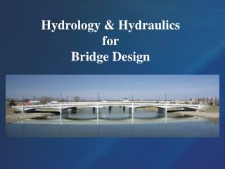
Introduction to Hydrology: Floodplains & Drainage Basins Lessons 21 & 22. Introduction to hydrology Stream types, orders, and gradient Floodplains and landforms. Stream Systems. Streams are bodies of water that are confined to a small region such as within stream banks

E N D
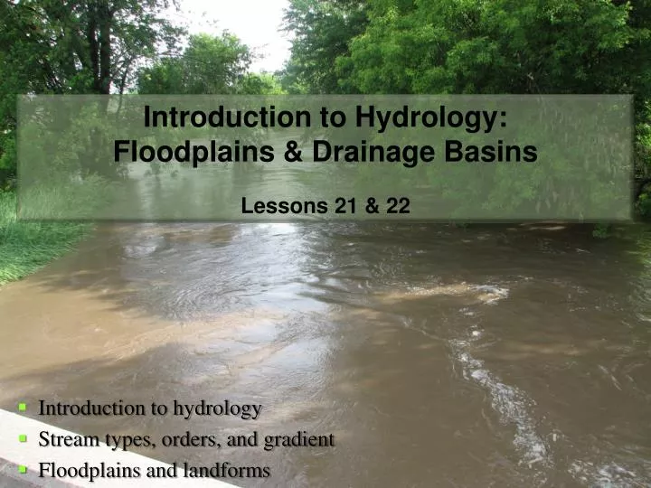
Introduction to Hydrology:Floodplains & Drainage BasinsLessons 21 & 22 Introduction to hydrology Stream types, orders, and gradient Floodplains and landforms
Stream Systems • Streams are bodies of water that are confined to a small region such as within stream banks • Streams produce erosion, known as fluvial erosion • Streams are also important for groundwater recharge and wildlife • A stream may also be called a branch, brook, creek, crick, lick, bayou, wash, run, etc.
Stream Systems, cont. • Usually, a stream begins at a location known as the headwaters • This source location can be a spring or seep or a low area in a valley where water drains to • Recall, water flows from high to low elevation • Small streams flow downhill and converge into larger streams • The point at which two streams merge is called the confluence • The opposite of confluence is bifurcation, where one stream splits into two separate streams
Stream Systems, cont. • As streams converge and diverge, they create a hierarchy of streams with different gradients, lengths, drainage areas, and total volume of water
Types of Streams • Perennial streams are those that have flowing water 90% of the year in a well-defined channel • Intermittent streams are those that have flowing water only during the wet season (≤50% of the year) • Ephemeral streams generally have flowing water only after heavy rainfall events (e.g. thunderstorms) • Winterbourne streams flow only during the winter months
Stream Characteristics • Streams located on gentle slopes with low water velocities will flow back and forth, finding the lowest elevation to flow to • This shift in the streams course is known as meandering • Over time, a stream will meander back and forth across the flat valley floor, known as a floodplain • Lateral erosion, shifts the course of the stream over time
Stream Characteristics, cont. • This lateral erosion is concentrated along the outside bank of the meandering stream • Primarily due to higher water velocity • However, on the inner bank (slower moving water), soil and silt is being deposited • Known as fluvial deposition • Over time, lateral erosion and fluvial deposition gradually shift the course of the stream back and forth across the floodplain • This results in the newer stream course being steeper, generally in a more straight direction with a faster flow
Stream Characteristics, cont. • Erosion along the outer bank eats away at the soil (1) • Further erosion forms a cut-off meander and a new stream/river channel (2) • Eventually an ox-bow lake is created that is separate from the stream/river (3)
Stream Characteristics, cont. Fast current = erosion
Stream Characteristics, cont. Slow current = deposition
Stream Characteristics, cont. • Oxbow lakes may eventually become swamps, known as oxbow swamps • If precipitation is low, these swamps may dry up and form small streams or dry stream beds known as meander scars
Floodplain Landforms • Several types of landforms are associated with larger streams and rivers and the floodplains they produce
Floodplain Landforms, cont. • Hills or ridges along each side of a major stream or river are known as bluffs • If river flooding occurs, it generally does not reach this level • Undercut banks or natural levees are formed from silt/soil deposits along the outer edge of the stream/river
Floodplain Landforms, cont. • Streams that flow parallel to the main stream or river are called yazoo streams • Yazoo streams are cutoff from the main stream due to natural levees • When a stream/river meanders and cuts into itself it is called a cutoff meander • This allows for the stream/river to take a shorter course
Floodplain Landforms, cont. • A cutoff meander will initially become an isolated lake known as an oxbow lake • When cutoff meanders fill with sediment and dry up, the become what’s known as meander scars
Floodplain Landforms, cont. • As a stream/river cuts across the narrow neck of a meander (a), the cutoff river bend becomes an oxbow lake (b), which over time becomes an oxbow swamp (c), which in turn becomes a meander scar (d). From McKnight and Hess.
Drainage Basins • A drainage basin or watershed is an area within which all water flows toward a single stream • Watersheds are separated by what’s known as a drainage divide • This is usually a ridge or some sort of man-made divide
Stream Orders • Looking at an entire watershed we can see many streams which have various lengths, sizes, and patterns • These streams can be analyzed through stream ordering • A 1st order stream is the smallest stream in a watershed or system of streams • They do not have tributaries flowing into them • Where two 1st order streams meet, a 2nd order stream is formed • Where two 2nd order streams meet, a 3rd order stream is created • However; when a 1st order and 2nd order stream meet, a 3rd order stream isn’t formed • Two 2nd order streams are required to form a 3rd order stream, etc, etc.
Stream Orders, cont. • Notice that the elevation gradient changes much faster between 1st and 2nd order streams than it does between 3rd and 4th order streams downstream
Quick Review • Homework problems ask that you evaluate several topographic profiles. I highly suggest you refresh your memory and revisit lessons 5 and 6, which can be found online at: http://www.wx4sno.com/portfolio/BSU/spring_2012/lectures/GEOG101L_Lessons_5-6.pptx
Quick Review, cont. • Furthermore, recall that contour lines in the shape of a “V” indicate a stream or creek…with the apex of the “V” pointing uphill • There are 63,360 inches in one mile • There are 5,280 feet in one mile • Page 139: Problem 2a-2d, bonus worth 1pt. • If you need help at all, please email me to setup an appointment or come see me during office hours…
Office Hours • Wed: 11:30 AM to 12:30 PM • Thr: 9:15 AM to 12:30 PM • Fri: 10:00 AM to 12:00 PM • Meet briefly next week to turn in Lessons 21 and 22. • If you have questions about your grades, see me no later than April 27th!