Download
1 / 30
310 likes | 471 Views
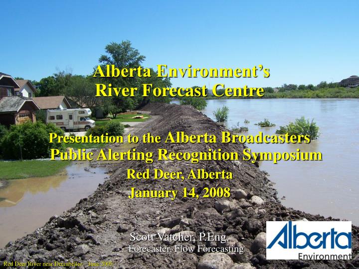
Alberta Environment’s River Forecast Centre Presentation to the Alberta Broadcasters Public Alerting Recognition Symposium Red Deer, Alberta January 14, 2008 Scott Vatcher, P.Eng. Forecaster, Flow Forecasting. Red Deer River near Drumheller – June 2005. What River Forecasting Does.

E N D
Alberta Environment’s • River Forecast Centre • Presentation to the Alberta Broadcasters Public Alerting Recognition Symposium • Red Deer, Alberta • January 14, 2008 Scott Vatcher, P.Eng. Forecaster, Flow Forecasting Red Deer River near Drumheller – June 2005
What River Forecasting Does • Real-time monitoring and reporting • Water Management • Infrastructure Management • Water Supply Forecasting • Flood Forecasting
1. What do we monitor and report? Real-time data • Stream levels and flows • Lake and reservoir levels • Precipitation • Snowpack • Temperature, wind, humidity • Water quality
Real-time Hydrometric Stations • Over 350 currently • Stream, lake, reservoir levels • Satellite/phone links
Real-time Meteorological Stations ~ 218 Federal and Provincial Hourly Data • Precipitation • Temperature • Relative humidity • Wind speed
Forestry Meteorological Stations • ~ 190stations • Mostly in north • Most report 2x-daily • Some report 1x-daily
46 Mountain Snow Course Sites 71 Plains
Snow Pillows • 13Mountain Sites • (new site at South Esk) • 2Plains Area Sites USES • Snow-on-ground • Snow / Rain indicators • Melt rates
2. Water Management Provide information to support in real-time: • In-stream flow needs • (Fish, water intakes, ferry crossings) • Apportionment (sharing) agreements • Prairie Provinces, U.S. • Natural Flows • License requirements • Water Quality • QA/QC of real-time data Waterton Reservoir
3. Infrastructure Management • ~$5.2 Billion of provincial water infrastructure in Alberta • Develop flood operating procedures and provide operational advice to dam operators • Conduct annual flood drills for provincially owned reservoirs • Provide cross-check of operations during floods • Coordinate with Trans Alta Utilities • Provide technical resources and secondary notification of potential dam emergencies – coordinated with Emergency Management Alberta • Provide forecasts for • Floods • Water quality • Water supply • Reservoir Inflows • Natural flows Oldman River Dam
4. Water Supply Forecasting • Current conditions reporting assesses snowpack, precipitation and soil moisture conditions and their impact for runoff potential 08-2001 • Runoff forecasts and current conditions are updated monthly and published in the Water Supply Outlook for Alberta (20 forecast points) • Runoff forecast used by others to plan allotment of reservoir water supplies for irrigation, hydroelectric, and community & municipal purposes and reservoir operations 09-2002 Chin Reservoir Photos by Wally Chinn
5. Flood Forecasting • Forecast floods and flows • Issue Advisory and Warnings • High Streamflow Advisories • Flood Watches • Flood Warnings • Assist Alberta Environment’s River Engineering in issuing advisories and warnings for ice and ice jams High River – June 2005
Why is Forecasting Necessary? • Potential to reduce Flood Damage by Flood Avoidance • 66Communities Identified having a Flood Risk • 36 of 66 have forecast procedures developed • Potential to reduce Flood Peaks using Reservoir Storage • 5Major Government & 10 Major Private Reservoirs located upstream of populated centres with potential for flood attenuation North Saskatchewan River at Edmonton – July 1986
Why is Forecasting Necessary? • Rapid Response Time of Mountain / Foothill Streams • Rapid Response “FLASH FLOODS” in Southern Alberta and Swan Hills • Response time much longer in Northern Alberta • Variety of Flood Conditions • Snowmelt • Plains - March - April • Only smaller streams affected (Paddle, Battle, Vermilion, etc) • Ice jams • Mountains - May - July • No flooding of major rivers by mountain snowmelt alone • Rainfall • Affects all rivers in Alberta • Flooding along major rivers is caused by heavy rainfall or heavy rainfall during mountain snowmelt Oldman River at Lethbridge – June 2005
Importance of Weather Forecasting • Lead time prior to onset of storm • Quick response times of many rivers • Identify major storm patterns • Storms can cover large area of the Province • Partnerships with Meteorological Service of Canada, and Alberta Sustainable Resource Development (Fire Weather), who provide weather forecasts • Satellite and radar imagery used to track weather systems
Provincial Responsibilities for Floods • Department of Environment – Lead Agency • Flow Forecasting • Issuing of flood related advisories and warnings • Provide information/forecasts about the floods • Coordinate all information from government and non-government agencies and provide value added information to all stakeholders, including the public • Coordinate reservoir operations to provide early warning and forecasts for communities • Water Operations • Operate the $5.2 billion of infrastructure in the province • Disaster Services Act • Municipalities are tasked with the due care and safety of their citizens – response on the ground • When overwhelmed in an emergency, provincial help is available through Emergency Management Alberta
Field Staff: Water Survey of Canada/AENV Data Management and Systems Public Weather Info: MSC ASRD AENV Communications Emergency Management Alberta AENV Water Operations Saskatchewan Watershed Authority Municipalities and other responders (RCMP) Other Government and non-govt Agencies Media River Forecasting
Alerts If a storm is forecast to cause major changes in streamflow, we can issue up to 3 levels of alerts: Flood Watch High Streamflow Advisory A High Streamflow Advisory means that stream levels are rising or expected to rise rapidly and no major flooding is expected. Minor flooding in low-lying areas is possible. Anyone situated close to the streams affected (campers, fishermen, boaters, and the general public) is advised to be cautious of the rising levels. A Flood Watch means that stream levels are rising and will approach and may exceed bank full. Flooding of areas adjacent to these streams may occur. Anyone situated close to these streams is advised to take appropriate precautionary measures. Paddle River - 2001 Paddle River - 2001 Flood Warning A Flood Warningmeans that rising river levels will result in flooding of areas adjacent to the streams affected. Anyone situated close to the river should take appropriate measures to avoid flood damage. Red Deer River at Drumheller – June 2005
Spring Runoff Advisory A Spring Runoff Advisory means that stream levels are rising or expected to rise due to snowmelt and no major flooding is expected. Minor flooding in low-lying areas is possible. Anyone situated close to the streams affected (property owners and the general public) is advised to be cautious of the rising levels. Medicine River - 1999
What When Where Why Next Update Definitions Contacts
Forecaster’s Comments Impact: Gave Forecasters an opportunity to put out more information – restricted to one page on fax
Communicating Flood Related Information • FAX • Two FAX Broadcast Systems - can notify 400 clients in 30 minutes • TELEPHONE • Automated notification system – operational since the 2004 season • INTERNET • http://www3.gov.ab.ca/env/water/ws/advisories/ • Numerous data and information products (Forecaster’s Comments) available • IVR (Interactive Telephone Response) • RADIO AND TELEVISION • Emergency Public Warning System North Saskatchewan River at Edmonton – June 2005
When They Are Notified • Stage 1 - Anticipation Of Major Storm • Verify Weather Forecasts • Forecasting Staff - Allocate Manpower for Shift (7x24 – two 12 hour shifts required) • Notify Dam Operators • Usually 12 - 48 Hours Prior to Start of Storm • Information in Forecaster’s Comments • Stage 2 - Heavy Rainfall Warning Issued or High Streamflow Situation • Assess Situation Identify Problem Areas • Notify Other Water Managers • Qualitative Forecasts • Update Dam Operators, Water Managers • Alert Local Authorities, Media (Advisory) • Stage 3 - Flood Emergency • Quantitative Forecasts (Time and Stage of peak) • Alert as in Stage 2
Questions? Sundre – June 2005
June 2005 Flood Events Bearberry Creek at Sundre – June 2005
June 2005 Flood Events • In June 2005, three major flood events occurred in a short period of time • The flood event covered a large geographic area • In many areas, these events are the worst floods on record Red Deer River upstream of Red Deer – June 2005
Chronology of Key Events – Red Deer Wednesday, June 15 1:30 pm Call to Dickson Dam to inform of potential rain event over the weekend 3:30 pm Dickson Dam begins to pre-release from reservoir Thursday, June 16 9:10 am High Streamflow Advisory issued for downstream of Dickson Dam, including Red Deer and Drumheller 9:40 am Calls to Red Deer, Drumheller and other local municipalities about possibility of large flows over the weekend 1:00 pm Emergency Management Alberta notified of potential heavy rain event for the Oldman, Bow and Red Deer River basins
Chronology of Key Events – Red Deer • Friday, June 17 • 9:45 am Flood Watch issued for streams and rivers upstream of Dickson Dam, including the mainstem of the Red Deer – also included Little Red Deer River • ~12:00 pm Precipitation begins in headwaters of Red Deer River basin • Saturday, June 18 • 8:10 am Flood Warning issued for Red Deer River upstream of Dickson Dam (not including Sundre) and Little Red Deer River • 9:20 am Flood Warning issued for Sundre and for James and Raven Rivers – Broadcast on Emergency Public Warning System • 12:00 pm Red Deer, Drumheller and other local municipalities advised of major flood event to affect towns – preliminary forecasts given • 12:30 pm EMA advised of situation to affect Red Deer and Drumheller • 12:45 pm Flood Warning issued for Red Deer River downstream of Dickson Dam, including Red Deer and Drumheller • 2:00 pm Water levels in Dickson Dam begin to rise • ~2:30 pm RFC notified by WSC of measurement at Little Red Deer River near Water Valley of 568 m³/s
Alberta June 2005 Floods by the numbers • Number of storm events: 4 • Number of flood events: 3 • Number of times High River and Okotoks flooded in 22 days: 3 • Number of years to the day from the last flood in High River to the first one this year: 10 • Number of stations recording flood of record: 21 • Number of communities declaring local states of emergency: 29 • Highest flow recorded: 3,832 m3/s • South Saskatchewan River at Medicine Hat • Number of provinces flooded as a result of second event: 3 • Alberta, Saskatchewan and Manitoba • Preliminary damage estimate: $700 million
Alberta June 2005 Floods by the numbers • Number of advisories issued by River Forecasting: 44 • Number of phone calls to/from River Forecasting: 2,566 • Number of faxes sent by River Forecasting: 26,436 • Number of web hits to flood information: 774,310 • Previous High: 179,266 - June 2002 • Most web hits in one day: 98,310 - June 7, 2005 • Number of gauge site visits by Water Survey of Canada and AENV field staff: 352 • Number of gauge measurements conducted by WSC and AENV field staff in June: 204 • Number of days that River Forecasting was on 7x24: 22 • Number of overtime hours worked by River Forecasting, Data Management and System Support: 1,553 • Number of times Emergency Public Warning System used by River Forecasting: 7