Download
1 / 18
180 likes | 299 Views
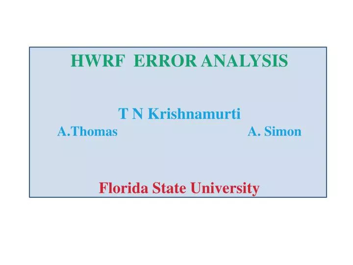
HWRF ERROR ANALYSIS T N Krishnamurti A.Thomas A. Simon Florida State University. IN THIS STUDY WE MAKE USE OF HWRF DATA SETS FROM THEIR FEBRUARY 2012 TAG , WHICH UTILIZES A 3KM HORIZONTAL RESOLUTION FOR THE INNERMOST MOVING NEST .

E N D
HWRF ERROR ANALYSIS T N Krishnamurti A.Thomas A. Simon Florida State University
IN THIS STUDY WE MAKE USE OF HWRF DATA SETS FROM THEIR FEBRUARY 2012 TAG , WHICH UTILIZES A 3KM HORIZONTAL RESOLUTION FOR THE INNERMOST MOVING NEST . THE FOLLOWING STORMS WERE USED TO DETERMINE THE MULTIPLIERS: KATIA, OPHELIA, PHILIPPE, MARIA, BRET,SEAN AND RINA THE FOLLOWING STORMS WERE USED TO DETERMINE ERROR STRUCTURE AFTER THE MULTIPLIERS HAD BEEN CALCULATED: IRENE,NATE, AND EMILY
FSU ERROR FINDING ALGORITHM Total tendency errors can be estimated from the following equation: Where i, j and k denote an index for the three co-ordinates, and l the variable. The three-dimensional (multiple regression based) multiplier λijklis defined such that: The determination of λijklutilizes the least squares minimization –procedure based on several multiple linear regression. λijkl provides mean for statistically corrected estimates of the forcing for the dynamics and physics of any of the equations while minimizing (towards 0) the total tendency error. The four dimensionally distributed error at a grid location is given by (1- λijkl )Aijkl
……………………(1) Temp. Tendency = Temp. Tendency from advection +Temp. Tendency from adiabatic heating +Temp. Tendency from microphysics ( This includes cumulus convection) + Temp. Tendency from long/short wave radiation + Temp. Tendency from PBL + Temp. Tendency from large scale condensation + Temp. Tendency from diffusion
Writing this in terms of linear regression coefficients for the HWRF forecasts: OBS =λ1ADV +λ2ADB +λ3CU +λ4MP+ λ5LW +λ6SW + λ7PBL + λ8LSC+RESIDUAL where, OBS, ADV, ADB, CU, MP, LW, SW, PBL are from the observed, advection, adiabatic heating, cumulus convection, planetary boundary layer, long wave radiation, short wave radiation, and micro physics respectively. λ1, λ2, λ3, λ4, λ5, λ6, λ7,λ8are the linear regression coefficients (multipliers) ……………………(2)
COMPUTATIONAL FLOW CHART Three Dimensional Data from 250 HWRF forecasts Compute six hourly tendencies CONVECTION MICROPHYSICS L.WAVE S.WAVE PBL LSC Perform Multiple Regression Using Eqn.2 and find λit (I,J,K) Compute Errors of Different fields of Eqn.1 Apply the λs to Map the Errors for New Storms A
LOCAL CHANGE Use a pair of adjacent six hourly field data sets INPUT DATA T(I,J,K) at Hour ‘t’ T(I,J,K) at Hour ‘t+6’ Univariate Analysis Find Find T(I,J,K) at Hour ‘t+6’ at locations of hour ‘t’ A
Time ‘t+6’ Time ‘t’
STEPS TO FIND THE MULTIPLIERS 1.Multipliers are obtained by stringing data sets, by 6 hourly forecast hours, in a local cylindrical coordinate using the storm motion as the principal azimuth. 2. Collate forecasts of temperature tendencies ( including those from component physics and microphysics) at intervals of every 6 hours using a local cylindrical coordinate with the direction of storm motion as the principle azimuth. 3. Compute model and observed total temperature tendencies 4. Calculate model residual tendency which represents l tendencies from diffusion etc that are not explicitly included in 2 above. 5. Obtain the multipliers by regressing the observed total tendency against all of the model tendency terms. This uses as many as 112 forecasts from HWRF for the hurricanes of the 2011 season.
……………………(2) (MOD TENDENCY – HCUMULUS) RESIDUAL = RESIDUAL
CALCULATING THE CORRECTED TERMS Having the three dimensional multipliers for each term, MULTIPLYING THE GRID VALUE OF THE TERM WITH CORRESPONDING MULTIPLIER WE GET THE CORRECTED TERM multiplier * model tendency gives CORRECTED TENDENCY (1 – multiplier)* model tendency gives the ERROR in the corresponding tendency
Θ=270 Θ=0 Θ Θ=90
THIS IS AN EXAMPLE OF COLLATING FORECAST DATA ( MICROPHYSICAL TEMPERATURE TENDENCY) ALONG THE PRINCIPAL AZIMUTH, HERE IT CALLED FOR A ROTATION OF THE ORIGINAL FORECAST FIELD BY 60 DEGREES.
a The uncorrected temperature tendencies ( from the PBL Physics) at the pressure level 850 hPa , for hurricane Irene , 25 July 00 UTC, 2011 . These corrections for hour 12 of forecast , show values as large as - 90 x 10-5 deg C /sec (over the region of purple shading). Elsewhere the tendencies are smaller, over the region to the left, where orange shading prevails, the temperature tendencies are of the order of 10 x 10-5 deg C /sec. The multipliers are large near the eye wall region and along a rain band where it calls for large corrections. The corrected tendencies bottom right panel are quite different from the uncorrected tendencies of the top left panel. The corrected tendencies near the eye wall are around +4 0 x 10-5 deg C /sec. b c d (a) Model temperature tendency (0C/s) arising from the PBL physics for the 12hour forecast of hurricane Irene at 850 hPavalid at 00z of 25 July 2011; (b) Field of the multiplier, λ; (c) (1- λ); (d) The corrected temperature tendency.
a The uncorrected temperature tendencies from microphysics ( are very large along the eye wall region of hurricane Irene on September 25 00UTC 2011, at the pressure level 400 hPa.. Here we are showing results for hour 12 of forecasts. The uncorrected values near the storms center purple, blue and dark green colors implying tendencies from the microphysics of the order of 8 to 20 degrees C / day. Somewhat large corrections were implied for the temperature tendencies arising from microphysics at the 400 hPa level in these locations with multiplier taking values like -0.8 . In these regions the corrected tendency changes from 8 to 20 deg C/day to - 10 deg C/day. Which implies condensation heating being possibly replaced by evaporative cooling. Over the right of the storm the uncorrected green shading carries a tendency of the order of 1 deg C/day for heating, the corrected tendency shown in pink colorcarries a warming by about two deg C/day. These are instantaneous systematic errors for hour 12 of forecast for hurricane Irene. b a a b b c d c d c d • (a) Model temperature tendency (x 10-5 0C/s) arising from the microphysics for the 12hour forecast of hurricane Irene valid at 400 hPa valid at 00z of 25 July 2011; (b) Field of the multiplier, λ; (c) (1- λ); (d) The corrected temperature tendency
a b The uncorrected tendencies for the long wave radiation are generally small they are of the order of 1 to 2 degrees C/day . The multipliers shown in the top right panel carry purple colors ( with values of around -1.) and red color ( with values around + 0.4). The purple coloring occupies a larger area where the corrected tendencies now show much lowered temperature tendencies of the order of 0.5 degrees C/day.The prevailing red shading in the corrected tendencies carry long wave radiative temperature tendencies of the order of + 0.5 degrees C /day at the 850 hPa level, the plus sign implies below the cloud a net warming by long wave radiative flux convergence. This feature is absent in many models Overall it appears that the radiative cooling around the hurricane was somewhat over estimated by HWRF. The magnitudes of the long wave radiative tendencies are somewhat reduced by these corrections. c d (a)Model temperature tendency (x 10-5 0C/s) arising from the long wave radiation for the hour 12 forecast of hurricane Irene at 850 hPa valid at 00z of 25 July 2011; (b) Field of the multiplier, λ; (c) (1- λ); (d) The corrected temperature tendency
a b THE UNCORRECTED TENDENCIES ARE IN THE RANGE -3 TO +5 DEG C/DAY. , MOST VALUES ARE ON THE PLUS SIDE, THE CORRECTIONS, POSSIBLY REFLECT CLOUD RADIATIVE CORRECTIONS, THOSE RANGE FROM +1.5 TO - 1.0 DEG C/DAY. c d Model temperature tendency (x 10-5 0C/s) arising from the short wave radiation for the 12hour forecast of hurricane Irene at 850 hPa valid at 00z of 25 July 2011; (b) Field of the multiplier, λ; (c) (1- λ); (d) The corrected temperature tendency
WHERE WE ARE GOING NEXT THE COMPOSITED MULTIPLIERS, AT 6 HOURLY INTERVALS, ARE BACK TRANSFORMED FROM THE LOCAL CYLINDRICAL GRID TO A LAT-LON GRID, OF HWRF, FOR EACH POSSIBLE AZIMUTHAL HEADING OF THE STORM MOTION, WE USE 36 AZIMUTHS. WE INTRODUCE THESE MULTIPLIER FIELDS , AT ALL VERTICAL LEVELS FOR THE INNERMOST GRID OF HWRF , TO ALL TENDENCY TERMS OF THE MODEL CODE., THAT IS EACH TERM IS MULTIPLIED BY A MULTIPLIER FIELD ( INTERPOLATED TO EACH TIME STEP OF THE MODEL). FORECAST EXPERIMENTS ARE CARRIED OUT THAT UTILIZE THE MULTIPLIERS ie THEY REDUCE THE SYSTEMATIC ERRORS ARISING FROM VARIOUS COMPONENTS OF MODEL PHYSICS. THE SAME EXERCISE IS DONE FOR THE MOISTURE CONSERVATION EQUATION OF HWRF.