Download
1 / 25
250 likes | 386 Views
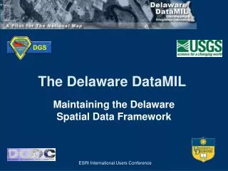
The Delaware DataMIL A Pilot Project for The National Map. Richard S. Sacher Research & Data Management Services Office of Information Technologies University of Delaware. IASSIST 2002 Conference Storrs, CT June 13, 2002. Delaware Geographic Data Committee (DGDC).

E N D
The Delaware DataMILA Pilot Project for The National Map Richard S. SacherResearch & Data Management ServicesOffice of Information TechnologiesUniversity of Delaware IASSIST 2002 Conference Storrs, CT June 13, 2002
Delaware Geographic Data Committee (DGDC) • House Bill 395, 1998 created the DGDC • Statewide, multi-disciplinary membership • To promote the sharing of geospatial data, information, and knowledge • Quarterly meetings, e-mail listserver • Coordination, not Control! • http://www.state.de.us/planning/coord/dgdc/
Delaware’s Framework • Geographic Names • Land Use • Cadastral • Transportation • Hydrography • Gov. Units • Geodetic Control • Hypsography • Orthoimagery
Delaware’s Framework • Geographic Names • Land Use • Cadastral • Transportation • Hydrography • Gov. Units • Geodetic Control • Hypsography • Orthoimagery
Delaware’s Framework • Geographic Names • Land Use • Cadastral • Transportation • Hydrography • Gov. Units • Geodetic Control • Hypsography • Orthoimagery
Delaware’s Framework • Geographic Names • Land Use • Cadastral • Transportation • Hydrography • Gov. Units • Geodetic Control • Hypsography • Orthoimagery
Delaware’s Framework • Geographic Names • Land Use • Cadastral • Transportation • Hydrography • Gov. Units • Geodetic Control • Hypsography • Orthoimagery
Delaware’s Framework • Geographic Names • Land Use • Cadastral • Transportation • Hydrography • Gov. Units • Geodetic Control • Hypsography • Orthoimagery
Delaware’s Framework • Geographic Names • Land Use • Cadastral • Transportation • Hydrography • Gov. Units • Geodetic Control • Hypsography • Orthoimagery
Delaware’s Framework • Geographic Names • Land Use • Cadastral • Transportation • Hydrography • Gov. Units • Geodetic Control • Hypsography • Orthoimagery
Delaware’s Framework • Geographic Names • Land Use • Cadastral • Transportation • Hydrography • Gov. Units • Geodetic Control • Hypsography • Orthoimagery
The National Map • Seamless nationwide • Current • Partnership based • Major data themes • Public domain • Online accessibility • 9 pilot projects
The National Map Pilot Projects Washington-Idaho Pennsylvania Lake Tahoe Area Utah Missouri Delaware Florida Texas US Landsat
What is DataMIL? DataMIL = Data Mapping and Integration Laboratory • Interactive Mapping Web Site • NSDI Metadata Clearinghouse • Public Feedback Mechanism • Federal, State, and Local Partnerships • Released at Delaware GIS Conference, April 18, 2002
DataMIL - Primary Objectives • Combine state (Delaware) and federal (USGS) geographic data to create a continuously maintained, up-to-date, public-domain database • Allow online access for the general public, academia, and state and federal agencies in the form of digital GIS data, online images, hard-copy maps, and database attribute information • Optimize data storage, maintenance, accessibility, and archival procedures (distributed database)
Metadata Explorer Integration Lab DataMIL Architecture Portal Standards Collaboration Integration Production Lab Forums
Map Production Lab • Delaware Framework • The National Map (USGS DLGs) • Online Maps • Production Maps • GIS data download • Metadata • Discussion Forums
Discussion Forums • Divided by geographic theme • Threaded discussion list • Content/Keyword, Date searchable • Online archive of all messages • Submission through the forum and Map Lab • Open to all with moderators for each theme • Feedback
Discussion Forums Mapping & Metadata Errors Comments Delaware Data Providers Delaware Geological Survey Database Resolution Federal Agencies US Geological Survey DataMIL Feedback User
Located at UD Oracle/ArcSDE USGS Internet DNREC Data Server DE OSPC WWW DelDOT Web/Map Server DataMIL – Data Sources
Infrastructure - Software • Windows 2000 Server • Sun’s iPlanet 6.0 and Chili!Soft ASP • ArcIMS 4.0 • Image, Feature, Metadata, ArcMap Services • ASP, Servlet and WMS Connectors • ArcGIS/ArcSDE 8.1 • Oracle 8.1.7 • WebBoard 5.0
Infrastructure - Hardware Web Server Map Server Dual PIV 1.4 GHz 2 GB RAM 40 GB Disk Dual PIV 2.0 GHz 2 GB RAM 60 GB Disk Quad PIII Xeon 700 MHz 2 MB L2 cache/proc 2 GB RAM 2-36 GB OS – RAID1 4-36 GB Data – RAID5 Data Server FTP site for statewide data Archival site at DGIC
DataMIL Audience • Federal, State, and Local Gov’t Agencies • Geospatial Data Providers/Stewards • University Researchers • Delaware K-20 Educators • General Public
Demonstration of DataMIL Web Site http://datamil.udel.edu