Download
1 / 16
160 likes | 264 Views
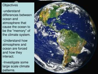
Level 2 Ocean Salinity L1 -> L2OS tools. 12 February 2014. ARGANS & SMOS L2OS ESL. L1 -> L2OS tools. L1 performance characteristic Long term drift/bias Land/sea contamination Latitude bias/short term drift Spatial bias TB absolute accuracy Sun correction Sun tail flagging/correction

E N D
Level 2 Ocean Salinity L1 -> L2OS tools 12 February 2014 ARGANS & SMOS L2OS ESL
L1 -> L2OS tools • L1 performance characteristic • Long term drift/bias • Land/sea contamination • Latitude bias/short term drift • Spatial bias • TB absolute accuracy • Sun correction • Sun tail flagging/correction • RFI detection/mitigation • Ascending/descending delta • Full polarimetry • SSS quality Parameter – product parameter tested Maturity – is the test tool available? Time – estimated time to run Run by – ESL/ESAC/IDEAS/SPQC – TBD Impact – on L1 quality/metrics
L1 -> L2OS tools: long term drift/bias 2.1 Stokes 1 bias using forward model 2 (CLS) 92+ Pacific orbit model 2 TBs from CLS compare with L1b TBs Plot bias in (Tx+Ty)/2 in AF & EAF for ascending & descending orbits 2.3. Snapshot mean deltaTB from AUX_DTBXY (ARGANS) Extracts mean deltaTB (= L1c – model 1 TBs) per snapshot in 0.3 radius xi/eta circle Plot deltaTB for any region, per polarisation 2.4. OTT deltaTB statistics from AUX_DTBCUR (ARGANS) Extracts OTT region deltaTB statistics (median & std) for FOV sub-regions Plot deltaTB per polarisation, per FOV sub-region
L1 -> L2OS tools: land-sea contamination 3.1. Global Stokes 1 plots (Ifremer/CLS – same as 6.1) Global plots of JRECON minus (Tx+Ty)/2 L1c TB Global plots of delta between (JRECON – L1b) for different L1 configurations/versions 3.3. Ghost detection (ACRI-ST) Monthly TB map from 42.5° TB at 3 FOV positions. All polarizations.
L1 -> L2OS tools: latitude bias/short term drift 4.1. Hovmoller plots of Stokes 1 in AFFOV using forward model 2 (Ifremer/CLS) South Pacific orbits; Hovmoller plots of (Tx+Ty)/2 L1c TB minus JRECON 4.2. Hovmoller plots of snapshot mean deltaTB from AUX_DTBXY_ (ARGANS) Hovmoller plots per polarisation (or Stokes1) for any region of binned mean deltaTB (= L1c – model 1 TBs) per snapshot in 0.3 radius xi/eta circle 4.3. Latitudinal plots of delta(SSS – ISAS) (LOCEAN) Compare good quality retrieved SSS with ISAS for similar orbits (eastern Pacific or other) Bias patterns can be due to L1 or L2OS forward model
L1 -> L2OS tools: spatial bias 5.1. OTT analysis (ARGANS) Plots, statistics and histograms of OTT deltaTB for all polarisations in AF/EAF/FOV sub-regions, for single orbits (AUX_DTBXY_, any geographical region) and multiple orbits (AUX_DTBCUR, OTT regions only). v505 v611_300 v505 v611_300 Ascending OTT median & std deltaTB for FOV sub-regions (AUX_DTBCUR, 10 May 2011)
L1 -> L2OS tools: TB absolute accuracy 6.1. Compare Stokes 1 with forward model TBs (Ifremer/CLS – same as 3.1) Global plots of JRECON minus (Tx+Ty)/2 L1c TB Global plots of delta between (JRECON – L1b) for different L1 configurations/versions 6.2. Global plots of per snapshot mean deltaTBs from AUX_DTBXY_ (ARGANS) Global plots of any polarisation or Stokes 1 of binned per snapshot mean deltaTBs in a xi/eta 0.3 circle
L1 -> L2OS tools: sun & sun tails 7.1. OTT anomaly plots (LOCEAN) Plots of anomalies (vertical & diagonal stripes) between reference and extracted OTTs 8.1. OTT std(deltaTB)/ra plots (LOCEAN) Plots of ratios of std(deltaTB) to radiometric accuracy: high values indicate sun tail flagging/correction problems
L1 -> L2OS tools: RFI 9.1. OTT std(deltaTB)/ra plots (LOCEAN/ARGANS) Plots of std(deltaTB)/ra for one or more orbits Data extracted using breakpoints/ L2OS debug version 9.3. Compare L1 & L2OS RFI flagging (LOCEAN/ARGANS/ACRI-ST) Snapshot data extracted using compareTBs, flags/TBs plotted per snapshot -> statistical analysis, animations, visual inspection…
L1 -> L2OS tools: ascending/descending delta 10.1. Hovmoller plots (Pacific) & global maps (Ifremer/CLS – same as 3.1/6.1/7.1) Hovmoller & global plots of Stokes 1 descending minus ascending 10.2 Global L3 SSS maps (LOCEAN/CLS/BEC) Global plots of L3 SSS ascending minus descending
L1 -> L2OS tools: Full polarimetry 11.1. Globally averaged maps of T3 and T4 (Ifremer/CLS) – not yet available -Monitoring of Sea ice/ocean and land/ocean edges -Monitoring of high TEC regions -Monitoring of storms signatures 11.2. Polarisation mixing (ACRI-ST). Monthly maps of T3/(TX-TY) and T4/T3 at 42.5° and 3 FOV positions.
L1 -> L2OS tools: SSS quality 12.1 Global monthly SSS anomaly maps (LOCEAN) SSSSMOS minus SSSISAS (2D smoothed ARGO), shows systematic biases eg land and ice contamination. 12.2 Collocations with ARGO (LOCEAN) Quantitative comparisons of SSS with collocated ARGO => SSS quality (bias, std_difference, r) at global and regional scale 12.3 Global L3 SSS anomaly maps (BEC) Global plots of L3 SSS anomaly