Download
1 / 10
100 likes | 247 Views
Overview of CEOS Virtual Constellations. Andrew Mitchell NASA CEOS SIT Team / WGISS NASA. GEOSS Vision and Architecture Meeting ESRIN – Frascati , Italy September 20, 2013. CEOS Data Access. Data Policy and Interoperability

E N D
Overview of CEOS Virtual Constellations Andrew Mitchell NASA CEOS SIT Team / WGISS NASA GEOSS Vision and Architecture MeetingESRIN – Frascati, ItalySeptember 20, 2013
CEOS Data Access Data Policy and Interoperability • Full and open data accessis a CEOS foundingprinciplethat continues to drive the efforts of the CEOS collective • Overall, 70% of CEOS Mission Data is accessible (OPEN). This includes all missions launched since 2000. The CEOS Data Policy Portal is intended to capture the data access policies of CEOS Mission and Instrument Combinations in order to promote improved access to data and GEO data sharing principles. • 2013 enhancements to data availabilityinclude the addition of the Essential Climate Variable Inventoryof data sets to the CEOS MIM (Missions, Instruments, and Measurements) data base (http://ecv-inventory.com/ecv-inventory) • CEOS develops and coordinates tools that improve discovery, interoperability, and access to satellite data such as the CEOS WGISS Integrated Catalogue (CWIC), the International Directory Network (IDN), and the ESA’s FedEO system. • CEOS works to optimize the use of portals sponsored by CEOS Agencies, Virtual Constellations (VCs), and Societal Benefit Areas (SBAs) Teams, to enhance dataset discovery and access by users. • CEOS is working to implement a common format to search and access CEOS data. (CEOS OpenSearch Best Practices) • CEOS data is a major source of satellite data for GEOSS.
CEOS Virtual Constellations (VCs) CEOS has developed a concept of Virtual, space-based Constellations. A constellation is a coordinated set of space and/or ground segment capabilities from different partners that focuses on observing a particular parameter or set of parameters of the Earth system. CEOS is working to identify key data for each Virtual Constellation, to work with its partners to identify the open data that is offered with minimal restrictions to the general users, and to improve access to the open satellite data from the multiple international partners.
Atmospheric Composition (ACC) The CEOS Constellation for Atmospheric Composition (ACC) goal is to collect and deliver data to improve monitoring, assessment and predictive capabilities for changes in the ozone layer, air quality and climate forcing associated with changes in the environment through coordination of existing and future international space assets. The ACC Constellation directly addresses the Societal Benefit Areas of Disasters, Health, Energy, Climate, and Ecosystems.
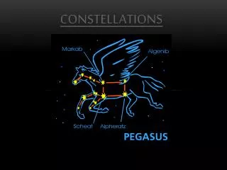
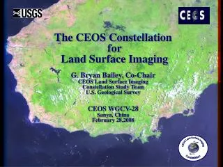
Land Surface Imaging The fundamental mission of the CEOS Land Surface Imaging (LSI) Constellation is to promote the efficient, effective, and comprehensive collection, distribution, and application of space-acquired image data of the global land surface, especially to meet societal needs of the global population, such as those addressed by the Group on Earth Observations (GEO) societal benefit areas (SBAs).The LSI Portal is located at http://eros.usgs.gov/ceos/index.shtml
Ocean Surface Topography (OST) The CEOS Constellation for Ocean Surface Topography (OST) goal is to implement a sustained, systematic capability to observe the surface topography of global oceans from the basin scale to the mesoscale (~ 100 km). The surface topography from satellite altimeters and the upper-ocean density field from Argo profiling floats are oceanic analogues to the surface pressure from barometers and the density field from atmospheric profilers. Observations of these two fundamental state variables are necessary for understanding the dynamics of the oceans, assessing their role in climate, and developing an operational forecast capability.
Precipitation The Japan Aerospace Exploration Agency (JAXA) and the National Aeronautics and Space Agency (NASA) have been identified as the lead agencies in the study of the development of a CEOS Precipitation Constellation and charged with drafting a scoping paper to provide a common vision of the scope and objectives of the Precipitation Constellation. The goal of the CEOS Precipitation Constellation is to establish an international framework to guide, facilitate, and coordinate the continued advancements of multi-satellite global precipitation products.
Ocean Color Radiometry The Ocean Color Radiometry Virtual Constellation (OCR-VC) will provide long time series of calibrated ocean color radiance (OCR) at key wavelength bands from measurements obtained from multiple satellites. OCR-VC activities will include calibration, validation, merging of satellite and in situ data, product generation, as well as development and demonstrations of new and improved applications. Examples and prototypes of programs the OCR-VC will require to meet its objectives include the SIMBIOS (NASA), GlobColour (ESA), ChloroGIN (POGO-GEO-GOOS) and SAFARI (CSA/GEO) projects.
Ocean Surface Vector Wind The Ocean Surface Vector Wind Virtual Constellation (OSVW-VC) will improve operational marine warnings and forecasts through the use of ocean surface vector winds (OSVW) from satellite scatterometry (together with significant wave height, SWH, from the Ocean Surface Topography Virtual Constellation). The OSVW-VC will also characterize the OSVW field for use in climate-quality data records and facilitate research related to the influence of wind forcing on the circulation of the oceans.
Sea Surface Temperature The SST-VC serves as the formal link between the Group for High Resolution Sea Surface Temperature (GHRSST) and the broader CEOS community. At the highest level, the SST-VC provides a means for CEOS to present to GHRSST its needs and requirements, and for GHRSST to present its needs directly to global community of space agencies. In addition, there are several thematic connections between GHRSST and CEOS that take place at the working group level (for example, between the GHRSST Climate Data Record TAG and the CEOS Working Group on Climate).