Download

1 / 19
200 likes | 428 Views
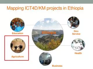
Mapping Initiatives in Ethiopia. By Sultan Mohammed Director General Ethiopian Mapping Agency January 2011 Hyderabad, India. 1. Introducing the Ethiopian Mapping Agency (EMA). Organizational Background

E N D
Mapping Initiatives in Ethiopia By Sultan Mohammed Director General Ethiopian Mapping Agency January 2011 Hyderabad, India
1. Introducing the Ethiopian Mapping Agency (EMA) Organizational Background • The origins of the Ethiopian Mapping Agency (EMA) date back to1954 when a small mapping unit was established under the Ministry of Education which later (in 1956) was reorganized as the Mapping and Geography Institute of Ethiopia under the Ministry of the Interior. Since then, it has passed through various organizational setups until its establishment as an autonomous agency by a Proclamation of the Government of Ethiopia in 1980.
1. Mandate • Under the Proclamation, EMA is mandated to collect, transform, generate, store & disseminate the following sets of Fundamental Geospatial Data sets in Ethiopia: • Geodetic Control Networks (Ground Control Points) • Remotely Sensed Imagery (Aerial Photographs, Satellite Imagery) • Topographic (Base) Maps • Thematic Maps • Hypsography (Contours, DEM, Spot Heights, etc.) • Administrative Boundaries (International, Regional, Zonal & District) • Geographic Names • Atlas (National, Regional, etc.)
Mandate Cont’d • Furthermore, EMA is the authorized Agency of the Federal Democratic Republic of Ethiopia empowered to: • Certify duly qualified person or organization to undertake surveying or mapping activities. • Certify and approve all fundamental geo-information data sets produced by duly qualified person or organization. • Supervise and coordinate any fundamental geo-information data set production activities undertaken within Ethiopia by any duly qualified person.
2. EMA Vision & Mission Vision “to become a reliable and prime source of geospatial information products and services in Ethiopia, and there by to be recognized as a centre of excellence in the field in Africa.”
3. EMA Vision & Mission Mission “To satisfy the requirements of our customers by generating and delivering best quality and contemporaneous geospatial information products and services every time, on time and at low cost, and to regulate the quality and standards of GIS products in Ethiopia. ”
Director General Planning, & Budget Directorate Quality & Standards Directorate Audit Directorate Women Affairs Directorate IT Directorate Remote Sensing & GIS Directorate Human Resources Directorate Surveying Directorate Mapping Directorate Finance, Purchase & Materials Management Directorate Communications & Business Development Directorate 3. EMA Organization Structure
4. Survey & Mapping Activities in Ethiopia • Surveying • Establishment of the National Geodetic Network • The first stage of geodetic survey in Ethiopia was carried out during 1957 -1961, covering over 30% of the country and straddling the Blue Nile Watershed in North–South and East–West direction tying the network to the 30th Meridian Arc Adindan Datum. This was extended further to the rest of the country over the years in connection with the 1:50k mapping project and to date some 3,000 points have been established. • The hypsometric data of the national leveling network is interconnected with the Alexandria Datum and the sea level of the Red Sea Ports of Djibouti and Asab.
4. Survey & Mapping Activities… • Distribution of Ground Control Points
4. Survey & Mapping Activities…. Recently Established Primary GCPs (48 Hrs GPS Observation)
4. Survey & Mapping Activities…. • Mapping • In the history EMA the first extensive mapping activity started in 1956 with the Blue Nile River Basin Investigation Project covering an area of 300,000 km2 with aerial photography at a scale of 1:50,000. • In 1963, the mapping of the country with 1:250,000 scale map started and the full coverage was completed in 1972. These map series covered the whole country in 73 map sheets.
4. Survey & Mapping Activities…. • Mapping • Since 1971, the Ethiopian Mapping Agency has been engaged in producing standard national topographic maps series at scale of 1:50,000. To date about 85% of the country has been mapped in this scale.
4. Survey & Mapping Activities…. 1:50k coverage
4. Survey & Mapping Activities…. • Currently Available Maps • 1:2,000,000 scale wall map of Ethiopia • 1:1,000,000 scale maps (10 sheets covering the whole country) • 1:250,000 scale maps (75 sheets covering the whole country) • 1:50,000 scale maps (1340 sheets covering 85% of the country) • Various large scale maps (1:2,000 to 1:25,000) of major cities and areas of interest.
5. Ongoing/Planned Survey & Mapping Initiatives • Surveying • Densification of the existing Geodetic Network • About 120 additional 1st Order GCPs • 12 Additional CORS • 10,000 2nd and 3rd Order GCPs.
5. Ongoing/Planned Survey & Mapping Initiatives Existing & Planned CORS
5. Ongoing/Planned Survey & Mapping Initiatives Existing & Planned 1st Order GCPs
5. Ongoing/Planned Survey & Mapping Initiatives • Mapping • Analogue to Digital Conversion of existing Maps • Updating of 1:50,000 scale Maps • 1:100,000 scale Land Use/Land Cover Mapping of the Country using satellite imagery. • 1:25,000 and 1:10,000 scale topographic and orthophoto mapping of the Country via Aerial Photography & Ground Survey. • Large scale mapping (1:2,000 to 1:5,000) of towns and other development corridors. • Further to these activities EMA is currently engaged in the preparation of the 3rd Edition National Atlas of Ethiopia.