Download
1 / 30
300 likes | 304 Views
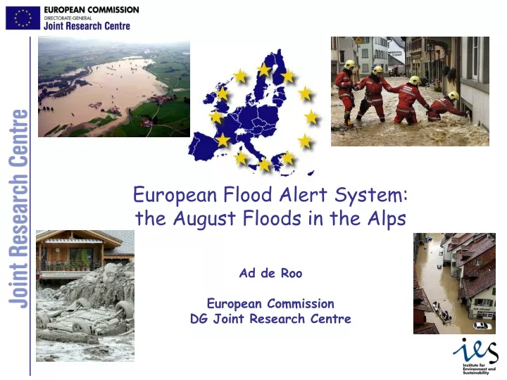
European Flood Alert System: the August Floods in the Alps Ad de Roo European Commission DG Joint Research Centre. Why a European Flood Alert System?. Early flood alert information to National Hydrological Services (> 48 hrs, max 10 days) to complement MS WA systems

E N D
European Flood Alert System:the August Floods in the Alps Ad de RooEuropean CommissionDG Joint Research Centre
Why a European Flood Alert System? • Early flood alert information to National Hydrological Services (> 48 hrs, max 10 days) to complement MS WA systems • Catchment based: not depending on information from upstream catchments -> enabling longer leadtime by simulating entire catchment • Probabilistic approach using different weather forecasts and ensemble weather forecasts (EPS) • Improved simulation of initial conditions (soil moisture, groundwater, snow cover) • Overview and monitoring of flood situation in Europe (assist DG ENV MIC & DG REGIO Solidarity Fund applications): • Sharing rescue resources during European crises • Potential backup for national systems
EFAS setup • European catchments > 2000 km2 on a 5 km grid • Selected transnational catchments on a 1 km grid (Danube, Elbe, Meuse, Oder) • LISFLOOD model • hourly time step • forecast run on arrival of meteo forecasts (00&12) Input data • 2xDWD (GME+LM), 7 days • 2xECMWF – Deterministic, 10 days • 51x2 ECMWF EPS, 10 days • observed meteo data • Tests with COSMO-LEPS, 5 days
EFAS: how does it work • ECMWF-JRC cooperation agreement established to provide access to real time weather forecasts • Collaboration with German weather service (DWD) • Memoranda of Understanding established and in preparation with approx 25 countries in Europe with major river basins (liability, no re-distribution since still in experimental phase): • Signed: DE (BfG, Brandenburg, Saxony,), HU, SK, BG, IT, LT, PL, MD • In progress with: FR, RO, DE (Baden-Wuertenberg, Bavaria), NL, CZ(*), BE-Flanders, UK, ES, SL • No reply yet from: AT, PR, BE-Wallonia, SB, BH, HR, SE • Not started yet: CH, NO, UKR (*) collaboration agreement exists • European Parliament support and funding for EU Flood GIS, to assist the development of EFAS (+ droughts) • Open tender (published 11/9 in European Journal) • Envisaged collaboration with WMO’s GRDC and GPCC • DG ENTR IDABC funding for realtime database (under discussion) • Envisaged collaboration with GRDC (admin negotiations ongoing) • Transfer to operational service (ECMWF, MS, other, ???) (> 2006)
EFAS alert thresholds Alert thresholds are based on statistics of a 12 year simulation (1990-2002) using observed weather data from SYNOP stations
Passau (Danube, DE): EFAS: forecast based on ECMWF 16 17 18 19 20 21 22 23 24 25 26 27 28 29 Critical discharge predicted for 23-26 August, with peak around 25 August
Passau (Danube, DE): EFAS forecast based on DWD External alert report send 16 17 18 19 20 21 22 23 24 25 26 27 28 29 Critical discharge predicted for 23-27 August, with peak/extreme at 24 August
An EFAS alert is send out: • If a forecast is persistent • If MoU exists (liability) • If systems & data are checked • Send daily until flood event is over
EFAS forecast on 21 Aug(DWD 2005082100) PL DE BE DE SK Danube Isar Lech Reuss AT Raba Aare HU SL HR IT FR BH
Providing info where critical discharges are expected: Aug 21 EFAS forecast CZ FR DE AT CH IT
EFAS forecast Danube 22 Aug 2005, based on DWD weather forecasts River discharge date The timing and amounts proved mostly within the 10% accuracy range!
Specific info for selected sites: Danube at Passau Isar at Munich
After the event: collecting feedback • Questionnaire: • Was forecast correct? • Did a flood happen? • Comparison with observed data • Was the information useful • Is other info needed • EFAS user forum meeting (Feb 2006)
Passau (Danube, D):observed waterlevels Critical waterlevels observed from 24-27 August, with peak at 24 August evening
severe high medium low Flood Ensemble Prediction Systems “I only want to know HOW MUCH rainfall is going to fall, and WHEN and WHERE!!” (citation end-user at 1st EFAS workshop when discussing uncertainty) ? Potential of EFAS: Translating the range of different forecasts into concise and useful information for local forecasters for a potential look “ahead”.
Pt1 Case-Study: Danube Catchment - July 2005 Forecast date: 200507 0812
Alps: EFAS forecast based on ECMWF-EPS 19 Aug 12:00 Danube: 10-22 in the upper parts of Danube DE, Lech, Isar, Inn, Salzach, 20-25 in AT, peak for about 23-24/08 Rhine: very few: 2-4 in the Rhine CH, DE, slightly reaching the HAL, 8-13 in the Neckar, peak for 23/08
Conclusions • EFAS did predict the Alpine floods of August: • External alerts send 20 August & onwards (DE and later AT, SK, HU) • First signals in ECMWF forecast of 16 August • More info/signals in EPS, needs further research • DWD-LM forecasts seems very accurate in this case • Times of peak and magnitude reasonably accurate • (given the fact that EFAS is meant as early warning!) • The 1km Danube & Elbe setups could possibly even increase the quality of the forecast • Positive feedback from DE (BfG), CZ, SK • feedback from Bavaria, AT & HU awaited • CH and Baden-Wuertemberg predictions were within 48 hours and therefore not communicated / or no MoU existed (CH)
EFAS way forward • Pre-operational testing until 2006 for Elbe/Danube: • Danube, Elbe; linked to Basin Flood Action Programs (FP6) • Light validation for other European river basins (FP6) • Detailed validation for rest of Europe (FP7) • Further pre-operational testing for entire Europe until 2009 • Using EU-FLOOD-GIS and IDABC data, and IP results: • EU Flood Geographic Information System (EP support via DG ENV) • Static and historic hydro-meteorological data+ realtime meteo data • IDABC Lisflood Alert (DG Enterprise) • Real-time river levels (with WMO Global Run-off Data Centre) • IP PREVIEW (plainfloods) • IP FLOODSITE (flashfloods) • EFAS as contribution to research & information exchange within European Flood Action Plan : • EFAS exchanges information to National Hydrological Services and within French/JRC Euroean Exchange Circle on Flood Forecasting (EXCIFF) • EXCIFF as feedback platform for EFAS • EFAS as research tool for ensemble forecasting & early warning
http://natural-hazards.jrc.it Thank you ad.de-roo@jrc.it
EFAS: current status & outlook • ECMWF-JRC cooperation agreement established • Memoranda of Understanding established and in preparation with approx 25 countries in Europe with major river basins: • Signed: DE (BfG, Brandenburg, Saxony,), HU, SK, BG, IT, LT, PL, MD • In progress with: DE (Baden-Wuertenberg, Bavaria), NL, CZ(*), BE-Flanders, UK, ES, SL • No reply yet from: FR, AT, RO, PR, BE-Wallonia, SB, BH, HR, SE • Not started yet: CH, NO, UKR (*) collaboration agreement exists • European Parliament support and funding for EU Flood GIS, to assist the development of EFAS (+ droughts) (2005-2007) • Open tender (published 11/9 in European Journal) • Envisaged collaboration with WMO’s GRDC and GPCC • DG ENTR IDABC funding for realtime database (2005-2007) • Envisaged collaboration with GRDC (admin negotiations ongoing) • Transfer to operational service (ECMWF, MS, other, ???) (~ 2009)
Case-Study: Danube Catchment - July 2005 Forecast date: 200507 0812 EFAS Alert Map based on 10 day ECMWF forecasting data low severe high medium Pt1 Danube
EFAS way forward (2) • Feedback thru: • ECWMF agreement (link to NMS’s) • EFAS network with NWA (thru MoU) • Elbe (IKSE) and Danube (ICPDR) commission, flood WG/ FAP • Flood forecasting exchange circle (F-JRC) • Continued R&D: • JRC workprogramme FP6 & FP7 • IP PREVIEW, IP FLOODSITE, (EFFS) • After >2006, transfer to ??
From floods to droughts • Feasibility study drought assessment using EFAS tools • Draft drought risk maps delivered to DG REGIO • Outlook (FP7): European Drought Alert System (EDAS)
EFAS: how did it start? • Initiative of JRC launched at JRC-EUMETNET informal meeting in 1999: ECMWF, DMI & DWD interested to participate • Feasibility study EFFS (2000-2003) with 18 partners • Elbe and Danube floods (2002), realtime application of EFAS; • triggered COM2002-481: Commission decision on the 2002 floods, incl. support of the development a European Flood Alert System • Following that: JRC research on development and pre-operational testing of EFAS prototype (2003-2006) • Strong support and request from DG ENV civil protection to develop EFAS • Supported by MS by sending DNE’s for 2-3 years to JRC • Embedded in Danube Flood Action Plan of ICPDR (2004)
EFAS forecast Danube 22 Aug 2005, based on DWD weather forecasts The timing and amounts proved mostly within the 10% accuracy range!