Download
1 / 15
150 likes | 303 Views
Longitudes & Latitudes. What can we use to show the position of place on the atlas or map? We can use latitudes and longitudes to give the position of places on the map What are longitudes and latitudes ? They are imaginary vertical and horizontal lines around the Earth.

E N D
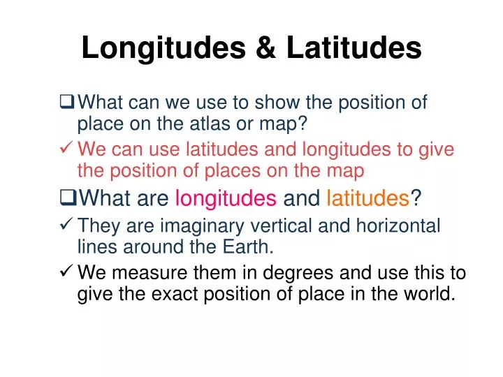
Longitudes & Latitudes • What can we use to show the position of place on the atlas or map? • We can use latitudes and longitudes to give the position of places on the map • What are longitudes and latitudes? • They are imaginary vertical and horizontal lines around the Earth. • We measure them in degrees and use this to give the exact position of place in the world.
Longitudes & Latitudes • What are longitudes and latitudes? • Lines of longitude are the vertical lines in the world imaginary grid. • They go from the North Pole to the South Pole and they are the same length. • Lines of latitude are the horizontal lines in the world’s imaginary grid. • Lines of latitude are not all the same length.
180o E and 180o W are the largest longitude. West East Australasia The vertical lines (直線) are called longitude (經度). The 0o is called the Prime Meridian (本初子午線) which passes through Greenwich Observatory (格林威治天文台) near London, England.
longitudes and latitudes • To describe position more accurately, we divide each degree of latitude and longitude into smaller parts call minutes. • There are 60 minutes in a degree. • The symbol for minutes is ’
Find the location of the following in your atlas. 23o00’N 114o00’E 31o15’N 122o30’E 1o20’N 103o50’E 39o55’N 116o20’E 48o52’N 2o20’E 1o = 60’ 1’=60”
Australasia Seven Continents (七大洲) : Four Oceans (四大洋) :
90o N (North Pole北極) 66 1/2o N (Arctic Circle北極圈) 23 1/2o N (Tropic of Cancer) 0o (Equator 赤道) 23 1/2o S (Tropic of Capricon) Australasia 66 1/2oS (Antarctic circle) 90oS (South Pole 南極) The horizontal lines (橫線) are called latitude (緯度). The 0oEquator is the longest latitude. It divides the Earth into Northern Hemisphere (北半球) and Southern Hemisphere (南半球). The closer to the Poles, the shorter lines of latitude are.
Arctic Ocean Pacific Ocean Atlantic Ocean Indian Ocean
Europe North America Asia Australasia Africa South America Antarctica
Continents and Oceans • How many Continents in the world? • There are seven Continents in the world. • How many Oceans in the world? • There are four Oceans in the world. • Which continents lie between the Atlantic Ocean and Pacific Ocean? • North America and South America • Which continent lie between the Indian Ocean and the Atlantic Ocean? • Africa
Where is Hong Kong? • Can You find and describe the location of Hong Kong.? • Hong Kong is located at latitude 22o30’N and longitude 114o10’E. • What is the weather of Hong Kong? • Hong Kong is hot .
Where is Hong Kong? • Can you say that Hong Kong has a good position in Asia? • Yes, it is because it lies between South East Asia and Japan. • What is the advantages of the good position of Hong Kong? • This central location helps us to develop trade and business.
Japan Thailand China Malaysia
Seoul Tokyo Beijing Guangzhou Shanghai Manila Bangkok Jakarta