Download
1 / 16
160 likes | 279 Views
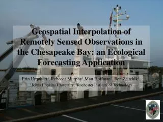
Spatial Interpolation of Satellite-derived Temperature and Salinity in the Chesapeake Bay: an Ecological Forecasting Application. Erin Urquhart 1 , Rebecca Murphy 1 ,Matt Hoffman 2 , Ben Zaitchik 1 , 1 Johns Hopkins University, 2 Rochester Institute of Technology. Chesapeake Bay.

E N D
Spatial Interpolation of Satellite-derived Temperature and Salinity in the Chesapeake Bay: an Ecological Forecasting Application Erin Urquhart1, Rebecca Murphy1,Matt Hoffman2, Ben Zaitchik1, 1Johns Hopkins University, 2Rochester Institute of Technology
Chesapeake Bay • Major Inputs • Atlantic Ocean • Susquehanna River • Salinity gradient (0-30psu) • Sea surface temperature • (-0.5C to 31C) • 2-Layer gravitational circulation scheme Urquhart et al. ASPRS 2013 Annual Conference March 26, 2013 Special Session: Maritime Applications of Remote Sensing
Percent Satellite Coverage by Month Urquhart et al. ASPRS 2013 Annual Conference March 26, 2013 Special Session: Maritime Applications of Remote Sensing
Percent Satellite Coverage by Month & Station Urquhart et al. ASPRS 2013 Annual Conference March 26, 2013 Special Session: Maritime Applications of Remote Sensing
Urquhart et al. ASPRS 2013 Annual Conference March 26, 2013 Special Session: Maritime Applications of Remote Sensing
Geostatistical Spatial Interpolation: Kriging • What is Kriging? • Determine data dependency • Semivariogram • Spatial autocorrelation • Model fitting • Predictions • Ordinary Kriging • Y(s) = β0 + ε(s) • Constant mean is unknown • Universal Kriging • Y(s) = β0 +β1X1(s) + … + βpXp(s) + ε(s) • Trend in the data Urquhart et al. ASPRS 2013 Annual Conference March 26, 2013 Special Session: Maritime Applications of Remote Sensing
Urquhart et al. ASPRS 2013 Annual Conference March 26, 2013 Special Session: Maritime Applications of Remote Sensing
Urquhart et al. ASPRS 2013 Annual Conference March 26, 2013 Special Session: Maritime Applications of Remote Sensing
Urquhart et al. ASPRS 2013 Annual Conference March 26, 2013 Special Session: Maritime Applications of Remote Sensing
ChesROMS • Numericsare obtained from (ROMS) • 100x150x20 curvilinear grid • 1-5km spatial; 6hr temporal resolution • Model forcing • 9 tidal constituents (ADCIRC) • Non-tidal water levels (NOAA National Ocean Service Program) • River discharges/forcing (USGS) • Air-surface boundary (NARR) • 3-hr winds, net shortwave/longwave radiation • Temperature • Relative humidity • Pressure • 2003 & 2007 Xu et al. (2002) Urquhart et al. ASPRS 2013 Annual Conference March 26, 2013 Special Session: Maritime Applications of Remote Sensing
Comparison of Interpolated and ChesROMS Parameter Output Parameter Method ME MAE RMSE R2 2.47 Salinity 0.61 0.86 UK 1.89 1.86 ROMS -0.52 0.94 (psu) 1.46 0.84 UK 0.28 0.99 Temperature 0.63 -1.39 ROMS -0.76 0.98 -1.14 (oC) Urquhart et al. ASPRS 2013 Annual Conference March 26, 2013 Special Session: Maritime Applications of Remote Sensing
SO WHAT? • Methods had similar SSS errors during data heavy months • Interpolated SST had a smaller average error than ChesROMS • Interpolated observations act as a second-source of Bay-wide observations • Extreme event accuracy • Data assimilation potential (future work) • Observations can be utilized when they are available/reliable • Hoffman et al. (2012) • Two techniques offer complementary information that can be applied to Vibrio spp. monitoring Urquhart et al. ASPRS 2013 Annual Conference March 26, 2013 Special Session: Maritime Applications of Remote Sensing
Vibrio in the Chesapeake Bay *V. vulnificus *V. parahaemolyticus Urquhart et al. ASPRS 2013 Annual Conference March 26, 2013 Special Session: Maritime Applications of Remote Sensing
Remote Sensing of Vibrio in the Chesapeake Bay z(V.c)= -1.1939 + (0.1233 * Temp) – (0.1997 * Saln) – (0.0324 * (Temp * Saln) Urquhart et al. ASPRS 2013 Annual Conference March 26, 2013 Special Session: Maritime Applications of Remote Sensing
Remote Sensing of Vibrio in the Chesapeake Bay Urquhart et al. ASPRS 2013 Annual Conference March 26, 2013 Special Session: Maritime Applications of Remote Sensing
Acknowledgments Johns Hopkins Applied Physics Lab, Carlos del Castillo Johns Hopkins University, Rebecca Murphy Cornell University, Dr. Bruce Monger University of Delaware, Erick Geiger University of Maryland, Bradd Haley, Elisa Taviani NASA Goddard, Molly Brown, Vanessa Escobar Funding Sources Johns Hopkins University