Download
1 / 22
220 likes | 379 Views
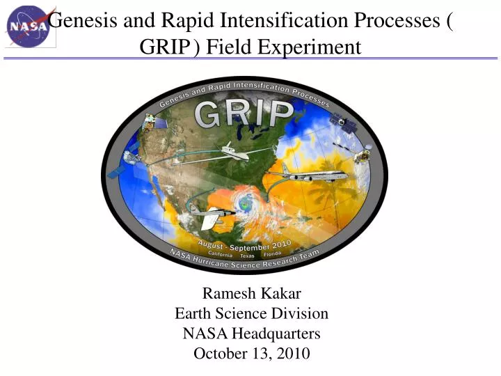
Genesis and Rapid Intensification Processes ( GRIP ) Field Experiment. Ramesh Kakar Earth Science Division NASA Headquarters October 13, 2010. NASA Hurricane Field Experiments. Field programs coordinated with other Federal Agencies. 1998. 2001. 2005. 2006. 2010 GRIP .

E N D
Genesis and Rapid Intensification Processes ( GRIP) Field Experiment Ramesh Kakar Earth Science Division NASA Headquarters October 13, 2010
NASA Hurricane Field Experiments Field programs coordinated with other Federal Agencies 1998 2001 2005 2006 2010 GRIP • NASA sponsored field campaigns have helped us develop a better understanding of many hurricane properties including inner core dynamics, rapid intensification and genesis • We do field experiments to accomplish: • - calibration/validation of satellite sensors • - evaluation of new sensor concepts • - process studies
Mission and Science Overview:Summary of GRIP Science Objectives • Genesis: Distinguish the role of the larger-scale environment vs. meso-convective processes near the putative developing center. • Rapid Intensification: Relative role of environmental vs. inner core processes? Is RI predictable? • Test-bed: Evaluate candidate technologies for remote sensing from aircraft and from satellites. Wind lidar, high frequency passive microwave, dual-frequency radars, Global Hawk itself.
NASA Hurricane Research Science Team(selected competitively) ROSES 08 (Science Team) ROSES 09 (Field/Instrument Team) Scott Braun NASA GSFC Richard Blakeslee NASA MSFC Shu-Hua Chen U. of California, Davis Paul Bui NASA ARC William Cotton Colorado State U. Stephen Durden NASA JPL Robert Hart Florida State U. Michael Goodman NASA MSFC & Gerald Heymsfield NASA GSFC Svetla Hristova-Veleva NASA JPL Robert Houze U. of Washington Jeffrey Halverson UMBC/JCET Haiyan Jiang U. of Utah (to FIU) Andrew Heymsfield NCAR Tiruvalam Krishnamurti Florida State U. Gerald Heymsfield NASA GSFC Greg McFarquhar U. of Illinois Syed Ismail NASA LARC John Molinari U. of Albany Michael Kavaya NASA LARC Michael Montgomery Naval Postgrad School Tiruvalam Krishnamurti Florida State U. Elizabeth Ritchie U. of Arizona Bjorn Lambrigtsen NASA JPL Robert Rogers NOAA/AOML Nick Shay U of Miami Eric Smith NASA GSFC Christopher Thorncroft U. of Albany Edward Zipser U. of Utah
Several Advanced Technologies To Support the 2010 GRIP Campaign DC-8 - The Doppler Aerosol WiNd lidar (DAWN) is a 2-micron Doppler lidar that can take vertical profiles of vectored horizontal winds. (Principal Investigator: Michael Kavaya, NASA LaRC, IIP-04/IIP-07) - The Airborne Second Generation Precipitation Radar (APR-2) is an advanced radar system that obtained the first-ever simultaneous measurements of rain intensity and fall velocity profiles during the4th Convection and Moisture Experiment (CAMEX-4) in 2001.(Principal Investigator: Eastwood Im, JPL, IIP-98) Global Hawk • The High-Altitude MMIC Sounding Radiometer (HAMSR) is a microwave atmospheric sounder that provides measurements that can be used to infer the 3-D distribution of temperature, water vapor, and liquid water in the atmosphere, even in the presence of clouds. (Principal Investigator: Bjorn Lambrigsten, JPL, IIP-98) • - The High-Altitude Imaging Wind and Rain Airborne Profiler (HIWRAP) is a dual-frequency Doppler radar capable of measuring tropospheric winds within precipitation regions as well as ocean surface winds in rain-free to light rain regions. (Principal Investigator: Gerald Heymsfield, NASA GSFC, IIP-07) WB-57 - The Hurricane Imaging Radiometer (HIRAD) instrument on board the WB-57 includes an ESTO-funded Agile Digital Detector (ADD) for Radio Frequency Interference (RFI) Detection and Mitigation system that can produce clearer microwave measurements, particularly over populated areas where wireless communications can crowd the spectrum. (Principal Investigator: Chris Ruf, University of Michigan, IIP-04) Support - The Real Time Mission Monitor (RTMM) is a situational awareness tool that integrates satellite, airborne and surface data sets; weather information; model and forecast outputs; and vehicle state data (e.g., aircraft navigation, satellite tracks and instrument field-of-views) for field experiment management. RTMM will optimize science and logistic decision-making during the GRIP campaign by presenting timely data, graphics and visualizations that improve real time situational awareness of the experiment’s assets. (Principal Investigator: Michael Goodman, Marshall Space Flight Center, AIST-08)
GRIP DC-8 Payload NASA DC-8 Payload MMS Meteorological Measurement System (Insitu Press, Temp, 3D Winds and Turbulence) DAWN Doppler Aerosol Wind Lidar (Vertical Profiles of Vectored Horizontal Winds) Dropsondes (Vertical Profiles of Temp, Press, Humidity and Winds) CAPS, CVI, PIP (Cloud Particle Size distributions, Precip Rate, Rain & Ice water content) APR-2 Airborne Precipitation Radar Dual Frequency (Vertical Structure Rain Reflectivity and Cross Winds) LASE Lidar Atmospheric Sensing Experiment (H2Ov, Aerosol profiles and Cloud distributions)
GRIP Global Hawk Instrument Payload LIP (1,2) LIP (3,4) TurbulenceSensors 2-Cameras, and Storm Scope 27 7 65 1 16 13 12 46 22 61 3 25 LIP (5) HDVis HAMSR DropSonde LIP (6) HIWRAP HIWRAP DropSonde HAMSR LIP 3 Cameras Storm Scope Accelerometers • High Altitude Imaging Wind and Rain Profiler (GSFC) • NOAA DropSonde System (incl. 75 dropsondes) (NCAR) • High Altitude MMIC Sounding Radiometer (JPL) • Lightning (and Electric Field Meas.) Instrument Package (MSFC) • Visual (including IR) Situational Awareness to Pilot • Lightning Detection Display in Flt. Op’s Area • Real-time Turbulence Time-history Display in Flt. Op’s Area
Flight Tracks in Hurricane Earl Green-NASA DC-8 Purple-NASA WB57 Orange-NASA Global Hawk Yellow-NOAA G-IV Blue-NOAA P-3 8
Flight Tracks Into Hurricane Karl Green-NASA DC-8 Purple-NASA WB57 Orange-NASA Global Hawk Red-PREDICT G-V Yellow-NOAA G-IV Blue-NOAA P-3 9
GRIP: Genesis and Rapid Intensification Processes Field Experiment Hurricane Earl TS Frank Hurricane Karl Pre-Karl TS Matthew • GRIP accomplishments: • • Two case of storm genesis (Karl and Matthew) • • Two cases of RI (Earl and Karl) • Global Hawk accomplishments: • • Easily overflew intense hurricanes • • ~14 h on-station over Karl • • 20 eye overpasses during Karl 10
NASA Aircraft Hours and GRIP Coordination Coordination of a combined 5 NASA and NOAA aircraft in Hurricane Karl on 16 September 2010 at ~1955 UTC
Hurricane and Severe Storm Sentinel (HS3) Hurricane and Severe Storm Sentinel HS3 Future NASA Hurricane Research PI: Scott A. Braun (GSFC) Science Goal: Tounderstand hurricane genesis and intensification. Key Science Questions: • How do hurricanes form? • What causes rapid intensity changes? • How are intensity changes after formation related to upper-tropospheric flow features? • What’s the role of the Saharan Air Layer? Two Global Hawk (GH) aircraft • Environment GH instrumentation • TWiLiTE (direct detection wind lidar) • CPL (cloud & aerosol lidar) • Scanning HIS (T, RH) • Dropsondes (wind, T, RH) • Over-storm GH instrumentation • HIWRAP (3-D winds plus sfc winds) • HIRAD (sfc winds and rain) • HAMSR (T, RH) Key Elements: • Part of NASA’s Earth Venture program • Two Global Hawk aircraft, one to sample the environment, the other over storm • Three one-month deployments in 2012-2014 • Deployment from the East Coast (likely Wallops Flight Facility) Environment GH Genesis Locations and Loiter Times Over-storm GH
JPL High Altitude MMIC Sounding Radiometer (HAMSR) Microwave radiometer for 3-D all-weather temperature and water vapor sounding, similar to AMSU on NOAA platform 25 sounding channels in three bands: 50-60 GHz, 118 GHz, 183 GHz Cross track scanning + 45o off nadir 40 km swath at 20 km 2 km resolution Flew in CAMEX-4, TCSP and NAMMA JPL High Altitude MMIC Sounding Radiometer (HAMSR) Flight path q(z): Cross-track q(z): Along-track CLW(z): Along-track Precipitation Structure/Imagery
High-Altitude Imaging Wind and Rain Airborne Profiler (HIWRAP) MEASUREMENTS GOALS: Map the 3-dimensional winds and precipitation within hurricanes and other severe weather events. Map ocean surface winds in clear to light rain regions using scatterometry. NASA Global Hawk: • 19 km altitude, 30 hours HIWRAP Characteristics: • Conically scanning. • Simultaneous Ku/Ka-band & two beams @30 and 40 deg • Winds using precipitation & clouds as tracers. • Ocean vector wind scatter-ometry similar to QuikScat.
GRIP Coherent Pulsed Doppler Wind Profiling Lidar System • Nominal Parameters • Laser beam nadir angle = 45 degrees (unchangeable) • Laser beam azimuth angle = 45, 135, 225, and 315 degrees • 60 laser shots per LOS wind profile (12 sec) • LOS wind profiles 8.8 km from track • Aft LOS profile begins 71 s after Fore began • Fore and Aft LOS wind profile = 1 horizontal wind profile (83 s measurement time) • Left and Right of track horizontal wind profiles = 1 scan pattern • Pattern repeat = horizontal resolution = 12.5 km (50 sec) Vertical profile of horizontal wind magnitude and direction “= balloonsonde launch or very tall anemometer tower” DC-8: 425 – 490 knots True Air Speed (cruise) = 218 - 252 m/s (250). 41,000 ft = 12.5 km
Airborne Precipitation Radar (APR-2) • APR-2 is a dual-frequency, dual-polarization, Doppler radar that operates on the NASA DC-8 aircraft • Below is vertical slice through Earl on Sep 2 from NNE to SSW (1815 UTC); southern eyewall was decaying 13 GHz reflectivity eye Vertical motion of precipitation (fall speed + air motion) Updraft of 5 m/s Max 58 m/s out of page Horizontal wind speed Max 49 m/s into page
NASA Langley LASE measurements over Hurricane Earl DC-8 GRIP Flight 13 - September 2, 2010 • LASE measured water vapor, aerosol, and cloud distributions during flights over Hurricane Earl • LASE and dropsonde measurements of water vapor just outside eyewall show good agreement Flight Segment across Earl between 18 – 19 UT Water Vapor Mixing Ratio Eye Water Vapor Mixing Ratio cirrus clouds (outflow) water clouds (eyewall) Relative Aerosol And Cloud Scattering
NASA Langley LASE Samples Evolution of the Eye of Hurricane Earl on August 30, 2010 RELATIVE AEROSOL SCATTERING FLIGHT TRACK ACROSS THE ‘EYE’ Dust Dust H2O PROFILE IN THE ‘EYE’ Relative Aerosol Scattering Water Vapor Mixing Ratio
NASA’s Global Hawk UAS Hurricane Earl’s eye as seen from the GH Cruise Climb from 56-65K ft (max takeoff weight)
10 km 7 km 5 km 3 km (All retrievals are preliminary) HAMSR @ Earl, 9/2/2010, 1815-1905 UTC Temperature Brightness temperatures Reflectivity (experimental) Ch. 01 Ch. 04 Up to 10 K warm core anomaly Tb anomaly Ch. 13 Ch. 09 Precipitable water 4-5 cm TPW Significant convection & precipitation Cloud liquid water Ch. 19 Ch. 25 Up to 2 mm LWC Nadir (0-15 km altitude)
Summary • NASA satellite sensors are helping to expand weather/hurricane research frontiers • Columbia and Pleiades supercomputers support high resolution hurricane modeling • NASA sponsored field campaigns have helped us develop a better understanding of many hurricane properties including inner core dynamics, rapid intensification and genesis • NASA satellite sensor data is being under utilized in hurricane research (assimilation of satellite data has a much greater potential impact on the track and intensity forecasts)