Download
1 / 11
110 likes | 211 Views
Continental-Margin Sedimentation during High Sea Level. Fluvial and glacial valleys flooded Sediments trapped in river-mouth estuaries and fjords If much sediment supplied, estuaries and fjords are filled deltas formed Sediment can escape to continental shelf mud winnowed by waves

E N D
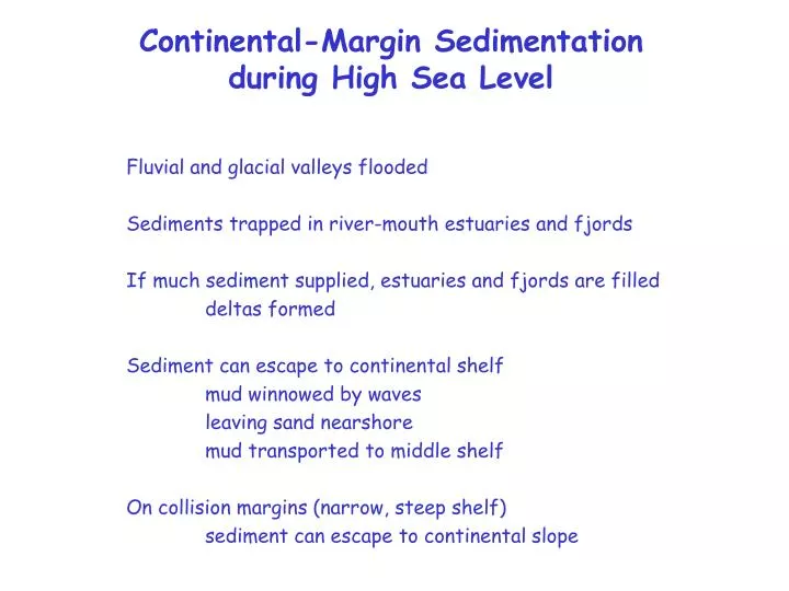
Continental-Margin Sedimentation during High Sea Level Fluvial and glacial valleys flooded Sediments trapped in river-mouth estuaries and fjords If much sediment supplied, estuaries and fjords are filled deltas formed Sediment can escape to continental shelf mud winnowed by waves leaving sand nearshore mud transported to middle shelf On collision margins (narrow, steep shelf) sediment can escape to continental slope
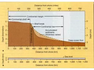
Holocene deposits (<20,000 y) on continental shelves Note: boundary between modern inner-shelf sand and modern mid-shelf mud depends on waves
Continental-Margin Sedimentation during High Sea Level Fluvial and glacial valleys flooded Sediments trapped in river-mouth estuaries and fjords If much sediment supplied, estuaries and fjords are filled deltas formed Sediment can escape to continental shelf mud winnowed by waves leaving sand nearshore mud transported to middle shelf On collision margins (narrow, steep shelf) sediment can escape to continental slope
0 0 0 0 0 3 4 0 0 0 0 2 0 8 0 0 0 1 0 0 0 0 0 7 4 0 6 2 5 0 0 6 5 0 5 5 2 0 1 9 3 0 0 7 0 5 3 1 Eel margin California Elevation 0 m 350 1400 Eel River Drainage Basin 41o00’ 40o50’ 40o40’ 124o40’ 124o30’ Study Area Eel River Drainage Basin ~9000 km2
Eel Canyon, northern California Multiple entrants that are presently receiving sediment and experience many turbidity currents each year
DUPLICATE CORES Larry Channel Thalweg = 137 m L1C12 L1C13 L1C12 L1C13