Download

1 / 66
680 likes | 1.01k Views
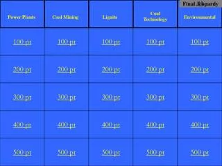
Jeopardy. Click to begin. Choose a point value. Choose a point value. Click here for Final Jeopardy. Dynamic Crust. Earth’s History. Rocks and Minerals. Astronomy. Meteorology. Earth’s Dimensions and Weathering Erosion. 10 Point. 10 Point. 10 Point. 10 Point. 10 Point.

E N D
Jeopardy Click to begin.
Choose a point value. Choose a point value. Click here for Final Jeopardy
Dynamic Crust Earth’s History Rocks and Minerals Astronomy Meteorology Earth’s Dimensions and Weathering Erosion 10 Point 10 Point 10 Point 10 Point 10 Point 10 Point 20 Points 20 Points 20 Points 20 Points 20 Points 20 Points 30 Points 30 Points 30 Points 30 Points 30 Points 30 Points 40 Points 40 Points 40 Points 40 Points 40 Points 40 Points 50 Points 50 Points 50 Points 50 Points 50 Points 50 Points
Approximately how long does an earthquake P-wave take to travel the first 6500 kilometers after the earthquake occurs? 1. 6.5 min 2. 8.0 min 3. 10.0 min 4. 18.5 min
Base your answer to this question on the map below. The map shows the locations of deep-sea core drilling sites numbered 1 through 4. The approximate location of the East Pacific Ridge is shown by a dashed line. Point A is located on the East Pacific Ridge.At point A, the East Pacific Ridge is the boundary between the 1. Cocos Plate and the North American Plate 2. South American Plate and the Nazca Plate 3. Pacific Plate and the South American Plate 4. Pacific Plate and the Nazca Plate
Base your answer to this question on the map below. The map shows the locations of deep-sea core drilling sites numbered 1 through 4. The approximate location of the East Pacific Ridge is shown by a dashed line. Point A is located on the East Pacific Ridge.At which drilling site would the oldest igneous bedrock most likely be found? 1. 1 2. 2 3. 3 4. 4
The arrows shown in the asthenosphere represent the inferred slow circulation of the plastic mantle by a process called… 1. insolation 2. convection 3. conduction 4. radiation
Compared to the thickness and density of the continental crust, oceanic crust is… 1. thinner and less dense 2. thinner and more dense 3. thicker and less dense 4. thicker and more dense
The Devonian-aged siltstone shown in the photograph below occurs as surface bedrock near Hamilton, New York.What does the presence of the fossils suggest about the Hamilton area during the Devonian? 1. It had a terrestrial environment sometime between 443 and 418 million years ago. 2. It had a terrestrial environment sometime between 418 and 362 million years ago. 3. It had a marine environment sometime between 443 and 418 million years ago. 4. It had a marine environment sometime between 418 and 362 million years ago.
4. It had a marine environment sometime between 418 and 362 million years ago.
Which feature is represented by the symbol along the edges of the dike and sills? 1. contact metamorphic rock 2. an unconformity 3. a glacial moraine 4. index fossils
In which type of environment were the sediments that formed these sedimentary rock layers most likely deposited? 1. glacial 2. mountainous 3. marine 4. terrestrial plateau
The sedimentary rock layers at the three locations can be most accurately correlated by comparing the 1. thickness of the sedimentary rock layers 2. foliation bands in the metamorphic basement rocks 3. fossils in the sedimentary rocks 4. minerals in the igneous rocks
Base your answer to this question on the geologic cross section below. Overturning has not occurred. The dike and sills shown in the cross section are igneous intrusions.Which rock type is the oldest?
Which sample best shows the physical properties normally associated with regional metamorphism? 1. A 2. B3. C 4. D
Which mineral is white or colorless, has a hardness of 2.5, and splits with cubic cleavage? 1. calcite 2. halite 3. pyrite 4. mica
Compared to dull and rough rock surfaces, shiny and smooth rock surfaces are most likely to cause sunlight to be … 1. reflected 2. refracted 3. scattered 4. absorbed
Which sedimentary rock is most likely to be changed to slate during regional metamorphism? 1. breccia 2. conglomerate 3. dolostone 4. shale
What do all four rock samples have in common? 1. They show cleavage. 2. They contain minerals. 3. They are organically formed. 4. They formed on Earth’s surface.
To an observer in Buffalo, New York, the North Star, Polaris, is always located above the northern horizon at an altitude of approximately 1. 23½° 2. 43° 3. 66½° 4. 90°
The apparent daily path of the Sun changes with the seasons because 1. Earth's axis is tilted 2. Earth's distance from the Sun changes 3. the Sun revolves 4. the Sun rotates
The diagram below shows the Moon orbiting Earth as viewed from space above the North Pole. The Moon is shown at eight different positions in its orbit.At which two positions of the Moon is an eclipse of the Sun or Moon possible? 1. 1 and 5 2. 2 and 6 3. 3 and 7 4. 4 and 8
Summer days in New York State are likely to be hotter than winter days because in summer 1. Earth is closer to the Sun 2. the number of sunspots increases 3. Earth’s northern axis is tilted toward the Sun 4. the Sun gives off more energy
A cycle of Moon phases can be seen from Earth because the 1. Moon’s distance from Earth changes at a predictable rate 2. Moon’s axis is tilted 3. Moon spins on its axis 4. Moon revolves around Earth
What is the dewpoint when the dry-bulb temperature is 24°C and the wet-bulb temperature is 15°C? 1. 8°C 2. -18°C 3. 36°C 4. 4°C
In New York State, dry, cool air masses (cP) often interact with moist, warm air masses (mT). Which statement correctly matches each air mass with its usual geographic source region? 1. cP is from the North Atlantic Ocean and mT is from the deserts of the southwestern United States. 2. cP is from northern Canada and mT is from the deserts of the southwestern United States. 3. cP is from northern Canada and mT is from the Gulf of Mexico. 4. cP is from the North Atlantic Ocean and mT is from the Gulf of Mexico.
3. cP is from northern Canada and mT is from the Gulf of Mexico.
A map view of surface air movement in a low-pressure system is shown below.The air near the center of this low-pressure system usually will 1. evaporate into a liquid 2. reverse direction 3. rise and form clouds 4. squeeze together to form a high-pressure system
Clouds usually form when… 1. air temperature reaches the dew point 2. evaporation has warmed the surrounding air 3. relative humidity is 0% 4. condensation nuclei have been removed from the air