Download
1 / 21
210 likes | 340 Views
Towards a BSR MSP Data Group. First thoughts and steps Kira Gee , Stephen Jay, Bettina Käppeler. Background. Why the proposed BSR MSP Data group?

E N D
Towards a BSR MSP Data Group First thoughtsandsteps Kira Gee, Stephen Jay, Bettina Käppeler
Background Why the proposed BSR MSP Data group? • PartiSEApate stakeholder meetings: Need to improve existing data services and data sharing in the BSR (EU MSP Directive, 2007 INSPIRE Directive); • PartiSEApate multilevel governance framework suggests expert groups, “MSP data needs and transnational MSP data requirements/network formation” identified as an urgent topic; • BSH as the initiator of this expert group; • Group proposed to the HELCOM/VASAB MSP Working Group, setup still subject to HELCOM and VASAB approval; • University of Liverpool contracted to help with the first steps.
Background TOR suggested by BSH for the group based on PartiSEApate results: • To identify MSP data needs from a planners' point of view, including setting priorities; • To identify relevant available data from MSP authorities and institutions; • To identify data and information gaps, especially with regard to transnational MSP; • To identify requirements and propose solutions for data scope, content, attributes, formats, etc, and estimate harmonisation needs; • To agree on measures for data quality, reliability, accuracy, accessibility, etc; • To identify research priorities to fill evidence gaps; • To develop terms of reference for a regional spatial data infrastructure for MSP; • To develop funding applications for external services for tasks that cannot be performed by the group.
The task First steps towards establishing the potential group • Led by BSH • UL subcontracted to: • Identify and assess relevant initiatives and projects addressing marine and maritime spatial data and data infrastructure; • Identify potential experts as members of the group; • Further develop the suggested TOR for the group; • Develop a roadmap for implementing the group.
Empiricalbasis • Internet researchanddocumentanalysis • Short internetsurveyofdataand MSP experts • 25 respondents, 3 incomplete / unusable • Respondents from DE (4), EE (2), SE (3), LV (2), DK (2), LT (1), NO (1), PL (4), FI (3) • MSP expertise = 14 • GIS expertise = 14 • Marine data collection/management expertise = 16 • 3 telephone interviews (DE, EE, PL) • Teleconference with 11 participants (DE, FI, LT, EE, DK, SE, PL)
Data managementtosupport MSP What would you say is most needed for more effective data management to support MSP at national and transnational levels? 1. Data harmonisationandcoordination • Consistency (e.g. common standards for GIS systems, harmonised data and data structures) • Minimum common standards for data acquisition, processing and representation • Metadata • Regular update interval • Map tools linked to metadata • Effectivedatamanagement
Data managementtosupport MSP What would you say is most needed for more effective data management to support MSP at national and transnational levels? 2. Access todata • Easy accesstoreliabledata • Reductionofdatafragmentation • Nobigdatastores • Nofancynewplatforms, keepit simple 3. Better understanding of data gaps • Common understanding of what is needed for transboundary cooperation • Good communication between stakeholders, managers, scientists and policy makers
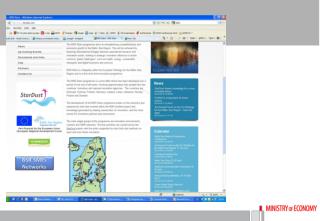
Examplesof SDI Existing initiatives for spatial data infrastructure National examples… … e.g. Germany, Estonia, Denmark ... and a wide range of international examples • EMODnet • HELCOM Map and Data Service • ICES marine databases • ESPON databases • SeaDataNet • SEAGIS • Shelf Geo Explorer • Baltic Sea Bathymetry Database • Others ... • Suitability for MSP? • What type ofdata do theymakeavailable? • Howregularlyaretheyupdated? • Common standard? • Can theyservethedynamic MSP process fast enough? • Howtoensuredataisalwaysfreshanduptodate?
Whatkindof regional spatialdatainfrastructure? Initial thoughts: • System must enable exchange of data from different sources • Standardisation is very important (e.g. data resolution, scale), but establishing a standardised data structure takes time as reaching agreement may be difficult • Decentralised system generally favoured, but needs centralised national node where data can be drawn from. • Up to date data must come from data owners/institutions. • Mixed system as a way forward: A list of providers of relevant data/data entry points in different countries in combination with harmonised data where available • Use EMODnet as a starting point for categories of data and for data compatibility • Be realistic – don’t be too ambitious to start with! • Identify data sets that are particularly useful as a starting point, work on these as a pilot case
Existing MSP Data workinggroups Baltic Sea Region: • International Hydrographic Organisation (IHO), marine spatial data infrastructure working group (MSDIWG); • Baltic Sea Hydrographic Commission – Baltic Sea Marine Spatial Data Infrastructure Working Group (BSMSDIWG). Current tasks: study on different laws with relevance to MSDI in the Baltic countries, establish a list of MSDI relevant projects, establish a framework for common understanding of MSDI; • Eurostat: new Task Force on the integration of geography and statistics; • EurostatESSnet grant project to be launched in 2015 to create a framework for point based statistics; • EMODnet
TOR fortheproposedgroup Other taskssuggestedforthegroup • overcomepoliticaland/orinstitutionalinconsistencies • reviewexistingexamplesofdatainfrastructureto check whethertheycouldbeused / extendedforpan Baltic datamanagement • Promote dataeducationandgovernance • Establish a financial model • Create a stablecommunicationplatform • Provideregularinformation, e.g. throughmailinglist, duringtheprocess. • Developtoolsforpracticaluseatthemanagementlevel, mostlikelymaptools; theseneedtobe transnational.
Format andcompositionofthegroup Format suggested in thePartiSEApategovernanceframework: • Independent group at the interface of MSP policy, sectors and MSP practice. • Consist of technical data experts selected for their expertise in the field, plus (potentially) country data experts nominated by national MSP contact points and MSP experts. • No permanent institution, but tasked with producing specific results within a set timeframe. • Will report to the HELCOM/VASAB MSP Working Group and give input to decisions taken by the WG.
Format andcompositionofthegroup Membership • Challenge given the diverse expertise needed! • Balanced representation – data and GIS experts, BSR countries, MSP, reflective of diverse MSP data needs (use data, scientific data, socioeconomic data) • Each MSP authority should be represented plus international representation (EMODNET, HELCOM) • but what about federal countries? • Possibly observers from other similar groups • Group should not be too large • Idea of observer status and advisory board • Other specialists can be drawn in for specific tasks • Many contact names were suggested!
Format andcompositionofthegroup • General willingnesstodedicate time, depending on tasksandfunding; • Group shouldmeetonce a year. • Open question: Country representation?
Funding • Travel and subsistence essential for non-authority participants • Authorities should fund the group since data is one of the core tasks of MSP authorities • Some funding for writing tasks • Small budget initially • VASAB secretariat should act as a coordination body • PartiSEApate as an example of how projects can be used
Over toyou! We‘dnowliketoaskforyourinput! Group workconcentrating on thefollowingquestions:
Yourthoughts • MSP Data infrastructure • What are the advantages and disadvantages of different approaches, e.g. centralised vs decentralised approaches? • What are the key attributes that would need to be considered in setting up a BSR spatial data infrastructure for MSP?
Yourthoughts • Data priorities for transboundary MSP: • Which data is most urgently needed? • How to facilitate cooperation between MSP practitioners and data experts? • How to link to existing data collections/mechanisms (e.g. EMODNET) and avoid duplication?
Yourthoughts • Practical setup of the group • Membership (country representation, balancing MSP and Data/GIS expertise) • The most important tasks of the group (TORs) • Can we think of a "test case" for establishing a BSR marine spatial data infrastructure? (e.g. pipelines)