Download
1 / 21
210 likes | 388 Views
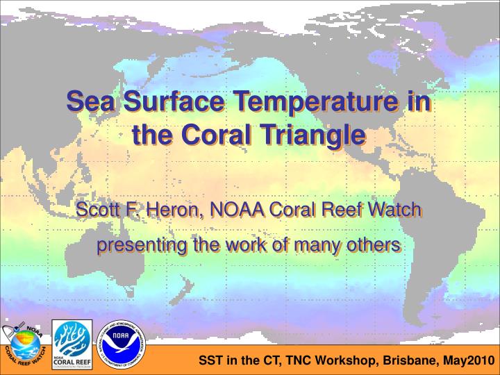
Sea Surface Temperature in the Coral Triangle Scott F. Heron, NOAA Coral Reef Watch presenting the work of many others. Long-term SST, >100km scale, monthly. ERSST (2° grid ). Heron et al. (2008). HadISST (1° grid) Eakin et al. (2009). SST trend Peñaflor et al. 2009.

E N D
Sea Surface Temperature in the Coral Triangle Scott F. Heron, NOAA Coral Reef Watch presenting the work of many others
Long-term SST, >100km scale, monthly ERSST (2° grid) Heron et al. (2008) HadISST (1° grid) Eakin et al. (2009)
SST trend Peñaflor et al. 2009 Recent SST, ~50km scale, twice-weekly DHW > 0 DHW ≥ 4 Regional trend (9 sites) 0.232 ± 0.078 °C/dec Global trend (50 sites) 0.237 ± 0.061 °C/dec (Eakin et al. 2009) # stress events % reef pixels 85-95 96-06 Peñaflor et al. 2009
CT regions – SST, fish, combined Peñaflor et al. 2009 Green and Mous 2008
TSA CoRTAD Selig et al. 2010 85-95 96-06 Recent SST, 4km scale, retrospective Strong et al. 2009
Recent SST, 1km scale, daily 30.84 °C imos.org.au 3.48 °C
MPA Modelling, 250m scale - Palau TC SST Currents + Sea-level connectivity residence time search and rescue tidal variation thermal capacitance Low High High Low
MPA Modelling, 30m scale – Heron Island Local Regional Intermediate
Climate Modelling, 30m downscaling – Heron Island • Same spatial patterns • Temperature increase • (per climate model)
MPA design – satellite history High chronic Low acute High chronic High acute Maximum of the Monthly Means chronic stress Low chronic Low acute Low chronic High acute acute stress Anomaly during bleaching Mumby et al., in review
MPA design – satellite history High chronic High acute A chronic stress Low chronic Low acute Low chronic High acute acute stress
MPA design – satellite history B A chronic stress Low chronic Low acute Low chronic High acute acute stress
MPA design – satellite history B A chronic stress Low chronic High acute C acute stress
MPA design – satellite history B A chronic stress D C acute stress
MPA design – satellite history A A chronic B B B A acute A B chronic stress C C D D C D C acute stress
MPA design – satellite history, Bahamas A chronic B acute Montastraea and gorgonian reefs were identified from the national habitat map 286 polygons were created containing these sites C D Thermal history for each site was determined
MPA design – satellite history + connectivity A chronic B acute Cowen R.K., et al. (2006) C D 945 km
AR4 streamfunction changes A2 in 2090, Sverdrups Ganachaud et al. 2010
Pacific Sea Level Anomalies C. Steinberg, pers. comm.
Acknowledgements Craig Steinberg, AIMS Al Strong, NOAA CRW Mark Eakin, NOAA CRW