Download
1 / 20
200 likes | 340 Views
G S F C E a r t h S c i e n c e s D i v i s i o n. David Herring • 301-614-6219 • dherring@climate.gsfc.nasa.gov. Presentation overview Earth Sciences Division (ESD) brief status update Big picture from ESDIS & CEOS Giovanni & Hurricane portal

E N D
G S F C E a r t h S c i e n c e s D i v i s i o n David Herring • 301-614-6219 • dherring@climate.gsfc.nasa.gov Presentation overview • Earth Sciences Division (ESD) brief status update • Big picture from ESDIS & CEOS • Giovanni & Hurricane portal • The SIVO • NAMMA Field Campaign • NEO & Earth Observatory S e p t e m b e r 7 , 2 0 0 6 S e p t e m b e r 7 , 2 0 0 6
NASA ESD Status • 16 EOS satellites successfully deployed, 3 more to go • Future mission profile looks uncertain, appears to ramp down • Earth science appears to be losing ground in NASA’s overall priority list • Focus currently on six interdisciplinary science areas: • Atmospheric Composition • Carbon Cycle and Ecosystems • Water and Energy Cycle • Climate Variability and Change • Weather • Earth Surface and Interior • The fundamental question: “How is Earth changing and what are the consequences for life on Earth?” S e p t e m b e r 7 , 2 0 0 6
New CEOS InitiativesCourtesy Ken McDonald, ESDIS • Coordinated Enhanced Observing Period (CEOP) is a major initiative of the Integrated Global Observing Strategy (IGOS) Water Cycle Theme • CEOP seeks to establish an integrated global observing system for measurement, understanding, modeling and predicting water and energy cycles • CEOP has established 35 reference sites and multiple enhanced observing periods where they are collecting: • In-situ Data • Time Series and Gridded Model Output Data • EO Data From JAXA, NASA, ESA and EUMETSAT • Collections of each data type are being archived at NCAR, Max Planck Institute, and Univ. of Tokyo, respectively S e p t e m b e r 7 , 2 0 0 6
CEOP / CEOS Collaboration • CEOP Scientists need efficient access to satellite data, model output data, and field data • CEOP science community needs advanced tools to access the satellite data with the services needed to support data integration • CEOP Program initiated a discussion with CEOS Working Group on Information Systems & Services (WGISS) to ask for assistance in solving this problem • CEOP science community and CEOS WGISS information technologists have teamed together to remove IT barriers to access and use satellite data for CEOP data integration S e p t e m b e r 7 , 2 0 0 6
Data sources • Data location • Standalone physical location • Distributed sites reference by links • Data types • Model output data • Insitu data • Satellite data • Services • Metadata keyword search • Data value search • File format translation • Reprojection • Regridding • Data Interpolation Integrated datasets Multiple files from individual member datasets Intercomparison Of Integrated Datasets Spatial Temporal rectification Spatial rectification CEOP Data Integration • CEOP science community uses OPeNDAP-based clients to access in situ and model data • NASA focuses on improved access to distributed satellite data collections S e p t e m b e r 7 , 2 0 0 6
Grads Client Other OPeNDAP Clients OPeNDAP Request Translator Default georectification CF Attribute Construction Custom Requests (future) Grads-DODS Server (GDS) Field Data Model Output NASA Satellite Data Server WCS Client NWGISS WCS Standard Functions e.g. subsetting Standard Functions e.g. subsetting Custom Functions (Grads) Satellite Data, Swath and Grid S e p t e m b e r 7 , 2 0 0 6
NASA’s WTF-CEOP Contribution • CEOP scientists desire direct access to full range of satellite data products and services • Latest versions of products • Flexible access to data services • There is widespread and growing use of Open Geospatial Consortium (OGC) specifications by satellite data providers • NASA developed a CEOP Satellite Data Server prototype that demonstrated OPeNDAP client (Grads) access to the OGC-WCS server capabilities • Using the prototype as a basis, the NASA team proposed to NASA’s Advancing Collaborative Connections for Earth-Sun System Science (ACCESS) Program • Awarded 2 year ACCESS funding to develop the Satellite Data Server with an optional 3rd year • A second proposal to develop a gateway that would make OPeNDAP servers accessible to OGC clients merged with this effort • Added two new team members (Domenico/Unidata, Rutledge/NOAA-NCDC) S e p t e m b e r 7 , 2 0 0 6
OGC / Geoscience Gateway S e p t e m b e r 7 , 2 0 0 6
GIOVANNIhttp://daac.gsfc.nasa.gov/techlab/giovanni/ • NASA GES DISC created GIOVANNI — an on-line data visualization and analysis infrastructure, featuring: • Access to data from multiple remote sites as well as local sites. • Server-side temporal and spatial subsetting. • Server-side processing. • Support for multiple data formats including Hierarchical Data Format (HDF), HDF-EOS, network Common Data Form (netCDF), GRIdded Binary (GRIB), and binary. • Support for multiple plot types including area, time, Hovmoller, and image animation. • Support for outputting data in ASCII format in multiple resolutions. • Multi-parameter intercomparisons • Easily configurable to support customized portals for measurements-based projects or disciplines. S e p t e m b e r 7 , 2 0 0 6
New Hurricane Data Portalhttp://disc.gsfc.nasa.gov/hurricane/index.shtml • Current Atlantic conditions • Latest maps & profiles from TRMM, AIRS, etc. • Stories about scientists’ use of the data • Archived maps and profiles from past storms • Access to data S e p t e m b e r 7 , 2 0 0 6
Software Integration & Viz Officehttp://sivo.gsfc.nasa.gov • SIVO headed by Michael Seablom • A program to support NASA modeling programs, including development of software environments for collaborative research among a range of modeling and assimilation activities • Has a formal interface into the multi-agency Earth System Modeling Framework (ESMF) • Maintains publicly available WMS servers of model and satellite data sets, including the MAP ’06 Program • Provides oversight of: • NASA’s Earth Observatory Team (earthobservatory.nasa.gov) • NASA’s Scientific Visualizations Studio (svs.gsfc.nasa.gov) • Emphasis on the use of OGC standards & tools S e p t e m b e r 7 , 2 0 0 6
MAP ’06 Programhttp://map06.gsfc.nasa.gov • Modeling, Analysis, & Prediction Program • WMS Server providing: • Map layers of a wide variety of meteorological parameters from GEOS-5 forecast model • Satellite data from GOES, and Terra & Aqua MODIS • Issue regarding WMS, WCS access to vertical data, such as CloudSat’s S e p t e m b e r 7 , 2 0 0 6
NAMMA Field Campaignhttp://namma.msfc.nasa.gov • NASA African Monsoon Multidisciplinary Analysis (NAMMA) • Currently ongoing, based in Cape Verde Islands • Involves multiple NASA centers / scientists & NOAA • Real-time flight track and image access from the mission via GoogleEarth S e p t e m b e r 7 , 2 0 0 6
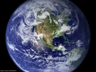
NASA’s Earth Observatory http://earthobservatory.nasa.gov • Interactive Web-based magazine • First published April 29, 1999 • Recipient of numerous awards • Webby People’s Voice Award (’06) • NASA Group Achievement Award (’05) • Webby Award in Education (’03) • Webby People’s Voice Award (’03) • Webby People’s Voice Award (’02) • Selected “50 Best of the Web” by Scientific American (’02) • NASA Group Achievement Award (’01) • GSFC Public Service Achievement Award (’01) • Selected “50 Best of the Web” by Popular Science (’00) S e p t e m b e r 7 , 2 0 0 6
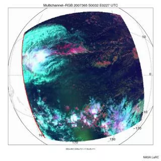
EO Natural Hazards http://naturalhazards.nasa.gov • Near-real-time Earth events monitor • Access to timely, newsworthy imagery posted as thumbnails, medium sized, & at sensors’ full-resolution • Thumbnails to help visitors determine images’ locations • Interpretive captions written in popular style • Scientist editorial oversight • Easily scalable to add info from more missions • Roughly 5,000 subscribers with daily e-mail notifications of new postings • Coming soon: daily updated maps showing locations & severity of hazards around the globe S e p t e m b e r 7 , 2 0 0 6
Earth Observatory User Stats • Unique visitors per day still climbing, but leveling off a bit in 2006 • Subscriptions still climbing, but leveling off a bit in 2006 • 44,603 subscribers in June ’06 • Rate was 10 new subscribers per day in July ’06 S e p t e m b e r 7 , 2 0 0 6
4-Year Trend of User Stats Hurricane Katrina Hurricanes Charley, Frances & Ivan Tsunami California Wildfires Visit rate and file driven largely by major Earth events. There is high correlation between visitors (pink), visits (yellow), and file downloads (blue). New “plateaus” seem to follow major events. S e p t e m b e r 7 , 2 0 0 6
EO Quantitative Assessmentshttp://earthobservatory.nasa.gov/SurveyResults/ • In May 2006, we surveyed site visitors & subscribers and received a total of 4,548 (+831) responses • 757 Teachers (17%,+3%) • 186 Informal Educators (4%) • 240 Students (5%) • 702 Scientists (15%) • 194 Media Professionals (4%, -2%) • 41 Legislative Officials (<1%, -2%) • 2,428 “None of the above” (53%) S e p t e m b e r 7 , 2 0 0 6
NEO Beta-2 Interface http://neo.sci.gsfc.nasa.gov • Who will come? • Educators • Students • Communicators • Citizen scientists • Why will they come? • To obtain images • To export into browsers & display devices • To export into analysis tools • To order data S e p t e m b e r 7 , 2 0 0 6
Data Products in NEO • Atmosphere Products • Aerosol optical thickness • Cloud fraction / cloud mask • Fraction of fine aerosol • Cloud particle radius • Water vapor • Cloud optical thickness • Carbon monoxide • Cloud water path • TRMM Precipitation • Stratospheric ozone • UV Surface Exposure • Ocean Products • Sea surface temperature (day) • Water-leaving radiance • AMSR-E SST • SST Anomaly • SST Climatology • Chlorophyll concentration • NOAA Bathymetry• Chlorophyll Anomaly • Land Products • Land cover classification • USGS Land Topography • Daily surface reflectance• Land Snow Cover • Global fire maps• Sea Ice Cover • Land surface temp (day & night time)• 8-day Albedo • Normalized Difference Vegetation Index• Leaf Area Index = products in hand = products near at hand = products planned, but may lag some months S e p t e m b e r 7 , 2 0 0 6