Download
1 / 13
130 likes | 381 Views
The GEO Caribbean Flood Project . LIMA Water Cycle Capacity Building Workshop November 30 – Dec 4, 2009 Cecille Blake, Jamaica . Introduction .

E N D
The GEO Caribbean Flood Project LIMA Water Cycle Capacity Building Workshop November 30 – Dec 4, 2009 Cecille Blake, Jamaica
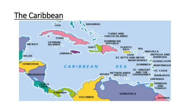
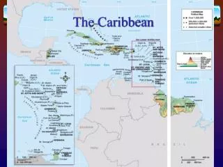
Introduction The Caribbean Flood Pilot was developed in the context of Geo task DI-06-09 as a demonstration of how satellites could be effectively used to improve risk management at the regional level for all phases of disaster management. In July 2009, the Steering Committee of the Caribbean Flood Pilot selected Barbados, British Virgin Islands, Grenada, Jamaica and Saint-Lucia as the National Partners for Phase 1 of the Caribbean Flood Pilot.
Pilot Partners Flood Pilot includes range of partners at this time, with further partners expected: • NASA Goddard SFC (Lead) • CEOS Disaster SBA Team (advisory role) • UNOOSA/UN-SPIDER (advisory role) • Caribbean Disaster Emergency Management Agency (CDEMA) • CATHALAC/SERVIR • ESA • Caribbean URISA Charter • University of the West Indies • American Institute of Technology (ITLA) • Caribbean Institute for Meteorology and Hydrology (CHMI) • Canadian Space Agency (CSA) • Canada/GEOSS, • Island Resources Foundation • Others invited to join
AIM To improve the application of satellite technologies to disaster management in the Caribbean and leverage satellite investment and in-kind contributions from national partners and contributing space agencies to develop a showcase for enhanced regional disaster management.
Objectives • To demonstrate the effectiveness of satellite imagery to strengthen regional, national and community level capacity for mitigation, management and coordinated response to natural hazards • To identify specific satellite-based products that can be used for disaster mitigation and response on a regional level • To identify capacity building activities that will increase the ability of the region to integrate satellite-based information into disaster management initiatives
Expected Outcomes Decision makers: better enabled to take critical decisions in context of flood planning and response Regional civil protection agencies: better able to face flooding, find information and increase awareness of flood impacts The public: more aware of flood impact during and after events Data suppliers: increased awareness of gaps in data supply and need for support during mitigation and warning phases, rather than only during response
Issues to be addressed: • Awareness • disaster managers are unfamiliar with the range of available satellite data and products; 2.Resolution • existing satellite-based tools and products mostly utilize imagery at low resolution that is not useful to local responders, planners or analysts
Main Issues cont’d 3. Cloud-cover • most satellite data used in the Caribbean is optical imagery and does not provide useful information during periods of cloud cover, which are common; 4. Data vs. Products • most users would like end-products focused on specific disaster relevant information, not data
Main Issues cont’d 5. Capacity • many countries have limited capacity to work with data and develop products • Mitigation • most efforts focus on response while limited resources are available for mitigation
Project Status - Jamaica The National Team inclusive of the following representatives has been established: • Office of Disaster Preparedness and Emergency Management ( Team Leader) • OPM, Spatial Data Management Division • Forestry Department • Planning Institute of Jamaica • Meteorological Services • Water Resource Authority • Mines and Geology Division and • National Environment & Planning Agency • Ministry of Agriculture
Project Status cont’d Local Pilot Projects Identified • Geohazard and risk mapping for urban and semi-urban areas (east central section of island) – river bank migration along the Hope River, related river systems and – effects of development over time on flood plain erosion and landslides occurrence • Risk mapping in agricultural areas (western Jamaica) - this area has been less vulnerable and is less prepared for a major hurricane • Island scale wetland monitoring - to investigate the health of wetlands and monitor changes that occur
Project Status cont’d • Data Mining of geospatial portals and satellite imagery providers is being conducted, to acquire data related to the projects identified • Funds are also being sourced to facilitate training in order to fulfill the Capacity Building phase of the project
Next Steps • Capacity Building Preparatory Workshop (suppliers and users), introduction of different satellite technologies and imagery products and their uses • Compilation of data acquired • Meeting of the National Team and CDEMA to decide on the approach to be taken to complete the pilot projects