Download
1 / 20
200 likes | 299 Views
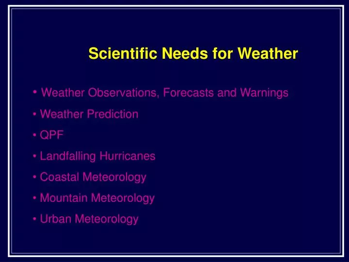
Scientific Needs for Weather. Weather Observations, Forecasts and Warnings Weather Prediction QPF Landfalling Hurricanes Coastal Meteorology Mountain Meteorology Urban Meteorology.

E N D
Scientific Needs for Weather • Weather Observations, Forecasts and Warnings • Weather Prediction • QPF • Landfalling Hurricanes • Coastal Meteorology • Mountain Meteorology • Urban Meteorology
Weather Observations and Forecasts and Warnings - 1(Emanuel et al. 1995 and Dabberdt and Schlatter 1996) • Scientific needs • Convective storms • Deep convective downdraft processes • Cloud microphysical processes • Cloud ice properties • Entrainment • Land-surface-atmosphere interactions • Atmospheric electricity
Weather Observations and Forecasts and Warnings - 2(Emanuel et al. 1995 and Dabberdt and Schlatter 1996) • Scientific needs • Extratropical cyclones • Understand mesoscale phenomena • Gravity waves • Slantwise convection • Development and evolution of frontal cyclones • Potential vorticity • Role of tropopause in atmospheric dynamics • Aviation weather • Better understanding of mesoscale phenomena • Thunderstorms • Fronts • Clear-air turbulence • Wind shear • Icing
Weather Observations and Forecasts and Warnings - 3(Emanuel et al. 1995 and Dabberdt and Schlatter 1996) • Scientific needs • Modeling fire weather • Seasonal climate prediction • Low-frequency oscillations • Influence of hurricanes on low-frequency coupled atmosphere-ocean and atmosphere-land surface • External influences, such as volcanoes and solar output • Data assimilation techniques for operational datasets
Weather Observations and Forecasts and Warnings - 4(Emanuel et al. 1995 and Dabberdt and Schlatter 1996) • Observational needs • Maintain operational rawinsonde network • Improved measurements of temperature, liquid and ice in cloud • Microphysical measurements, particularly within ice clouds • Improved water vapor measurements • WVSS on commercial aircraft • GPS • DIAL • Raman lidars • Radiosondes • Dropsondes • Infrared spectrometers • Microwave radiometers • Unpiloted aircraft • Satellite radiances
Weather Observations and Forecasts and Warnings - 5(Emanuel et al. 1995 and Dabberdt and Schlatter 1996) • Observational needs • Measurements of the maritime atmosphere • Ocean fluxes • Global observing systems • Targeted, adaptive observations • Better observations over the mountainous West • Wind profilers • Wind and temperature profiles upwind • Enhanced mesoscale observations
Weather Observations and Forecasts and Warnings - 6(Emanuel et al. 1995 and Dabberdt and Schlatter 1996) • Observational needs • Better observations over the eastern N. Pacific • Profiles of wind, temperature and humidity • GOES rapid scan • Dropsondes from commercial or military aircraft • Altitude-controlled balloons • Unpiloted aircraft • Buoys • Profilers on buoys • Satellite radiometric measurements • Moisture profiles combined with wind measurements • WVSS on commercial aircraft • GPS techniques • Eye-safe Raman lidars • Fourier transform infrared radiometry (like AERIs) • Wind profilers • WSR-88D radars
Weather Observations and Forecasts and Warnings - 7(Emanuel et al. 1995 and Dabberdt and Schlatter 1996) • Observational needs • Better measurements for initial conditions • Surface temperature and albedo • Soil classification • Soil moisture • Snow distribution • Vegetation • SST • Sea ice distribution • Wave state • Ocean color for tracking currents • Airborne radars for process studies • Aircraft in-situ measurements for downdraft process studies • Polarimetric radars for QPF • Bistatic radars • Joint radar and lightning measurements • Ultimate objective • Benefit to society
Weather Prediction (Emanuel et al. 1997) • Scientific needs • Physical mechanisms of rapidly growing weather systems • Observational needs • Observations in data sparse regions • Automated rawinsondes • Ship measurements • Profilers on ships • Moored and drifting buoys • ACARS • Piloted and unpiloted aircraft • Automated floating devices • Passive satellite measurements • Global winds derived from sequential satellite imagery • Sea-surface winds from scatterometers • GPS soundings of temperature and moisture • Lidar wind measurements from satellite • Ultimate objective • Benefit to society
QPF - 1 (Fritsch et al. 1998) • Scientific needs • Process and climatological studies • New design for data-gathering strategies for model initialization • Define probabilistic framework for precipitation forecasting and verification • Development of advanced ensemble techniques • Better understanding of storm lifecycle, especially MCCs • Better understanding of cloud microphysics • PV anomalies • Surface boundaries • Orographic influence • Improved precipitation estimates in 4DDA • Assimilate WSR-88D • Forecast validation • Land-surface-atmosphere interactions
QPF - 2(Fritsch et al. 1998) • Observational needs • Improved accuracy and resolution of precipitation observing system • Mobile radiosondes • Portable lidars • Mobile radiometers • Improved moisture measurements • Stability profiles • In situ aircraft observations • Land surface measurements • Polarimetric radars • Satellite estimates • Rain gauges • Ultimate objective • Benefit to citizens, governments, agriculture and businesses • “Precipitation is the most important atmospheric variable to forecast”
Landfalling Tropical Cyclones - 1(Marks and Shay 1998 and Emanuel et al. 1995) • Scientific needs – Improve physical understanding and provide better initial conditions • Hurricane motion – increased skill • Intensity change – poor skill • Atmospheric and oceanic boundary layers • Air-sea coupling mechanisms • Tropical cyclogenesis
Landfalling Tropical Cyclones - 2(Marks and Shay 1998 and Emanuel et al. 1995 and Rotunno et al. 1996) • Observational needs • Mobile observing system in a translating storm-coordinate system, including: • Satellites • Satellite-borne sensors • Sea surface scatterometers • Special Sensor Microwave Imager • Passive water vapor measurements • Active radar • Active lidar • Piloted and unpiloted aircraft from boundary layer to 20 km • Expendables from aircraft • Fixed and mobile coastal platforms • Moored and drifting platforms • Expendable bathythermographs • Ultimate objective • Real-time analyses of storm surge, winds and rain • Improve warnings • Provide local areas with info before, during and after landfall
Coastal Meteorology and Oceanography - 1 (Rotunno et al. 1996 and Emanuel et al. 1995) • Scientific needs • Coastal weather prediction • Air-sea fluxes and boundary layer structure in areas of mesoscale variability and at high wind speeds • Improved air-sea models of coastal zones • Understanding sea ice formation • Coastal flash flood forecasting • Polar lows
Coastal Meteorology and Oceanography - 2 (Rotunno et al. 1996 and Emanuel et al. 1995) • Observational needs • Measurements in ABL and upper-ocean mixed layer • Measurements of air-sea fluxes and boundary layers in presence of ice formation • Onshore and offshore profilers • Satellite data of • Special Sensor Microwave Imager (SSMI) • Ocean wave spectra and winds from scatterometers and SARs • Precipitation • Snow cover • Sea ice coverage and thickness • TPW • SST
Coastal Meteorology and Oceanography - 3 (Rotunno et al. 1996 and Emanuel et al. 1995) • Observational needs • Depth of thermocline • UAVs over oceans from boundary layer to upper levels • Moored and drifting buoys measuring ocean fluxes • Radars • Upper ocean current sensors • Minimeteorological drifters • Polar measurements of humidity and radiative fluxes • Ultimate objective • 4-D VAR • Improved forecasts for more than 50% of US population
Mountain Meteorology - 1(Smith et al. 1997 and Emanuel et al. 1995 and Dabberdt and Schlatter 1996) • Scientific needs • Modeling topographic circulations • Rocky Mountain lee-side phenomena • Lee-side cyclogenesis • Cold air outbreaks • MCSs • Trapping of cold air in basins and valleys • Orographic precipitation and flash floods • Generation of PV over mountains • Collective and multiscale effects of complex terrain (continuum of scales)
Mountain Meteorology - 2(Smith et al. 1997) • Observational needs • WSR-88Ds • Polarimetric radars • Profilers and RASS • Doppler lidars • 3-D, time-varying observations of multiscale orographic flows • Satellite sensors • Special Sensor Microwave/Imager (SSM/I) • Synthetic Aperture Radar (SAR) • Sun-glint observations • Visible imagery • Water vapor imagery • Sounding capabilities • GPS and sounding combinations to get temperature and water vapor profiles • Global wind measurements • Ultimate objective • Benefit to society
Urban Weather - 1(Dabberdt et al. 2000) • Scientific needs • Impacts of visibility and icing on transportation • Winter storms • Convective storms • Lightning • Air quality and toxic releases • Integrate multiple datasets into models • Explicit use of cloud-resolving models • Inadvertant urban convective storm modification • Forecast uncertainty quantification
Urban Weather - 2(Dabberdt et al. 2000) • Observational needs • Detection of low-visibility and icing conditions • Radar precipitation estimates in winter regimes • Location of mixed-phase precipitation • Quantitative forecasts of frozen/freezing precipitation • GPS integrated precipitable water and refractive index profiles • ACARS in-situ measurements • Boundary layer winds, stability and convergence lines • Ultimate objective • Benefit to society living in urban areas