Download
1 / 29
290 likes | 497 Views
GIS Ireland 2014 - The Future for GI. Integrating Geospatial Information & Linked Open Data Dr. John J O’Flaherty, The National Microelectronics Applications Centre Ltd , john@mac.ie. Contents. Geospatial Information (GI) – OGC/INSPIRE Linked Data (LD) – W3C/Semantic Web

E N D
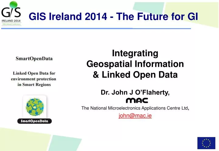
GIS Ireland 2014 - The Future for GI Integrating Geospatial Information & Linked Open Data Dr. John J O’Flaherty, The National Microelectronics Applications Centre Ltd, john@mac.ie
Contents • Geospatial Information (GI) – OGC/INSPIRE • Linked Data (LD) – W3C/Semantic Web • Linked Open Data (LOD) – Open Data/OGP • SmartOpenData Project • Linking Geospatial Data • SmartOpenData pilots • Conclusion on the Future for GI GIS Ireland 2014 - The Future for GI, Dublin, 16 Oct 2014, john@mac.ie
The Future for GI will be LOD • “Everything is somewhere” • Geospatial Information (GI) is fundamental. • Open Interoperability is critical • The societal, economic & scientific benefits of integrating GI into commercial & institutional processes is huge. • The process would be substantially aided if data were published on the Web with the appropriate GI at the source, • thus allowing discovery & access using the standard Web mechanisms GIS Ireland 2014 - The Future for GI, Dublin, 16 Oct 2014, john@mac.ie
GI – OGC (Open Geospatial Consortium) • GI is mainly based on standards fromOGC (Open Geospatial Consortium) & ISO (International Standards Organisation) • Based on the OGC Reference Model • E.g. WMS 1.0 - Maps, Display, Features & Data • See www.opengeospatial.org/standards • Based on extensive Spatial Data Infrastructures (SDI) that have been established • E.g. the Irish Spatial Data Exchange, www.isde.ie Ireland’s INSPIRE GeoPortal, www.geoportal.ie GIS Ireland 2014 - The Future for GI, Dublin, 16 Oct 2014, john@mac.ie
GI - INSPIRE Directive Infrastructure for Spatial Information in the European Community http://inspire.ec.europa.eu/ GIS Ireland 2014 - The Future for GI, Dublin, 16 Oct 2014, john@mac.ie
INSPIRE Principles GIS Ireland 2014 - The Future for GI, Dublin, 16 Oct 2014, john@mac.ie
INSPIRE 34 Spatial Data Themes Annex III • Statistical units • Buildings • Soil • Land use • Human health & safety • Utility & Government services • Environmental monitoring facilities • Production & industrial facilities • Agricultural & aquaculture facilities • Population distribution – demography • Area management/restriction/regulation zones & reporting units • Natural risk zones • Atmospheric conditions • Meteorological geographical features • Oceanographic geographical features • Sea regions • Bio-geographical regions • Habitats & biotopes • Species distribution • Energy resources • Mineral resources Annex I • Coordinate reference system • Geographical grid systems • Geographical names • Administrative units • Addresses • Cadastral parcels • Transport networks • Hydrography • Protected sites Annex II • Elevation • Land cover • Orthoimagery • Geology GIS Ireland 2014 - The Future for GI, Dublin, 16 Oct 2014, john@mac.ie
INSPIRE Directive – Legislatively driven- Top-down – mainly OGC/ISO standards USERS - Seamless access to data Mechanisms for sharing & exchange INSPIRE DIRECTIVE METADATA DATA SPECIFICATION NETWORKING SERVICES DATA & SERVICE SHARING MONITORING & REPORTING Member States Data GIS Ireland 2014 - The Future for GI, Dublin, 16 Oct 2014, john@mac.ie
Web of Linked Data (LD) – Semantic Web of knowledge • Community driven - bottom-up/collaborative • W3C (World Wide Web Consortium) standards • See www.w3.org/standards/ • Open Web of Linked Data (Semantic Web) - based on • HTML/HTTP – the “normal” web of documents – standard Web Browser • RDF Triples – Resource Description Framework - graph based data model • Two nodes (Subject & Object) & a relationship connecting them (Predicate) • URIs – Universal Resource Identifiers • Web addresses for everything • All Subjects, Objects & Predicates GIS Ireland 2014 - The Future for GI, Dublin, 16 Oct 2014, john@mac.ie
Tim Berners Lee – Founder of the Web “In an extreme view, the world can be seen as only connections, nothing else. We think of a dictionary as the repository of meaning, but it defines words only in terms of other words. I liked the idea that a piece of information is really defined only by what it's related to, & how it's related. There really is little else to meaning. The structure is everything. There are billions of neurons in our brains, but what are neurons? Just cells. The brain has no knowledge until connections are made between neurons. All that we know, all that we are, comes from the way our neurons are connected.” GIS Ireland 2014 - The Future for GI, Dublin, 16 Oct 2014, john@mac.ie
Open Data – OGP (Open Government Partnership) • Open Data is • "A piece of data is open if anyone is free to use, reuse, & redistribute it — subject only, at most, to the requirement to attribute and/or share-alike” • G8Open Data Charter - http://opensource.com/government/13/7/open-data-charter-g8 • All government data will be published open by default, • Will increase the quality, quantity & re-use of the data that is released. • To help unlock the economic potential of open data, support innovation & provide greater accountability. • EU Directive on reuse of Public Service Information (PSI) • See http://ec.europa.eu/digital-agenda/en/european-legislation-reuse-public-sector-information • Open Government Partnership (OGP) – Ireland joined in 2013 • OGP – 65 countries, www.opengovpartnership.org • Irish OGP National Action Plan, www.ogpireland.ie • Open Data is a key component • All PSI Open Data to be Linked Open Data within 5 years. GIS Ireland 2014 - The Future for GI, Dublin, 16 Oct 2014, john@mac.ie
Open Data Formats • Tim Berners-Lee, the inventor of the Web & Linked Data initiator, suggested a 5 star deployment scheme for Open Data. • From just electronic to Linked Open Data (LOD) • See http://5stardata.info/ GIS Ireland 2014 - The Future for GI, Dublin, 16 Oct 2014, john@mac.ie
Linked Open Data cloud Media User-generated Government Publications Cross-domain Geo Life sciences http://lod-cloud.net/ GIS Ireland 2014 - The Future for GI, Dublin, 16 Oct 2014, john@mac.ie
Irish Linked Open Data landscape • data.cso.ie • 2011 Census – Linked Open Data • 12 million RDF triples from Census • Geographical entities (counties, cities, etc.) • Codelists • StatBank time series database • Linked Logainm.ie (Digital Repository Ireland) – Irish Place names • Irish Opendata.ie portal • All-Island Research Observatory – www.airo.ie • Dublinked.ie • Etc. GIS Ireland 2014 - The Future for GI, Dublin, 16 Oct 2014, john@mac.ie
INSPIRE is moving quickly to becoming Linked Open Data • All INSPIRE Global IDs can now be defined as URIs. • INSPIRE Secretariat at the Joint Research Centre (JRC) is actively defining • An RDF representation for INSPIRE metadata based on DCAT-AP & other relevant vocabularies. • DCAT-AP (Data Catalogue Application Profile for European data portals – is a W3C recommendation. • An open INSPIRE Registry • See http://inspire.ec.europa.eu/ • Various projects, including our SmartOpenData project is working closely with them to achieve this GIS Ireland 2014 - The Future for GI, Dublin, 16 Oct 2014, john@mac.ie
SmartOpenData Linked Open Data for environment protection in Smart Regions FP7 ENVIR Grant no. 603824 - [Exploiting the European Open Data Strategy to mobilise the use of environmental data & information] • SmartOpenData is creating a Linked Open Data platform of tools • to make public & voluntary GI resources on rural areas - such as national parks. • available to SMEs as LOD in a way that will enable them to create new services & products. • Based on the practical needs & experience of 5 Demonstration Pilots • SmartOpenData aims to help bridge the gap between • GeoSpatial Information - from the SDI/INSPIRE “world” • OGC (Open Geospatial Consortium) – standards setting • Linked Open Data (LOD) - from the Semantic Web “world” • W3C (World Wide Web Consortium) – collaborative movement GIS Ireland 2014 - The Future for GI, Dublin, 16 Oct 2014, john@mac.ie
SmartOpenData Linked Open Data for environment protection in Smart Regions • Involves 16 partnersfrom 9 countries • PublicBodies, • AcademicResearchers, • Industry • SMEs • Ireland – MAC, MWRA, Sindice • Project started in November 2013 & will run for 2 years. • Seewww.smartopendata.eu 1 1 3 3 1 1 1 2 3 GIS Ireland 2014 - The Future for GI, Dublin, 16 Oct 2014, john@mac.ie
Public Body Industry Academic SMEs SmartOpenData Consortium Started: November 2013 Duration: 24 Month EU Contribution: €2.4M GIS Ireland 2014 - The Future for GI, Dublin, 16 Oct 2014, john@mac.ie
Linking Geospatial Data, joint W3C/OGC Conference, 5-6th March 2014, London • Sponsored by SmartOpenData & informed its work ! • 106 of the world’s experts, 38 presentations, 16 panellists, 8 bar camp pitches, 2 days • Report at http://www.w3.org/2014/03/lgd/report • Considered issues such as • how should we encode geometry? • how & where should we implement topological functions? • additional metadata is required for spatial datasets – how do we do that? • where is the software support for spatial data types & functions? • geometries expressed as WKT (Well Known Text) literals are large objects — the Linked data world is used to handling simple literals; • how do we help developers handle (or avoid) the steep learning curve to work with Linked Data? GIS Ireland 2014 - The Future for GI, Dublin, 16 Oct 2014, john@mac.ie
Linking Geospatial Data, joint W3C/OGC Conference, 5-6th March 2014, London Conclusions • We must seamlessly integrate the GI & LOD “worlds” • Joint Working Group is required to create or recommend standards that work across those communities. • OGC & W3C committed to work together in establishing such a group. • Working Group is in the process of being established. • Interesting technologies to standardise include • GeoSPARQL • GeoJSON GIS Ireland 2014 - The Future for GI, Dublin, 16 Oct 2014, john@mac.ie
SmareOpenData Demonstration Pilots • Environmental Conservation – Ireland • Focused on biodiversity & habitats data for researchers & decision makers in management & conservation of the Burren & other National Parks. • Water monitoring – Italy • Will explore the role of aggregating information from different Open Data sources to provide up to date monitoring of water quality in Sicily. • Forest sustainability – Czech Republic • Forest site classification, sustainable management & utilisation of forest roads using the National Forest Inventory & Regional Plans for Development datasets. • Environmental data reuse – Slovakia • Willdeploytwotypes of web applications to achievereuse of environmental data & information in line withtheEuropean Open Data Strategy. • Agroforestry Management – Spain & Portugal • Willfocusonbuilding a web basedcollaborativeSpatial Data Infrastructure to promotesustainableagroforestrymanagement, environmentprotection, rural economicdevelopment, watermanagement & drinkingwaterprotection. GIS Ireland 2014 - The Future for GI, Dublin, 16 Oct 2014, john@mac.ie
SmartOpenData Irish Pilot Environmental Conservation, Biodiversity • The Irish pilot will access & aggregate sources to impact on biodiversity, by allowing them to seamlessly bridge the gap between the “worlds” of open data & INSPIRE geo-spatial sources forEnvironmental Conservation. • Focusing on European protected areas & its National Parks, • Starting with the Burren National Park in Ireland. • To demonstrate the value of SmartOpenData in helping Researchers & Decision Makers to better manage, preserve, sustain & use this unique ecosystem. • Pilot will explore: • Discovery, seamless use & mashing together of sources to address immediate biodiversity research issues. • Overcoming the barriers (cultural, political, administrative) to opening up the data • Overcoming technical incompatibilities of datasets in terms of technical standards, semantic structuring etc. • Validation of the SmartOpenData platform in the aggregation, analysis & visualisation to support decision making of the various research & other stakeholders requirements, & the value-add/impact on their work GIS Ireland 2014 - The Future for GI, Dublin, 16 Oct 2014, john@mac.ie
SmartOpen Data Irish Pilot Burren National Park, Co. Clare, Ireland • 1,500 hectares on the west coast of Ireland • Managed by the Irish National Parks & Wildlife Service • An unique area of high conservation value • containing many habitats of international importance • including limestone pavement, calcareous grassland, oligotrophic lakes, turloughs, hazel scrub & ash/hazel woodland. • Involves many Communities & Europe-wide environmental issues GIS Ireland 2014 - The Future for GI, Dublin, 16 Oct 2014, john@mac.ie
SmartOpenData Irish Pilot User Scenarios Meetings & Discussions with the stakeholder groups have identified the following four User Scenarios SmartOpenDataenabled European Tourism Indicator System (ETIS) Webservicefor the Burren & European GeoParks Network. SmartOpenDataenabled Farming for Conservation webservice SmartOpenDataenabledApp to Ground-Truth potentialProtected Monument sites SmartOpenData Platform input to the Irish Open Government Partnership (OGP) process GIS Ireland 2014 - The Future for GI, Dublin, 16 Oct 2014, john@mac.ie
SmartOpenData Platform Architecture GIS Ireland 2014 - The Future for GI, Dublin, 16 Oct 2014, john@mac.ie
SmartOpenData Services • The SmartOpenData platform is • Integrates previously developed & available best open tools, • Being iteratively improved based on user operational feedback, • Provides services such as: • Discovery • Metadata harvesting & Publishing. • Data services • Distributed open data services • WMC • Registry services • GeoSPARQL tools • RSS/GeoRSS • KML/KMZ • Transformation • Workflow management • Monitoring • External services • Applications • CMS • Social Networks & Media GIS Ireland 2014 - The Future for GI, Dublin, 16 Oct 2014, john@mac.ie
Huge Market Opportunity in combining GeoSpatial Information & Linked Open Data • GI Data €110-200B (with 30% growth) annually • Ireland benefits > €0.5B/year • OD in EU €42B in 2015 (with 7% growth) annually • GeoSpatial OD has the widest applicability • Combined GI/LOD - potential market> €20B in EU alone. GIS Ireland 2014 - The Future for GI, Dublin, 16 Oct 2014, john@mac.ie
In Conclusion …. • The Future of GI will be • Linked • Open • Standardised - combining both OGC & W3C standards. • Huge opportunity for us all ! GIS Ireland 2014 - The Future for GI, Dublin, 16 Oct 2014, john@mac.ie
Thank You GIS Ireland 2014 - The Future for GI, Dublin, 16 Oct 2014, john@mac.ie