Download
1 / 16
160 likes | 163 Views
WALK is collaborating with TIPHER to create a detailed inventory of sidewalks in Seguin, Texas. The project aims to improve walkability and reduce obesity rates through the development of walking routes and identification of pedestrian attractors.

E N D
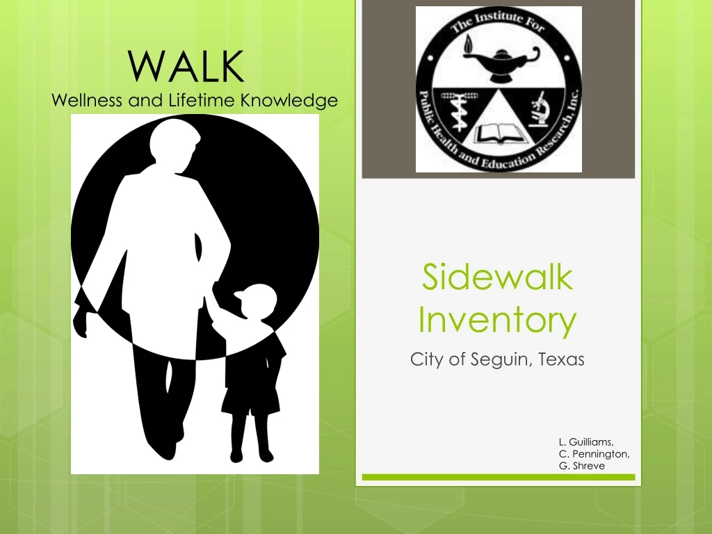
WALK Wellness and Lifetime Knowledge Sidewalk Inventory City of Seguin, Texas L. Guilliams, C. Pennington, G. Shreve
WALK • Catie Pennington • Project Manager/GIS Analyst • Geoff Shreve • GIS Analyst • Leslie Guilliams • GIS Analyst
Introduction • TIPHER’s mission is to improve the quality of life by: • Reducing obesity and managing diabetes • Making Seguin more walkable • Texas Department of State Health Services Transforming Texas grant: • Implement changes aligning with Healthy People 2020 focus areas • Supporting implementation of interventions to prevent heart attacks, strokes, cancer, and other leading causes of death or disability • WALK will be working for TIPHER, to create a map, with detailed information on all sidewalks in Seguin
Summary • Over the next five years, TIPHER is seeking to reduce the rate of obesity through nutrition and physical activity interventions by 5% • TIPHER’s goal is to create a walking program to encourage people to walk more
Purpose • WALK has been tasked by TIPHER to create a sidewalk inventory and walking maps that display routes in Seguin • The sidewalk inventory will show obstructions and specific attributes • TIPHER would like to reinforce the Safe Routes to School program • WALK will accomplish this by analyzing sidewalk connectivity
Purpose • WALK will determine sidewalk accessibility to pedestrian attractors • This will encourage people to walk more • WALK will also locate pedestrian attractors such as: • Schools • Banks • Grocery stores • Retail centers • We also need to distinguish the different types of walking surfaces
Scope • The geographic extent of our study area is Seguin, TX • Population (2010)per US Census website • Total 25,175 • Geography • 35 miles northeast of San Antonio • 22 miles south of San Marcos • 15 miles southeast of New Braunfels • Sidewalks to roads 4:100 miles (sidewalk on both sides of road)(TIPHER data layer, 2013)
Literature Review • Many other cities have developed pedestrian master plans : • College Station, TX • Austin, TX • Oakland, CA • San Francisco, CA • How other cities of done it: • Community involvement • Identify Pedestrian attractors/sources • Develop a Pedestrian friendliness index • A current study by the CDC has found that areas with high pedestrian workability index have a lower rate of childhood obesity than the national average • Develop a Walkability index • Identify Auto to Pedestrian issues
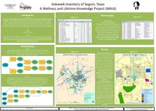
Data • The sidewalk inventory will cover the existing sidewalk network • The characteristics to be recorded for existing sidewalks include: • Width • Length • Material of the sidewalk/path • ADA compliance • Distance from curb • Obstructions • Pedestrian attractors will be located
Data • Data collection: WALK will gather the information needed • A survey will be attempted to bring in community opinions • Data will come from • TIPHER • Chamber of Commerce • Census data • Field work • Pre-processing data: converting collected data into a compatible format and preparing it for analysis • Data interpretation/analysis: WALK will study the area and make recommendations of where to build/repair sidewalks
Methodology • We will do the following: • Import the Chamber of Commerce (CoC) data set • The CoC data will be used to create routes to and from pedestrian attractors/sources • Verify/Expand the current data set provided by TIPHER • Create a current sidewalk inventory with attributes (as stated in Data section) • The Census data will be used to identify population densities to help rank neighborhoods • TIPHER will be assisting us in collecting pedestrian survey info to be used for identifying areas of high pedestrian traffic • Field work will help to accomplish these goals by looking into the various areas within Seguin
Implications • We will develop a strong foundation for a pedestrian master plan • This will encourage people to get out and walk more • Develop a stronger sense of community • Maintain a well-developed pedestrian network
Timetable • February 24th- March 23th Data Collection • March 10th- March 30th Pre-processing Data • March 31st- April 13th Data Analysis • April 14th- April 20th Data Interpretation
Final Deliverables • On Friday, May 3rd the following will be delivered: • A website • A final report of our processes and findings • A thumb drive containing • All data • All metadata • All reports (proposal, progress, and final) • All PowerPoint presentations
Conclusions • TIPHER and WALK are dedicated to improving Seguin’s health and well-being • WALK is assisting TIPHER by creating a sidewalk inventory • This will help improve the walkability of Seguin and encourage people to walk more in an effort to reduce diabetes and obesity