Download
1 / 24
240 likes | 505 Views
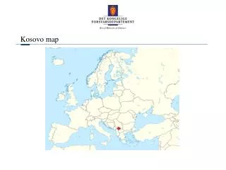
MOST COMMON STATE MAP PROJECTIONS FOR THE REPUBLIC OF KOSOVO. Prof.Dr.sc. Bashkim IDRIZI. 15-19 November 2009, Santiago - CHILE. Contents of presentation:. Location and dimensions of the Republic of Kosovo Parameters of former and new state coordinate systems of the Republic of Kosovo

E N D
MOST COMMON STATE MAP PROJECTIONS FOR THE REPUBLIC OF KOSOVO Prof.Dr.sc. Bashkim IDRIZI 15-19 November 2009, Santiago - CHILE
Contents of presentation: Location and dimensions of the Republic of Kosovo Parameters of former and new state coordinate systems of the Republic of Kosovo Most common state map projections related to the form of territory Test model for testing of map projections in the area of the Republic of Kosovo Criteria‘s for analyzing of map projections Researching methodology Utilized map projections Projecting of territory of the Republic of Kosovo in Gauss-Krűger projection with several scale factors Projecting of territory of the Republic of Kosovo in Lambert conform conic projection with several scale factors Projecting of territory of the Republic of Kosovo in stereographic projection with several scale factors Projecting of territory of the Republic of Kosovo in UTM projection Conclusions
Parameters of former and new state coordinate systems of the Republic of Kosovo
Most common state map projections related to the form of territory - Gauss-Krüger projection - for countries lengthened along the meridians, - Lambert conform conic projection - for countries lengthened along the parallels, - Stereographic projection - for countries with the form nearness to circle, and - Mercator projection - for the countries along the equator.
Test model for testing of map projections in the area of the Republic of Kosovo • 108 points grid, • 10km distance between points, • defined in ETRS89-GRS80.
Criteria‘s for analyzing of map projections Basic criteria’s for choosing of the most common state map projection: • the value of the largest linear deformation (main criteria), • right dispersion of the linear deformations, and • adopting of the mathematical module for geodetic calculations; Extended criteria’s for choosing of the most common state map projection: • the value of mean linear deformations, • sum of squares of linear deformations, • mean value of linear deformations in 1km length, and • the percent coverage with defined deformation.
Researching methodology • Analyzing of tangential variant. • Analyzing of secant option with value of negative linear deformation equal to half of largest from the tangential variant • Analyzing of secant option with value of negative linear deformation equal to average of extreme points from the tangential variant
Utilized map projections • Gauss-Krűger projection (because of lengthened along the meridians) • Stereographic projection (because of the form nearness to circle) • Lambert conform conic projection (because of lengthened along the parallels) • UTM (because of its international importance). Geographic and orthogonal coordinates (false easting and northing) of central point in all variants of Stereographic and Lambert conform conic projections
Projecting of Kosovo in Gauss-Krűger projection • Gauss-Krűger within the KosovaREF 01 (scale factor 0.9999; -10cm/km) • Gauss-Krűger in tangential variant • Gauss-Krűger with secant cylinder (scale factor 0.99996; -4cm/km) • Gauss-Krűger with secant cylinder (scale factor 0.999967; -3.3cm/km)
KosovaREF 01 (Gauss-Krűger - 0.9999) Gauss-Krűger – 1.0000
Gauss-Krűger – 0.99996 Gauss-Krűger – 0.999967
Projecting of Kosovo in Lambert conform conic projection • Lambert conform conic projection in tangential variant • Lambert conform conic projection with secant cone (scale factor 0.999962; -3.8cm/km)
Lambert conform conic– 1.0000 Lambert conform conic – 0.999962
Projecting of Kosovo in Stereographic projection • Stereographic projection in tangential variant • Secant stereographic projection (scale factor 0.999979; -2.1cm/km) • Secant stereographic projection (scale factor 0.999981; -1.9cm/km)
Stereographic – 0.999979 Stereographic – 0.999981
Area and border line of Kosovo in analyzed map projections
Conclusion … based on above results, most common state map projection of the Republic of Kosovo for internal use is Stereographic projection with scale factor 0.999979, and UTM projection for international use.
THANK YOU FOR YOUR ATTENTION!!! CONTACTS: Prof.Dr. Bashkim IDRIZI, STATE UNIVERSITY OF TETOVA; Faculty of Natural Sciences and Mathematics. Address: str. Ilindenska, bb; 1200 Tetova; Macedonia. Home: str. XhonKenedi, 25-4/20; 1000 Skopje; Macedonia. Gsm: +389 75 712 998; Home: + 389 2 2612 492; Fax: + 389 44 334 222; e-mail: bashkim.idrizi@yahoo.com,bashkim.idrizi@unite.edu.mk web site: www.unite.edu.mk, www.geocities.com/hartografia/ut.html
Prof.Dr.sc. Bashkim IDRIZI MOST COMMON STATE MAP PROJECTIONS FOR THE REPUBLIC OF KOSOVO 15-19 November 2009, Santiago - CHILE