Download

1 / 54
540 likes | 758 Views
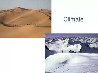
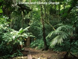
Climate. What Causes Climate?. Climate is the name for the general conditions of temperature and precipitation for an area over a long period of time. The climate of a region is determined by two basic factors: temperature and precipitation . Factors that Affect Temperature.

E N D
What Causes Climate? • Climate is the name for the general conditions of temperature and precipitation for an area over a long period of time. • The climate of a region is determined by two basic factors: • temperature and • precipitation.
Factors that Affect Temperature • Four natural factors that affect the temperature at a particular location are • latitude • elevation • albedo and cloud cover and • the presence of ocean currents
Latitude • Latitude is the measure of the distance north and south of the equator. • Latitude is measured in degrees. • Areas close to the equator, or 0 degrees latitude, receive the direct rays of the sun. These direct rays provide the most radiant energy. • Areas near the equator have a warm climate. Polar regions have a cold climate.
How Latitude effects Energy Because the globe is round, the sun’s incoming energy is more concentrated on some portions of the earth than in others. Lower latitudes, near the earth’s equator, receive a greater concentration of incoming energy than higher latitudes. This is because at higher latitudes, the same amount of incoming energy is spread over a larger area of the earth than at lower latitudes.
Elevation • Elevation, or altitude, is the distance above sea level. • As elevation increases, the air becomes less dense. This means there are fewer gas molecules in the air and they are spread far apart. • Less- dense air cannot hold as much heat as denser air. So as elevation increases, temperature decreases.
Albedo and Cloud Cover • Energy from the sun is returned to space from earth in two ways: reflection and radiation. About 30% of the solar energy that reaches the edge of Earth’s atmosphere is reflected back to space. • Albedo is the fraction of radiation that is reflected by a surface; the albedo of an object is dependent on its color; fresh snow is a good reflector of sunlight and has high albedo; asphalt absorbs sunlight and therefore has low albedo.
More on Albedo • The classic example of albedo effect is the snow-temperature feedback. If a snow-covered area warms and the snow melts, the albedo decreases, more sunlight is absorbed, and the temperature tends to increase. The converse is true: if snow forms, a cooling cycle happens. • The intensity of the albedo effect depends on the size of the change in albedo and the amount of insolation; for this reason it can be potentially very large in the tropics.
Cloud Cover • The amount of cloud cover influences temperature on earth. Clouds have a high albedo and reflect a lot of sunlight sending it back towards space. At night, clouds have the opposite effect. They act as a blanker absorbing outgoing terrestrial radiation. • The amount of albedo from clouds depends on the type of clouds and their location in the troposphere.
Location • The surface temperature of water affects the temperature of the water above it. • Warm water warms the air and cold water tends to cool it. • Land areas near warm water currents have warm temperatures. • The Gulf Stream is an ocean current that carries warm water along the eastern coast of the United States. The California Current travels toward the equator carrying cold water along the west coast of the United States.
Factors that Affect Precipitation • The two factors that affect the amount of precipitation at a particular location are • prevailing winds • mountain ranges.
Prevailing Winds • A wind that blows more often from one direction that from any other direction is called a prevailing wind. • Prevailing winds have a great influence on the climate of regions in their path. Different prevailing winds carry different amounts of moisture. • The amount of moisture carried by a prevailing wind affects the amount of precipitation a region receives. • Winds formed by rising warm air tend to bring precipitation.
Direction of Prevailing Winds • The direction from which a prevailing wind blows also affects the amount of moisture it carries. Some prevailing winds blow from the water to the land (sea breeze).
Desert • A region that receives less than 25 centimeters of rainfall a year is called a desert. The combined effect of a prevailing wind’s moisture content and its direction can make it possible for a desert to exist near a large body of water. • The Sahara Desert is bordered on the west by the Atlantic Ocean. The prevailing winds that blow across the Sahara originate far inland, carry little moisture and are caused by sinking cold air.
Mountain Ranges • The amount of precipitation at a particular location is also affected by mountain ranges. A mountain range acts as a barrier to prevailing winds. • The windward side of a mountain has a wet climate. On the leeward side, relatively dry air moves down the side of the mountain and results in very little precipitation. • A good example is the Great Basin on the leeward side of the Sierra Nevada Mountain Range.
Climate Zones • The Earth’s climate can be divided into general climate zones according to average temperatures. Scientist classify localized climates as microclimates. The three major climate zones on the Earth are • Polar zones • temperate zones • tropical zones
Polar Zones • In each hemisphere, the polar zone extends from the pole to about 60 degrees latitude. • In polar zones, the average yearly temperature is below freezing. • There are some areas in the polar zones, such as the northern coasts of Canada and Alaska and the southern tip of South America, where the snow melts during the warmest part of the year.
Temperate Zones • In each hemisphere, the temperate zone is found between 60 degrees and 30 degrees latitude. • In the areas of the temperate zones farther from the equator, snow is common in the winter. • In the areas of the temperate zones closer to the equator, rain normally falls all year round. • The average amount of precipitation is about the same throughout. • The average temperatures range from 5 C to 20 C.
Deserts in the Temperate Zone • Deserts in the temperate zones are usually located • In-land, far away from the oceans. • The winds that blow across these inland deserts carry little moisture. • Although very hot during the day, temperatures at night can drop to below freezing. Inland deserts are found in Australia (the Great Sandy Desert) and Central Asia ( the Gobi Desert).
Cold Deserts • A cold desert climate is typically found in temperate zones, almost always in the rain shadow of high mountains which restrict precipitation from the westerly winds, or in the case of Central Asia, from the monsoon. • The Gobi desert in Mongolia is a classic example of a region with a cold desert climate. Though hot in summer, it shares the very cold winters of the rest of Central Asia. • Cold desert climates can feature hot (sometimes exceptionally hot) and dry summers, though summers typically are not quite as hot as summers in hot desert climates. • Unlike hot desert climates, cold desert climates usually feature cold, sometimes brutally cold, dry winters with temperatures far below the freezing point. • Cold deserts are typically found at higher altitudes than hot desert climates, and are usually drier than hot desert climates.
Tropical Zones • The tropical zones, which extend from 30 degrees north and south latitude to the equator, have high temperatures and high humidity. • Tropical zones are also known as low-latitude climates. The average temperature during the coldest month of the year does not fall below 18 degrees C. • Many deserts are located on the western coasts of the continents. This is because the prevailing winds, the trades, blow from east to west.
Marine and Continental Climates • Within each of the three major climate zones, there are marine and continental climates. • Areas near an ocean or other large body of water have a marine climate. Areas located within a large landmass have a continental climate. • Areas with a marine climate receive more precipitation and have a more moderate climate. • A continental climate has less precipitation and a greater range in climate.
Changes in Climate • The three natural factors responsible for climate changes are • the slow drifting of the continents, • changes in the sun’s energy output and • variations in the position of the Earth relative to the sun. • These natural factors are not related to human activity. The results of the human activity of the burning of fossil fuels may also lead to changes in climate.
Ice Ages • Periods when much of the Earth’s surface has been covered with enormous sheets of ice are called ice ages or major glaciations. • Scientists have found evidence of four major ice ages during the last 2 million years each lasting about 100,000 years. • The average temperature was 10 to 15 degrees C. • The causes are not known but they are probably associated with variations in the tilt of the Earth’s axis and the shape of the Earth’s orbit around the sun.
Interglacials • Interglacials are the time periods between major glaciations. Interglacials are warm periods. During an interglacial, the average temperature was about 4 to 6 degrees higher than the average temperature during a major glaciation. A cold period called the Little Ice Age lasted from 1500 to 1900.
Drifting Continents • About 230 million years ago, all the Earth’s landmasses were joined in one super continent, Pangaea. The slow drifting apart of the continents caused dramatic changes. As the continents moved toward their present-day locations, the sea level dropped, volcanoes erupted, and much of the Earth’s surface was pushed upward. The combined effect was a drop in temperature and precipitation all over the Earth. These changes were gradual.
Extinction of the Dinosaurs • The climate change caused by the drifting of the continents may have resulted in the extinction of the dinosaur. Many types of plants also became extinct. Dinosaurs that depended on these plants died. Meat-eating dinosaurs that depended on plant-eating dinosaurs died. Other scientists believe that dinosaurs became extinct as the result of a giant asteroid striking the Earth 65 million years ago.