Download
1 / 30
300 likes | 482 Views
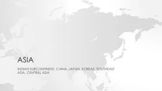
ASIA. Location (Physical Features & Countries) FSMS Standard SS7G9.a Days 1-3. ASIA GEOGRAPHIC UNDERSTANDINGS. SS7G9 – The student will locate selected features in Southern and Eastern Asia.

E N D
ASIA Location (Physical Features & Countries) FSMS Standard SS7G9.a Days 1-3
ASIAGEOGRAPHIC UNDERSTANDINGS • SS7G9 – The student will locate selected features in Southern and Eastern Asia. a. Locate on a world and regional political-physical map: Ganges River, Huang He (Yellow River), Indus River, Mekong River, Yangtze (Chang Jiang) River, Bay of Bengal, Indian Ocean, Sea of Japan, South China Sea, Yellow Sea, Gobi Desert, Taklimakan Desert, Himalayan Mountains, and Korean Peninsula
FIRST FIVE Agenda Message: Be sure to save your notes, E. Q.’s and maps on SWA for CRCT Reviews in the spring. Today we start our study of Southern and Eastern Asia. E.Q.Thursday, 11/10/11: What is the Relative Location of Southern & Eastern Asia? Standard: Locate selected features in Southern & Eastern Asia including rivers, mountains, Seas, Deserts, Oceans, Bays and the Korean Peninsula. TODAY WE WILL • Introduce the map of Southern & Eastern Asia
FIRST FIVE Agenda Message: High Order Thinking Skills (HOTS) assignment is to watch CNN Black in America series; 8p Sunday; November 13th. Segment will be about Black Entrepreneurs in Silicon Valley. Write three paragraph report about the entrepreneur who impressed you the most and why. E.Q.Friday, 11/11/11: What are the names of the five rivers we will study in Southern & Eastern Asia? Standard: Same TODAY WE WILL • Continue review on map of Southern & Eastern Asia
FIRST FIVE Agenda Message: E.Q.’s from last week have been graded and will be returned today.Remember to keep E.Q.’s from week to week for study/review. E.Q.Monday, 11/14/11: What are five major geographic landforms found in Southern & Eastern Asia? Standard: Locate selected features in Southern & Eastern Asia including rivers, mountains, Seas, Deserts, Oceans, Bays and the Korean Peninsula. TODAY WE WILL: • Continue map review of Southern & Eastern Asia
FIRST FIVE Agenda Message: First Quiz on Southern and Eastern Asia will be Thursday, December 1st. Quiz will cover Physical Geography, Vocabulary, and countries of S&EA. E.Q.Tuesday, 11/15/11: What are the two deserts in Southern and Eastern Asia? In what country are they located? Standard: Physical Geography; Locate selected features in Southern & Eastern Asia including rivers, mountains, Seas, Deserts, Oceans, Bays and the Korean Peninsula. TODAY WE WILL: • Continue map review of Southern & Eastern Asia
ASIAGEOGRAPHIC UNDERSTANDINGS Southern & Eastern Asia Landforms • Himalayan Mountains (Nepal, Tibet, Pakistan, Bhutan, and southern China) • Subcontinent (India) A large landmass that is part of a continent, but is geographically separate from it. • Tibetan Plateau (southern China) The highest plateau on earth. Nicknamed, “the roof of the world”. • Korean Peninsula (North and South Korea) • Archipelagos (Indonesian Islands) A group of islands. Indonesia has the 4th largest population in the world and is made up of over 17,000 islands.
FIRST FIVE Agenda Message: First Quiz on S&EA is Thursday, December 1st. Study guides will be distributed Friday, November 18th. E.Q.Wednesday, 11/16/11: What are the names of the eight (8) countries in S&EA that we will study as part of this unit? Standard: Locate on a world and regional political-physical map the leading countries of Southern & Eastern Asia. TODAY WE WILL: • Label the seven leading countries on the map of Southern & Eastern Asia
FIRST FIVE Agenda Message: First Quiz on S&EA is Thursday, December 1st. Study guides will be distributed tomorrow, November 18th. E.Q.Thursday, 11/17/11: What is the population of China and India? Standard: Locate on a world and regional political-physical map Pakistan, India, China, Japan, Indonesia, North Korea, South Korea, and Vietnam. TODAY WE WILL: • Label the seven leading countries on the map of Southern & Eastern Asia
FIRST FIVE E.Q. Answer Thursday 11/17/11 China – 1.3 Billion Population India – 1 Billion Population World Population – 7 Billion
FIRST FIVE Agenda Message: Pop Quiz Today on S&EA Geographic and Political Features. Study guides for December 1st quiz will be distributed today. E.Q.Friday, 11/18/11: India considers the Ganges River to be sacred. What is their religion? Standard: Locate on a world and regional political-physical map Pakistan, India, China, Japan, Indonesia, North Korea, South Korea, and Vietnam. TODAY WE WILL: • Pop Quiz
FIRST FIVE E.Q. Answer Friday 11/18/11 Hindu Religion
ASIAGEOGRAPHIC UNDERSTANDINGS Relative Location Southern and Eastern Asia is located between Pakistan on the west to Japan and the Philippine Islands on the east. To the north is Russia and the southern border is the Indian Ocean, Bay of Bengal, Indonesia, Malaysia and the South China Sea.
ASIAGEOGRAPHIC UNDERSTANDINGS Absolute Location Between 50o North Latitude & 10o South Latitude Between 60o East Longitude & 155o East Longitude
ASIAGEOGRAPHIC UNDERSTANDINGS The southern and eastern parts of Asia are home to almost half of the world’s population. The geography of this large area is varied, containing some of the world’s longest rivers, highest mountain ranges and extensive deserts.
ASIAGEOGRAPHIC UNDERSTANDINGS The Indus River begins in the Himalayan Mountains of Tibet and flows almost 200 miles through the country of Pakistan before emptying into the Arabian Sea. The Indus River valley is one of the richest farming areas in this region.
ASIAGEOGRAPHIC UNDERSTANDINGS The Ganges River is India’s most important river. It begins in the Himalayan Mountains and flows southeast through India and Bangladesh before emptying into the Bay of Bengal. The water of the Ganges carries tons of rich sediment (topsoil, silt and minerals from the mountains) which is gradually spread along its path.
ASIAGEOGRAPHIC UNDERSTANDINGS This sediment enriches the farmland along it’s shores and creating a large, fertile delta at the mouth of the river. Because so many people live and work along the Ganges, the water in the river is very heavily polluted.
ASIAGEOGRAPHIC UNDERSTANDINGS The country of Bangladesh is located almost completely in the Ganges River delta. Heavy flooding in this part of the world during the monsoon season (a seasonal prevailing wind, lasting several months, bringing heavy rains) often causes great hardships for those living in this country. Further out to sea is the third largest ocean in the world, the Indian Ocean.
ASIAGEOGRAPHIC UNDERSTANDINGS The Himalayan Mountains form the southern border of China. This high ground spreads to the north to form the Tibetan Plateau. The area is sometimes called “the roof of the world” because of its high altitudes. This wide area of mountains and high plateau blocks any moisture coming from the rivers and seas to the south.
ASIAGEOGRAPHIC UNDERSTANDINGS The Himalayan Mountains form India’s northeastern border with China and Nepal. These high mountains form a barrier between India and countries to it’s north and east. The Himalayan Mountains stretch for almost 200 miles. The highest mountain in the world, Mount Everest, is part of the Himalayan Mountains and is on the border between Nepal & China.
ASIAGEOGRAPHIC UNDERSTANDINGS As the mountains begin to level off in the north, the land becomes desert. Here one finds the Taklimakan Desert and the Gobi Desert. The Taklimakan Desert is over 600 miles in length, one of the longest deserts in the world.
ASIAGEOGRAPHIC UNDERSTANDINGS To the west and in the central part of China is the Gobi Desert, which can be one of the hottest and also one of the coldest places in the world. The yellow dust blowing out of the Gobi Desert is picked up by the Huang He (Yellow River) and carried along as loess (another name for silt), giving both the river and sea a yellowish color.
ASIAGEOGRAPHIC UNDERSTANDINGS Loess, or silt, is deposited along the river’s path, creating fertile soil for the farmers in the area. Most of China’s fertile farming areas lay north and east of this great desert region.
ASIAGEOGRAPHIC UNDERSTANDINGS The Yellow River, begins in the mountainous Tibetan Plateau. It flows toward the east and empties into the Yellow Sea.
ASIAGEOGRAPHIC UNDERSTANDINGS This river is also used for transporting people and goods, though sometimes annual floods make conditions along the river’s path dangerous. The frequent flooding has led some to call the Yellow River “China’s Sorrow.” The Yangtze River also begins in the Tibetan Plateau. This river travels east until it reaches the East China Sea.
ASIAGEOGRAPHIC UNDERSTANDINGS Shanghai, one of China’s most important ports, is located at the mouth of this river. The Yangtze River is China’s longest river stretching for over 3,400 miles. It goes through fertile farming land and is one of China’s main transportation routes.
ASIAGEOGRAPHIC UNDERSTANDINGS The Yangtze River and Huang He River are connected by the Grand Canal, one of the world’s oldest and longest canal systems. The oldest part of the canal was built 2,000 years ago. The Mekong River begins in the Tibetan Plateau. This river runs south from China through Myanmar, Thailand, Laos, Cambodia and finally Vietnam, where it empties into the South China Sea.
ASIAGEOGRAPHIC UNDERSTANDINGS The Mekong River delta has some of the richest farming land in the world. The Korean Peninsula is a mountainous peninsula. It is attached to China and is bordered by the Yellow Sea and the Sea of Japan. Over half of the peninsula is made up of mountains. Even though so much of the country is mountainous, there is still plenty of rich farmland.
ASIAGEOGRAPHIC UNDERSTANDINGS Since the end of World War II Korea has been divided into two different countries, North Korea and South Korea. The Sea of Japan is a small sea bound by Russia to the north, the Korean Peninsula to the west and Japan to the east. END OF SOUTHERN & EASTERN ASIA PHYSICAL GEOGRAPHIC FEATURES