Download
1 / 49
500 likes | 716 Views
Chapter 19: Shorelines and Shoreline Processes. SHORELINES and Shoreline Processes Shoreline-area of land in contact with sea or lake , stretching from low tide to highest elevation effected by storm waves -shoreline processes are restricted to a narrow zone along the shore at any

E N D
Chapter 19: Shorelines and Shoreline Processes SHORELINES and Shoreline Processes Shoreline-area of land in contact with sea or lake, stretching from low tide to highest elevation effected by storm waves -shoreline processes are restricted to a narrow zone along the shore at any particular time -recall that shorelines move landward/seaward through time in response to: 1. sea level changes, 2. subsidence or 3. tectonic uplift 1. Tides: surface of ocean rises and falls twice daily in response to gravitational attraction between Moon and Sun -flood tide: higher tides which cover portion of shoreline -ebb tide: lower tides when tide is withdrawing spring tides: high tides around equatorial region of Earth-Moon and Sun are aligned neap tides: high tides around polar regions; Sun along equator, Moon aligned with Pole
Tides are caused by gravitational pull of moon. Spring and neap tides shown; diurnal… Fig. 19-3, p.564
Low tide and high tide in Turnagain Arm, Cook Inlet Alaska. Tidal range is 10m!! Fig. 19-2a, p.563
Energy from the oceans-in regions with strong tidal surge. High tide and ebb tide….twice a day… p.566
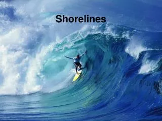
2. Waves: oscillations of a water surface Crest-highest point of wave trough-lowest point of wave wavelength- distance between successive wave crests or troughs wave height-vertical distance from trough to crest wave period- time for 2 successive wave crests or trough to pass any point: wave generation: generated by several different processes.... 1. most are generated by wind blowing across surface of ocean the longer wind blows, the higher the waves generated. the distance the wind blows over a body of water-known as fetch-is the determining factor for wave height 2. other causes, but relatively minor are- submarine landslides, faulting, volcanic eruptions A. Shallow water waves and breakers -deep water swells, the water surface oscillates and water particles move in elliptical paths, with little lateral net water movement -but as deep water swells encounter shallow water they transform from broad, shallow waves to sharp crested waves. this begins where the waves begin to 'feel' or intersect the sea floor- called wave base. -as waves enter ever shallower water they become oversteepened-the wave crest advances faster than the wave form, until crest plunges forward as a breaker
2 m high waves at Jenner, CA Fig. 19-5b, p.568
Plunging breaker in Hawaii Fig. 19-6a, p.569
Spilling breaker…. Fig. 19-6b, p.569
Waves in this lake have wavelength of 2m, so infer that wave base is 1m deep. Fig. 19-5a, p.568
B. Nearshore currents and sediment transport 1. nearshore zone: upper limit of shoreline to point offshore where waves begin to break a. breaker zone-where waves start to break to where they do break b. surf zone- where breaking waves rush onshore, followed by seaward movement of water as backwash c. width of zone depends upon wavelength of waves 2. Wave refraction and longshore currents -waves rarely encounter shorelines parallel to shore, they usually encounter shorelines at an angle -as a wave moves toward shore the landward edge will encounter wave base first, with the remainder of wave following after it...this results in waves bent along shoreline-we refer to this as wave refraction this results in net water transport along the shoreline- referred to as longshore current. this direction is in the same direction as waves longshore currents are important because they transport and deposit large volumes of sediment in the nearshore region Rip currents- narrow surface currents that flow out to sea through the breaker zone. wave heights are generally lower over rip currents-which means they occur over bathymetric highs (shallow water)
Wave refraction along coast-waves refract as enter shallow water. Waves generate longshore transport of sand from upper left to right. Fig. 19-7, p.570
Rip currents fed by currents moving parallel to shore. Rip currents carry suspended material seaward. Fig. 19-8, p.571
B. Deposition along shorelines depositional features along shorelines: beaches, spits, baymouth bars, tombolos, barrier islands 1.beaches-most familiar of all coastal landforms to people -a beach can include sand dunes or sea cliffs.... -most of sand on beaches is transported to the seashore by streams and redistributed along the shore by longshore currents -man made attempts to prevent shoreline erosion- a. groins- structure built perpendicular from the shoreline-trap sand on upcurrent side, beaches preserved....but erosion occurs on downcurrent side, which makes for irregular beach...doesn’t solve the problem!! black sand beaches in Hawaii-sand sized grains of weathered basalt... Seasonal changes in beaches: tides and longshore currents affect the beach extent and topography. -normally bad storms have negative impact on beach-removing large amount of sand. typically these storms occur during the winter so that a beach typically loses sand during winter storms, but is rebuilt by summer storms
Seasonal changes in beach profiles. ‘c’ was taken 2 years after ‘b’ attributed to winter erosion… Fig. 19-9, p.574
2. Spits, baymouth bars, and tombolos a. spit- continuation of a beach extending into a bay or ocean, connected to land on one end only b. baymouth bar- is a spit that has grown across mouth of bay, closing the bay -both form and grow as result of longshore currents c. tombolos- a type of spit that extends from seashore into the ocean connecting an island to seashore 3. Barrier Islands long, narrow islands composed of sand and separated from mainland by lagoon -seaward sides are smoothed by waves, landward sides are irregular. can contain dunes on landward side how formed: 1. spits that became detached from shoreline, or 2. beach ridges that are bounded by water due to subsidence
Shoreline features: a. spits and b. baymouth bar. Longshore transportation of sand results in these features…a spit that closes off a bay is a baymouth bar… Fig. 19-10, p.576
View from space of barrier island system offshore southern coast of Tx Fig. 19-12, p.578
2 models for origin of barrier islands: a-b: spit forms, is breached during a storm. c-d: beach ridge forms on land, sea level rises submerging beach ridge. Fig. 19-13, p.578
C. Erosion along Shorelines a shoreline that is largely erosional has very few beaches, those that are present are restricted to protected areas features produced by erosion- 1. Wave-cut Platforms: formed by retreat of sea cliffs landward. that retreat rate is a function of intensity of waves impinging on shoreline. wave undercutting at base of sea cliff results in upper part of cliff being susceptible to mass wasting. erosion proceeds long enough that beveled surface known as wave cut platforms develops 2. sea caves- form as waves refract around a headland, eroding from both sides 3. sea arches- form as sea caves merge 4. sea stacks- result from collapsed sea arches D. Nearshore Sediment budget gains and losses of sediment in the nearshore are the sediment 'budget' -a positive sediment budget=beaches can grow -a negative sediment budget=beaches eventually may recede beaches lose sediment by: longshore transport, offshore transport (storms), wind, deposition in submarine canyons
Wave erosion causes a sea cliff to migrate landward-leaves a gently sloping surface called a wave-cut platform. b. Sea cliffs and wave-cut platform. c. Gently sloping surface is a marine terrace. Notice the sea stacks rising above the terrace. Fig. 19-15, p.580
Erosion-wave energy concentrates on headlands. Extensive erosion of the headlands area causes retreat throught time…..straightening of shoreline.. Fig. 19-17, p.582
Nearshore sediment • Budget: • If outputs exceed inputs, • get erosion of beach. • b. If input exceeds output, • get deposition along beach, • also called accretion. • Note the numerous forces • that effect beach stability. Fig. 19-18, p.583
E. Impact of rising Sea Level on coastal areas causes of sea level rise: glaciers melting, subsidence, local tectonic effects... -as sea level rises we would expect landward migration of barrier islands-significant impact on coastal communities -people build seawalls (Galveston) to arrest barrier island movement pump sand onto beaches to replenish sand losses (Atlantic City, Miami Beach) -basically it is futile in long term to try to control nature because in the end she will always win....kinda like marriage.... F. Storm waves and coastal flooding -living in the Gulf Coast we all know that coastal flooding during hurricanes causes more damage than high winds -the hurricane surge is responsible for erosion of sand on islands, which is then transported offshore as surge retreats
Construction of seawall in Galveston, TX to protect city, began in 1902. Notice curved to deflect waves upward. Fig. 19-21, p.585
Berm built on seaward side of beach, will be destroyed in winter, needs to be rebuilt each spring…. Fig. 19-22, p.587
Erosion along sea shore-winter storms and beach erosion caused Seashore cliff to fail….undercutting Fig. 19-14b, p.578
Landward migration of barrier island- Note black lines, these are jetties built in 1930’s to protect inlet at Ocean City. Since then, Assateague Island has migrated 500m landward-jetties disrupted net southward longshore transport. Fig. 19-19, p.584
Beach at Miami Beach, Fla before After US Army Corps of Engineers beach replenishment Fig. 19-20a, p.584
Beach erosion effects: Lower rocks, colored grey, have been abraded because they are within surf zone. Upper rocks are above surf zone, so they have not been abraded. Fig. 19-14a, p.579
G. Types of Coasts 1. Depositional coast- abundance of detrital sediment and deposits such as barrier islands, wide sandy beaches, deltas: US Gulf Coast 2. Erosional coast- steep and irregular in profile, lack well-developed beaches; characterized by sea cliffs, wave cut platforms and sea stacks (W Coast of N America) 3. Submergent coast- sometimes called drowned....if sea level rises with respect to land or land subsides, coastal regions are flooded 4. Emergent coast- land has risen with respect to sea level. typically in tectonically active areas. noticeable due to exposure of old wave cut platforms which are called marine terraces when exposed.
Submergent coast: -extremely irregular with estuaries such as Chesapeake Bay. Fig. 19-23, p.588
Emergent coast: -straighter and steeper coastline. Notice several sea stacks and sea arch. Also marine terrace in background. Fig. 19-24, p.589
Barrier islands at Outer Banks of North Carolina. Notice suspended material in water column p.586a