Download
1 / 27
280 likes | 460 Views
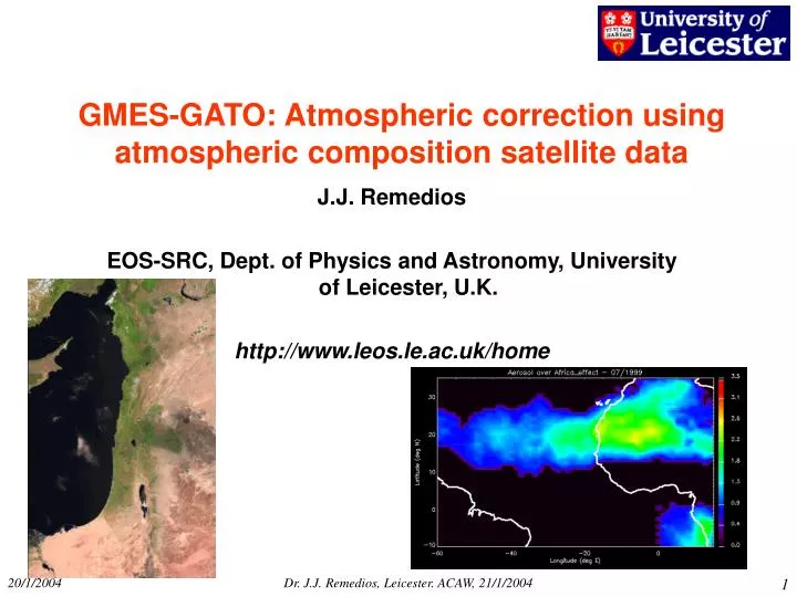
GMES-GATO: Atmospheric correction using atmospheric composition satellite data . J.J. Remedios EOS-SRC, Dept. of Physics and Astronomy, University of Leicester, U.K. http://www.leos.le.ac.uk/home. Structure. Influence of the atmosphere on surface observations Atmospheric correction

E N D
GMES-GATO: Atmospheric correction using atmospheric composition satellite data J.J. Remedios EOS-SRC, Dept. of Physics and Astronomy, University of Leicester, U.K. http://www.leos.le.ac.uk/home Dr. J.J. Remedios, Leicester. ACAW, 21/1/2004
Structure Influence of the atmosphere on surface observations • Atmospheric correction • Issues requiring surface and atmosphere information Requirements for atmospheric correction What are the technical issues? Current developments? Rational system needs (existing data/systems) What is missing (future systems)? GMES objectives Dr. J.J. Remedios, Leicester. ACAW, 21/1/2004
Atmospheric influence on Systems Observing the Earth’ s Surface I • Satellite observations of the surface must intrinsically account for the atmosphere (atmospheric correction) Atmospheric effects are present at almost all wavelengths Example of 1. is correction of phytoplankton (ocean colour) data for ozone contribution. • Atmospheric composition may also affect surface properties and also the reverse • Direct e.g., chemical action, deposition, emitted flux of gases. • Indirect, e.g., control of surface temperature or photosynthetic radiation. User requirements include combined surface and atmosphere datasets, e.g., forestation and carbon dioxide, vegetation and water vapour, U/V radiation. Example of 2. is dependence of phytoplankton concentrations on U/V radiation (and hence ozone) Concentrate on 1 here: atmospheric correction Dr. J.J. Remedios, Leicester. ACAW, 21/1/2004
SOURCES OF RADIATION AT THE TOP OF THE ATMOSPHERE; RADIATION BALANCE Dr. J.J. Remedios, Leicester. ACAW, 21/1/2004
ATMOSPHERIC GASES AND THE SOLAR SPECTRUM Dr. J.J. Remedios, Leicester. ACAW, 21/1/2004
Infra-red emission spectrum to space[Nadir signal for an i/r instrument Wavenumber = 1/ l but in cm-1. Ref. pt. 10 mm = 1000 cm-1 12 mm window 8 mm window N2O, CH4 CO2 H2O O3 20 mm 4 mm 5 mm 10 mm Dr. J.J. Remedios, Leicester. ACAW, 21/1/2004
I/R EMISSION SPECTRA Sahara Mediterranean Antarctic Dr. J.J. Remedios, Leicester. ACAW, 21/1/2004
Atmosphere influence on surface systems II Policy issues in this area arise from two sources: • Requirements for atmospheric correction to surface data • Requirements for atmosphere data relevant to interpretation of surface measurements. [cross-cutting BICEPS level] Concentrate on 1 here. User requirements for surface data can be grouped into three areas, for which a number of key issues can be identified. • Environmental hazards [GMES] • Environmental monitoring [GMES] • Commercial remote sensing Dr. J.J. Remedios, Leicester. ACAW, 21/1/2004
Volcanic Activity Dr. J.J. Remedios, Leicester. ACAW, 21/1/2004
RUSSIA FIRES 2003 MOPITT CO. MAY 3-8 2003 MODIS/AQUA – FIRES/AEROSOLMAY 9 2003 Dr. J.J. Remedios, Leicester. ACAW, 21/1/2004
VEGETATION ATSR-2 IMAGE: VEGETATION DIFFERENCES AT THE BORDERS OF ISRAEL ATSR-2 IMAGE: DERIVED VEGETATION COVER (06/09/95) Dr. J.J. Remedios, Leicester. ACAW, 21/1/2004
Atmospheric correction? • Most common atmospheric factors are • Clouds (troposphere – optically thick, thin, broken) • Tropospheric Aerosols (lower 2-3 km) • Tropospheric water vapour (lower 2-3 km) • Tropospheric CO2, CH4 (near-surface) • Molecular density (ground to approximately tropopause) • Stratospheric ozone (above 15/20 km) • Stratospheric aerosols (volcanic eruption) • O4 complex • Would also include ionosphere for radio/microwave Dr. J.J. Remedios, Leicester. ACAW, 21/1/2004
1x1 Block: Increasing time • Dual SST Matchups • 30 June 2003 • Overpass ± 60 min • Key - matchups: • - within ± 0.3 K X - > ± 0.3 K • - AATSR cloud PUERTO RICO Colour indicates dual-view SST Dr. J.J. Remedios, Leicester. ACAW, 21/1/2004
ATSR2 SST (dual-nadir) vs TOMS Aerosol DUAL-NADIR ATSR-2 SST TOMS AEROSOL Dr. J.J. Remedios, Leicester. ACAW, 21/1/2004
ATSR SST-AEROSOL: 07/1999 ATSR-2 VS AVHRR TOMS AEROSOL INDEX Dr. J.J. Remedios, Leicester. ACAW, 21/1/2004
Dust Storm over Red Sea(MODIS) August 14th 2003 http://naturalhazards.nasa.gov/ Dr. J.J. Remedios, Leicester. ACAW, 21/1/2004
Box14 Red Sea Correlation=0.79 Mean SST difference versus Time TOMS Aerosol Index versus Time Dr. J.J. Remedios, Leicester. ACAW, 21/1/2004
Scatter Plot of Mean SST Difference versus Aerosol Index Over the Red Sea Pixel by Pixel Correlation=0.544 Dr. J.J. Remedios, Leicester. ACAW, 21/1/2004
TOVS versus ECMWF profiles Schroedter, M., 1997 Diplomarbeit and M. Schrodter, F. Olesen, H. Fischer, 2003 IJRS Atmospheric correction Black:clouds,water,snow Difference between LST: TOVS - ECMWF AVHRR 17.09.1992 afternoon Bias TOVS vs. ECMWF 0.82 KStdv. TOVS – ECMWF 0.82 K AVHRR 16.09.1992 afternoon Bias TOVS vs. ECMWF 0.23 KStdv. TOVS – ECMWF 0.27 K Dr. J.J. Remedios, Leicester. ACAW, 21/1/2004
Parameter λ region Typical λ Typical spatial resn. Atmospheric correction requirements Sea/land surface temperature Infra-red 11 μm, 12 μm 3.7 μm (night) 1 x 1 km2 Aerosol, water vapour (T) Surface reflectance/imagery visible 470 nm -2.2 μm (discrete channels or low spectral resn.) 30 x 30 m2 to 5 x 5 m2 Aerosol, water vapour, ozone, O4 Vegetation indices (derived from reflectance) visible 600 nm – 1 μm 1 x 1 km2 Aerosol, water vapour, ozone Ocean colour visible 400-550 nm 1 x 1 km2 Aerosol, water vapour, ozone, O4 Sea/land surface height (SH) [single channel] microwave 13.575, 5.3, 3.2 GHz <2 x 2 km2 Water vapour 0 cm (poles)-40 cm (tropics) Ocean salinity microwave 1.4 GHz 35-50 x 35-50 km2 Water vapour Table of Requirements Dr. J.J. Remedios, Leicester. ACAW, 21/1/2004
Current and future developments • Current: • Hyperspectral • Multi-angle • Dedicated channels for atmospheric correction Future: • Future instruments: potential for joint surface/atmosphere measurements (e.g., aerosols from imagers, H2O from SAR) • Role of assimilation models, e.g., ECMWF, KNMI Ozone Dr. J.J. Remedios, Leicester. ACAW, 21/1/2004
What are the technical issues? • The latest sensors often incorporate a spectral channel for determining atmospheric correction factors. • Are all the relevant atmospheric factors measured • Is vertical resolution required? • Is the information measured at the correct wavelengths – particularly aerosols? • Surface products and imagers often require a high spatial resolution ( < 5 x 5 km2 ) with specific temporal resolution. What is the ability of atmospheric GMES systems to deliver this information? Spectral vs Spatial resolution • Will atmospheric instruments measure the “correct” (relevant) types of aerosol? • What is the accuracy of assimilation and the potential for improved spatial scales? Dr. J.J. Remedios, Leicester. ACAW, 21/1/2004
Rational System Needs (European) • Communication between surface sensing and atmospheric sensing communities (network) • Research into the exploitation of independent atmospheric sensing information within surface sensors. • Establish accuracies of ECMWF/ other assimilation systems for ozone/water vapour • Research into radiative transfer systems and models of the atmosphere • Inter-instrument research on aerosol across the e/m spectrum. • Operational data processing for multi-system data, e.g. ENVISAT/Metop • Continuity in the observation of key atmospheric variables and intercalibrated datasets relevant to surface products Dr. J.J. Remedios, Leicester. ACAW, 21/1/2004
What is missing (in European systems)? • Research into the derivation of atmospheric correction information at high spatial scales. • Development of synergistic mission system concepts – formation flying • Development of assimilation systems providing atmospheric information to surface sensing communities • High spatial resolution aerosol mission to establish aerosol climatology/radiative properties [air quality] • [“Quick reaction” system for volcanic eruption into stratosphere] Dr. J.J. Remedios, Leicester. ACAW, 21/1/2004
Overall surface-atmosphere system • An integration of surface and atmosphere systems: • Observation systems • Use of atmospheric sensors in other GMES (sub-) system. • Exploitation of atmospheric information derived from other GMES systems (two-way) • High spatial resolution aerosol mission • Continuity of measurements for water vapour, ozone. • Accessible and linked databases /processing centres [*] • NRT capabilities including data assimilation [*] Dr. J.J. Remedios, Leicester. ACAW, 21/1/2004
Volcanic Activity (c) Dr. A. Richter, IFE/IUP Bremen Andreas Richter and John Burrows – IUP Bremen Dr. J.J. Remedios, Leicester. ACAW, 21/1/2004
Mt Etna Dr. J.J. Remedios, Leicester. ACAW, 21/1/2004