Download
1 / 27
270 likes | 417 Views
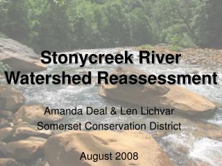
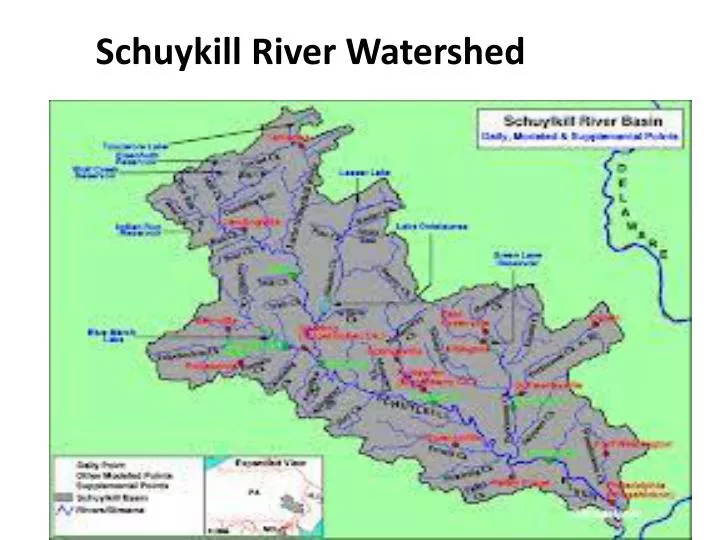
Schuykill River Watershed. http://maps.waterdata.usgs.gov/mapper/index.html http://www.schuylkillwaters.org/schuylkill_celebrateDetail.cfm?wsid=29. Watershed water movement. When water enters a watershed (by precipitation –rain or snowmelt), it will either -runoff to streams and rivers

E N D
http://maps.waterdata.usgs.gov/mapper/index.html http://www.schuylkillwaters.org/schuylkill_celebrateDetail.cfm?wsid=29
Watershed water movement When water enters a watershed (by precipitation –rain or snowmelt), it will either -runoff to streams and rivers or -infiltrate into groundwater
Importance of infiltration -water infiltrates into the soil - It continues to move vertically down through the soil profile -it is treated by the soil (cleans out impurities) -it joins with the local groundwater -enhancing the quantity of groundwater available for local use.
Factors that influence how much rainfall will runoff and how much will infiltrate into the ground: • . • 1. The topography • 2. The size of the watershed • 3. The type of land cover
Topography Definition-the features (such as mountains and rivers) in an area of land • The topography and elevation of the watershed will impact the speed in which runoff will reach the lake. The steeper the watershed land area, the faster the runoff
The size • . The greater the amount of land area in a watershed the more opportunities for runoff to reach the lake, river, or ocean via streams.
Type of land cover • .Watersheds covered in vegetation and forests provide a chance for rainfall to be absorbed by plants and filtered into the ground. • Watersheds covered in hard or impervious surfaces cause the rainfall to runoff more rapidly because there is no plant material to stop and absorb the flow of water.
Topographic Map • Shows relief using contour lines • -Relief – highs and lows of Earth’s surface • Relief can be calculated • 1. Take the difference between the highest point an the lowest. (ex. Mountain peak- 20m lake = 10 m 20m – 10m = 10m The relief of this area is 10m
Reading a topographic map-Contour Lines Contour lines -Lines on topographic maps -Connect points of equal elevation. Everything connected to that line has the same elevation Elevation – the distance something is above sea level. (sea level = 0m or 0 ft.)
Use of Topographic maps with watershed studies • Topographic maps are used to show the direction of waterflow over a watershed.
Slope direction is calculated perpendicular to the contour lines ...so the direction of flow is always perpendicular to the contour lines
Point source pollution • Water pollution that comes from a single, discrete place, typically a pipe.
Nonpoint source pollution • As water from rainfall and snowmelt flows over and through the landscape, it picks up and carries contaminants from many different sources.
What are some types of nonpoint pollution? • http://protectingwater.com/index.html
What are the affects of Increased Runoff? • Lower water depths during non-storm periods • Higher than normal water levels during wet weather periods • Increased sediment loads • Higher water temperatures • Native fish and other aquatic life are stressed by run off
What can we do to prevent Polluted Runoff? • Conserve water – inside and out • Do not fertilize your lawn before a rain storm or over-fertilize it so that the excess runs off into the streets • Take your car to a car wash where the water is treated and recycled. • Do not pour anything down your storm drain • Look for alternative forms of transportation, i.e.car pool, public transportation, bike, etc.
What can we do to prevent Polluted Runoff? • Clean up after your pets • Smart waste disposal, i.e. recycling, using proper receptacles to dispose of waste and hazardous waste, i.e. car batteries, solvents, pesticides, etc. • Become involved, join your local watershed group or volunteer monitoring organization • Get informed, learn all you can about your local watershed and about NPS pollution, with knowledge, we can make a difference