Download
1 / 41
420 likes | 548 Views
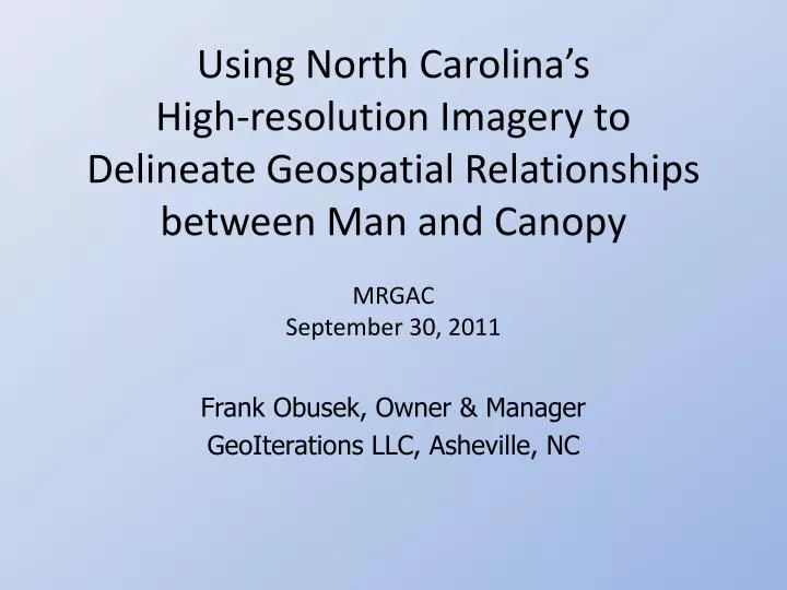
Using North Carolina’s High-resolution Imagery to Delineate Geospatial Relationships between Man and Canopy. MRGAC September 30, 2011. Frank Obusek, Owner & Manager GeoIterations LLC, Asheville, NC. Agenda. Geospatial Relationships of Man and Canopy Image Resources to map Man & Canopy

E N D
Using North Carolina’s High-resolution Imagery to Delineate Geospatial Relationships between Man and Canopy MRGAC September 30, 2011 Frank Obusek, Owner & Manager GeoIterations LLC, Asheville, NC
Agenda • Geospatial Relationships of Man and Canopy • Image Resources to map Man & Canopy • NC 2010 Statewide Ortho Imagery • NC 2010 Statewide NAIP Imagery • Mapping Man & Canopy www.GeoIterations.com
Geospatial Man • Roads • Buildings • Parking Lots • Shopping Malls • Development • Urban Sprawl • Parcels • Landuse • Impervious Surfaces www.GeoIterations.com
Geospatial Canopy • Trees • Understory • Habitat • Wildlife areas • Urban Forests www.GeoIterations.com
Relationships between Man & Canopy • Geolocation of Built and Natural Environments • Spatially integrated and coexisting • Encroachments on Canopy • Restrictions on Man • Distribution in urban environments www.GeoIterations.com
Effects of Man (development) • Degrading water quality • Reduce rain water infiltration • Reduce ground water recharge • Storm water runoff • Increased flooding • Poor air quality • Urban Heat Islands www.GeoIterations.com
Benefits of Canopy (urban forest) • Reduces temperature and saves energy • Removal of air & ground pollutants • Carbon Sequestering – Removing CO2 • Reduce Storm Water Runoff • Reduce Erosion • Protect Water Quality http://www.coloradotrees.org/benefits.htm
Benefits of Canopy (urban forest) • Extend the life of pavement • Increase traffic safety • Improve Economic Sustainability • Increase Real Estate Values • Increase Sociological Benefits http://www.coloradotrees.org/benefits.htm
Management of Man and Canopy • Attempting to balance M&C • Quantify M&C • Retain Tree Canopy during development • Manage planting efforts in urban areas • Establish green areas • Disaster Preparedness • Improve the quality of life and environment • Understand the geospatial distribution of M&C www.GeoIterations.com
Geospatial Imaging of M&C • Delineating the geospatial location and extent of man-made features using imagery • Delineating the geospatial location and extent of tree canopy using imagery www.GeoIterations.com
2010 NC Statewide Ortho-imagery • NC 911 Board awarded a grant to City of Durham’s Emergency Communications Center • Statewide leaf-off true color ortho imagery • Visible red, green, blue • 6 inch spatial resolution • GIS-Ready basemap • Available from individual counties • Available at NC OneMap Geoportal • http://data.nconemap.com/geoportal/
2010 NC Statewide NAIP Imagery • USDA National Agriculture Imagery Program • Statewide leaf-on ortho imagery • 4-band • visible red, green, blue • near-infrared (sensitive to chlorophyll) • 1 meter spatial resolution • Coverage for 2009, 2008* and 2006* • GIS-Ready basemap • Available from NC Department of Agriculture • Available at NC OneMapGeoportal • http://data.nconemap.com/geoportal/ * True Color Only
2010 Ortho Image ArcGIS Server http://imagery.nconemap.com/ArcGIS/services
2010 NAIP WMS Service http://ge-nt.ncmhtd.com/cgi-bin/naip2010ir.cgi?Layers=NAIP 2010 IR WMS&
2010 Ortho 6 Inch Resolution Eden, NC www.GeoIterations.com
2010 NAIP 1 Meter Resolution Eden, NC www.GeoIterations.com
Combining the 2010 Statewide Orthoswith the 2010 Statewide NAIP Frank Obusek, Owner & Manager GeoIterations LLC, Asheville, NCfrank.obusek@geoiterations.com
NAIP Derived NDVI Eden, NC www.GeoIterations.com
6 Inch Leaf-off Ortho without NDVI Eden, NC www.GeoIterations.com
6 Inch Leaf-off Ortho with NDVI Eden, NC www.GeoIterations.com
6 Inch Leaf-off Ortho with NDVI • 13 square miles • 33 Ortho Tiles • NAIP NDVI Eden, NC www.GeoIterations.com
NDVI Enhanced Eden, NC www.GeoIterations.com
NDVI Enhanced Iredell County, NC www.GeoIterations.com
NDVI Enhanced Cabarrus County, NC www.GeoIterations.com
Geospatial Information Extraction from NC Ortho and NAIP Imagery Frank Obusek, Owner & Manager GeoIterations LLC, Asheville, NCfrank.obusek@geoiterations.com
4-Class Landcover • Classification: • Open: Open space, developed, fields • Water: Coastal waters, lakes, ponds, large streams • Forest: Tree stands, deciduous and conifers • Shrub/Brush: Small trees and transition zones • Source Imagery • 2010 NAIP imagery with 1 meter spatial resolution www.GeoIterations.com
Landcover Cabarrus County, NC www.GeoIterations.com
Landcover Cabarrus County, NC www.GeoIterations.com
County-wide Landcover Rockingham County, NC 12 NAIP Tiles in North Rockingham County www.GeoIterations.com
County-wide Landcover Developed Deciduous Conifer Open/Fields/Grass Bare Ground Shadow Rockingham County, NC 12 NAIP Tiles in North Rockingham County www.GeoIterations.com
Leaf-Off Orthos and Parcels www.GeoIterations.com
Leaf-on NAIP and Parcels www.GeoIterations.com
Impervious Surfaces www.GeoIterations.com
Canopy & Parcels www.GeoIterations.com
Man & Canopy www.GeoIterations.com
Leaf-off Orthos Eden, NC www.GeoIterations.com
Leaf-off Orthos with Parcels www.GeoIterations.com
Leaf-off Orthos, Parcels & Impervious www.GeoIterations.com
Man and Canopy www.GeoIterations.com
Take Away Points • Statewide Image data resource • Available leaf-on/leaf-off imagery for 2010 • Great opportunity to map M&C • Understand coexisting geospatial relationships • Funding • Storm water for impervious surface data • Urban Forestry Community Grants www.GeoIterations.com
Thank you! Frank Obusek, Owner & Manager GeoIterations LLC, Asheville, NCfrank.obusek@geoiterations.com www.geoiterations.com P: 828.298.7508 M: 828.273.9187