Download

1 / 24
240 likes | 378 Views
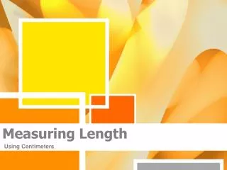
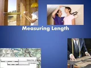
Tolowa man measuring the length of a string of dentalia. Captain John, a prominent Hupa man of the late 1800s, posing for the camera with some of his wealth around his neck. A Hupa woman in her dance dress, a fortune in dentalia around her neck.

E N D
Captain John, a prominent Hupa man of the late 1800s, posing for the camera with some of his wealth around his neck.
A Hupa woman in her dance dress, a fortune in dentalia around her neck.
Yurok men displaying the wealth of their community at a World Renewal Ceremony (Jump Dance at Pecwan).
The distinctive culture of the SW Oregon/NW California sub-area is matched by its distinctive linguistic profile. Nearly all of the tribal groups in the area spoke languages that belonged either to the Athabaskan or to the Algic language family.There were only three exceptions: in SW Oregon, some groups in the middle and upper Rogue River spoke Takelma, a language belonging to the Penutian family, while in NW California the Karuk of the middle Klamath and the Chimariko of the middle Trinity spoke languages belonging to the ancient Hokan stock.
Language families represented in the SW Ore - NW Calif area Hokan • Karuk • Chimariko Penutian • Takelma Algic • Yurok • Wiyot Athabaskan • Oregon Athabaskan • California Athabaskan
Migration from the North?Both the Algic and Athabaskan language families are centered far to the north -- the Algic languages in southern Canada, the Athabaskan languages in Alaska and the Yukon.It is thus likely that the ancestors of the Algic and Athabaskan speakers of NW California/SW Oregon migrated into this region in relatively recent times. What significance this had for the development of the region’s distinctive culture is not clear.
The Algonquian languages make up the vast majority of the Algic languages. The Algic homeland was probably in the Rocky Mountains of southeastern British Columbia, along the upper Columbia River.
The Athabaskan languages of SW Oregon and NW California appear to be at the southern end of a line of migration south from Canada around 700 AD. Navajo and Apache in the Southwest represent the end-point of a separate and later migration. The Athabaskan homeland was probably in Alaska or the Yukon, near Tlingit and Eyak, to which the family has a distant relationship.
Part Two Oregon Athabaskan Geography
From: Philip Drucker, “The Tolowa and their Southwest Oregon Kin” (UC-PAAE 36, no.4, 1937) Territory of the southwest Oregon Athabaskans and their neighbors.
From: Mollie Jackson, “Languages of Oregon”. Univ. of Oregon, Dept. of Linguistics website. “Coquille” [and adjacent Oregon Athabaskan dialects]
From: Don Macnaughtan, Lane Community College library website, Eugene. Map of ethnic distribution in southwest Oregon.
From: Victor Golla, California Indian Languages. UC Press, 2010. Oregon Athabaskanlanguages
1. South CoastSouth of Crescent City to north of Chetco River.Dense redwood forest in interior, marshy sloughs on coast south of Smith River.
2. Lower Rogue RiverPistol River to north of CapeBlanco and Sixes River, and up the Rogue River to Agness. Grassy marine terraces alongthe coast, Douglas Fir forest inthe interior.
3. Upper Coquille RiverCoquille River drainage to about 12 miles above Bandon (Coos villages downstream).
4. Upper Umpqua RiverMiddle course of the Umpqua River, centering on Roseburg.