Download
1 / 41
480 likes | 804 Views
Python and Geoprocessing. Ryan Branch, GISP, CFM GIS Analyst Melissa Williams, PE, GISP Senior Project Engineer. 2014 Ohio GIS Conference September 22 - 24, 2014 | Hyatt Regency Columbus| Columbus, Ohio. Agenda. 1 Simple Tasks. Joins, Splitting Features, Field Calculation.

E N D
Python and Geoprocessing Ryan Branch, GISP, CFM GIS Analyst Melissa Williams, PE, GISP Senior Project Engineer 2014 Ohio GIS Conference September 22 - 24, 2014 | Hyatt Regency Columbus| Columbus, Ohio
Agenda 1Simple Tasks Joins, Splitting Features, Field Calculation 2Other Tasks Iteration, ArcMap Tools, Model Builder Application 3Interfacing With Non-GIS Data Text, Excel, SQL Server, Access
Simple Tasks Joins, Splitting Features, Field Calculation 1
Table Management • Joins • arcpy.AddJoin_management(Table1, JoinF1, Table2, JoinF2, Condition) • Attributing fields • arcpy.CalculateField_management(Table, TargetField, DesiredInput, InputType)
Table Management Split by Attributes • TableSelect_analysis(Input, Output, Condition)
File Management • Path split • os.path.split (head, tail) • C:\Keep\Geodatabase.gdb\BufferPoints
File Management oneper = "[EVENT_TYP] = '1 PERCENT CHANCE'" fourper = "[EVENT_TYP] = '4 PERCENT CHANCE'" tenper = "[EVENT_TYP] = '10 PERCENT CHANCE'" twopwer = "[EVENT_TYP] = '2 PERCENT CHANCE'" pointtwoper = "[EVENT_TYP] = '0.2 PERCENT CHANCE'“ fc= r"V:\1735\temporary\users\RBranch\KegWeep\Working.gdb\FolderNetwork" for field in arcpy.da.SearchCursor(fc,("NetworkLocFull")): try: f = field[0] arcpy.TableSelect_analysis(f,os.path.split(f)[0] + r"\L_XS_Elev_1",oneper) arcpy.TableSelect_analysis(f,os.path.split(f)[0] + r"\L_XS_Elev_4",fourper) arcpy.TableSelect_analysis(f,os.path.split(f)[0] + r"\L_XS_Elev_10",tenper) arcpy.TableSelect_analysis(f,os.path.split(f)[0] + r"\L_XS_Elev_2",twopwer) arcpy.TableSelect_analysis(f,os.path.split(f)[0] + r"\L_XS_Elev_02",pointtwoper) This takes the field names within the list “field” and splits off their tail, then telling ArcMap to create a new table whose file name is that of the “field” plus “L_XS_Elev_1” when a specific attribute (namely, “EVENT_TYP”) is “1 PERCENT CHANCE”
Other Tasks Iteration, ArcMap Tools, Model Builder Application 2
Iteration • iglob • Used in conjunction with “*” placeholder • Finds all files/pathnames in a specific set • File path placeholders • “C:\temporary\Hydraulics\*\Hydraulic_Models\Spatial_Files\L_XS_Elev_1.dbf” This would find every table named “L_XS_Elev_1.dbf” within this set of folders
Iteration iglob and variable simplification tab02 = glob.iglob(r“C:\temporary\users\RBranch\KegWeep\Hydraulics\10240001\Hydraulic_Data\*\Hydraulic_Models\Spatial_Files\fema_2012_07_27.mdb\L_XS_Elev_02") tab1 = glob.iglob(r“C:\temporary\users\RBranch\KegWeep\Hydraulics\10240001\Hydraulic_Data\*\Hydraulic_Models\Spatial_Files\fema_2012_07_27.mdb\L_XS_Elev_1") for ret1 in tab02: dir = r"C:\Temp\GridWork\KegWeepingData\XS_Combined.gdb\XS_Combined" arcpy.AddJoin_management(ret1, dir)
ArcMap Tools Creating TINs # Process: Create TIN arcpy.CreateTin_3d(TIN_Name, Coordinate_System, Input_Data, "DELAUNAY")
ArcMap Tools Creating TINs
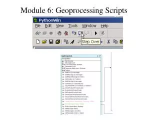
Model Builder • Code exports • ArcMap can export a tool or model as a .py
# Local variables: Ras03Min = Ground_elevation_raster Ras04SNul = Ras03Min Ras05Int = Ras04SNul Ras06Poly = Ras05Int Ras07Dislv = Ras06Poly Ras08Smooth = Ras07Dislv Ras08Smooth_Pnt = Ras07Dislv Ras01Ras = Raster_sampling_size__units_according_to_coord_system_ Ras02Extct = Ras01Ras Output_File_GDB = OutputLocation TIN = Output_File_GDB # Process: Create File GDB arcpy.CreateFileGDB_management(OutputLocation, "%OutputDatabaseName%", "10.0") # Process: Create TIN arcpy.CreateTin_3d(TIN, Coordinate_System, Backwater_polygon__use_Hard_Replace_option_, "DELAUNAY") # Process: TIN to Raster arcpy.TinRaster_3d(TIN, Ras01Ras, "FLOAT", "LINEAR", Raster_sampling_size__units_according_to_coord_system_, "1")
Interfacing With Non-GIS Data Text, Excel, SQL Server, Access 3
Text Files • Open/create a text file • textFile= open(‘C:\\example.txt', 'r') • Options when opening files:
Text Files • Read an existing text file • Read whole file at once: • textContent = textFile.read() • Read all the lines and return a list: • textList = textFile.readlines() • Read a single line at a time: • textLine= textFile.readline() • Create loop to look through each line: • for eachLine in textFile:
Text Files • Write to a text file • Use write function, \n for new line • textFile.write(“hello world\n”) • Save/close text file • Use whenever done reading or writing • textFile.close()
Text Files • Example:
Excel • Connect to Excel • XlsxWriter(https://xlsxwriter.readthedocs.org/) • - Can only write new files, not read/modify • OpenPyXL(https://pythonhosted.org/openpyxl/) • - For Excel 2007 only • EasyExcel class (http://anselmo.homeunix.net/ebooks/pythonwin32/ch09.htm) • - Only allows one Excel file open at a time
Excel • EasyExcel Class • Useful Functions:
Excel • Problems with EasyExcel • Could not have geoprocessing web service open Excel and write to file • Workaround was to write to a text file, save as CSV, then import into preset Excel template using VBA script
SQL Server/Access • Establish connection: SQL Server • Use pyodbc or other module that allows you to connect to other non-GIS databases • SQL Server must allow external connections, user with read/write permissions
SQL Server/Access • Establish connection: Access • Use pyodbc or other module that allows you to connect to other non-GIS databases
SQL Server/Access • Querying Data • Create cursor after creating connection • cursor = cnxn.cursor() • Use execute and fetch function to perform query • cursor.execute(“select user_id from users”) • rows = cursor.fetchall() • Use row objects to read data one row at a time • for row in rows: • Access data by column index or name • row[1] • row.ColumnName
SQL Server/Access • Example Query:
SQL Server/Access • Use execute to perform changes, commit to save • Insert • Update • row.user_id = newValue • cnxn.commit() • Delete • cursor.execute(“delete from products where id <> ‘test’”) • cnxn.commit()
SQL Server/Access • Problems with connections not closing in geoprocessing web service • Pyodbc module did not close connection • Solution: use pypyodbc or query layers in ArcMap
SQL Server/Access • Problems joining SQL Server table • Join field in SQL table was an integer with “Identity” property (autonumbering) = Yes • ArcGIS viewed field as an ObjectID instead of an integer • Workaround was to use query layers in ArcMap • Use advanced options to set multiple fields as the unique identifier fields
SQL Server/Access Problems joining table in SQL Server
Full Process Example • Splitting data out of a master table • Cross-sections for multiple streams each have elevation attributes in wrong format • Combining tables into properly formatted table • In order to process everything quickly, need one feature with each of 5 sets of elevations • Attach & attribute a line file with each split table • Creating TINs out of tables and cross-section layer • Use resulting datasets to create a TIN for each of 5 sets of elevations along each stream
Full Process Example Split master table (with improper field types) into 5 tables, one for each elevation set
Full Process Example Take sets of elevations from grouped tables and splitthem out to individual tables oneper = "[EVENT_TYP] = '1 PERCENT CHANCE'" fourper = "[EVENT_TYP] = '4 PERCENT CHANCE'" tenper = "[EVENT_TYP] = '10 PERCENT CHANCE'" twopwer = "[EVENT_TYP] = '2 PERCENT CHANCE'" pointtwoper = "[EVENT_TYP] = '0.2 PERCENT CHANCE'"
Full Process Example f = field[0] arcpy.TableSelect_analysis(f,os.path.split(f)[0] + r"\L_XS_Elev_1",oneper) arcpy.TableSelect_analysis(f,os.path.split(f)[0] + r"\L_XS_Elev_4",fourper) arcpy.TableSelect_analysis(f,os.path.split(f)[0] + r"\L_XS_Elev_10",tenper) arcpy.TableSelect_analysis(f,os.path.split(f)[0] + r"\L_XS_Elev_2",twopwer) arcpy.TableSelect_analysis(f,os.path.split(f)[0] + r"\L_XS_Elev_02",pointtwoper) print field[0] Export specific types of elevations into new tables
Full Process Example Split master table (with improper field types) into 5 tables, one for each elevation set oneper = "[EVENT_TYP] = '1 PERCENT CHANCE'" fourper = "[EVENT_TYP] = '4 PERCENT CHANCE'" tenper = "[EVENT_TYP] = '10 PERCENT CHANCE'" twopwer = "[EVENT_TYP] = '2 PERCENT CHANCE'" pointtwoper = "[EVENT_TYP] = '0.2 PERCENT CHANCE'" print "started" fc = r"V:\1735\temporary\users\RBranch\KegWeep\Working.gdb\FolderNetwork" for field in arcpy.da.SearchCursor(fc,("NetworkLocFull")): try: f = field[0] arcpy.TableSelect_analysis(f,os.path.split(f)[0] + r"\L_XS_Elev_1",oneper) arcpy.TableSelect_analysis(f,os.path.split(f)[0] + r"\L_XS_Elev_4",fourper) arcpy.TableSelect_analysis(f,os.path.split(f)[0] + r"\L_XS_Elev_10",tenper) arcpy.TableSelect_analysis(f,os.path.split(f)[0] + r"\L_XS_Elev_2",twopwer) arcpy.TableSelect_analysis(f,os.path.split(f)[0] + r"\L_XS_Elev_02",pointtwoper) print field[0] except: print "failed on " + str(field[0]) print "finished"
Full Process Example Find all groups of like tables (each elevation set) tab02 = r"V:\1735\temporary\users\RBranch\KegWeep\Hydraulics\10240001\Hydraulic_Data\*\Hydraulic_Models\Spatial_Files\fema_2012_07_27.mdb\L_XS_Elev_02“ tab1 = r"V:\1735\temporary\users\RBranch\KegWeep\Hydraulics\10240001\Hydraulic_Data\*\Hydraulic_Models\Spatial_Files\fema_2012_07_27.mdb\L_XS_Elev_1“ tab2 = r"V:\1735\temporary\users\RBranch\KegWeep\Hydraulics\10240001\Hydraulic_Data\*\Hydraulic_Models\Spatial_Files\fema_2012_07_27.mdb\L_XS_Elev_2“ tab4 = r"V:\1735\temporary\users\RBranch\KegWeep\Hydraulics\10240001\Hydraulic_Data\*\Hydraulic_Models\Spatial_Files\fema_2012_07_27.mdb\L_XS_Elev_4“ tab10 = r"V:\1735\temporary\users\RBranch\KegWeep\Hydraulics\10240001\Hydraulic_Data\*\Hydraulic_Models\Spatial_Files\fema_2012_07_27.mdb\L_XS_Elev_10"
Full Process Example Join to a combined cross-section feature, add one set of elevations to the feature for ret in tab02: print ret arcpy.AddJoin_management(tab02, C:\\Temp\\GridWork\\KegWeepingData\\XS_Combined.gdb\\XS_Combined) arcpy.CalculateField_management(C:\\Temp\\GridWork\\KegWeepingData\\XS_Combined.gdb\\XS_Combined, XS_Combined.El_02, L_XS_Elev_02.WSEL, "PYTHON_9.3") Repeat for each set of elevations
Full Process Example Create TINs from list of streams and from combined cross-section feature
Full Process Example With one overall TIN, it is now simple enough to create rasters and polygons in a single, coherent dataset