Download
1 / 30
300 likes | 501 Views
Extending ArcGIS using programming. David Tarboton GIS in Water Resources 22 October 2013. Why Programming. Automation of repetitive tasks (workflows) Implementation of functionality not available (programming new behavior). ArcGIS programming entry points. Model builder

E N D
Extending ArcGIS using programming David Tarboton GIS in Water Resources22 October 2013
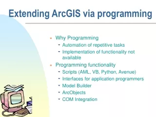
Why Programming • Automation of repetitive tasks (workflows) • Implementation of functionality not available (programming new behavior)
ArcGIS programming entry points • Model builder • Python scripting environment • ArcObjects library (for system language like C++, .Net) • Open standard data formats that anyone can use in programs (e.g. shapefiles, geoTIFF, netCDF)
Three Views of GIS Geodatabase view: Structured data sets that represent geographic information in terms of a generic GIS data model. Geovisualization view: A GIS is a set of intelligent maps and other views that shows features and feature relationships on the earth's surface. "Windows into the database" to support queries, analysis, and editing of the information. Geoprocessing view: Information transformation tools that derive new geographic data sets from existing data sets. adapted from www.esri.com
http://resources.arcgis.com/en/help/main/10.2/#/What_is_ModelBuilder/002w00000001000000/http://resources.arcgis.com/en/help/main/10.2/#/What_is_ModelBuilder/002w00000001000000/
An example – time series interpolation Soil moisture at 8 sites in field Hourly for a month ~ 720 time steps What is the spatial pattern over time Data from ManalElarab
How to use in ArcGIS • Time series in Excel imported to Object class in ArcGIS • Joined to Feature Class (one to many)
Time enabled layer with 4884 records that can be visualized using time slider
But what if you want spatial fields • Interpolate using spline or inverse distance weight at each time step • Analyze resulting rasters • 30 days – 720 hours ??? • A job for programming
The program workflow • Set up inputs • Get time extents from the time layer • Create a raster catalog (container for raster layers) • For each time step • Query and create layer with data only for that time step • Create raster using inverse distance weight • Add raster to raster catalog • Add date time field and populate with time values
I used PyScripter(as suggested by an ESRI programmer http://blogs.esri.com/esri/arcgis/2011/06/17/pyscripter-free-python-ide/) http://code.google.com/p/pyscripter/
This shows the reading of time parameters and creation of raster catalog
TauDEM • Stream and watershed delineation • Multiple flow direction flow field • Calculation of flow based derivative surfaces • MPI Parallel Implementation for speed up and large problems • Open source platform independent C++ command line executables for each function • Deployed as an ArcGIS Toolbox with python scripts that drive command line executables http://hydrology.usu.edu/taudem/
Model Builder Model to Delineate Watershed using TauDEM tools
D-Infinity Contributing Area D D8 Tarboton, D. G., (1997), "A New Method for the Determination of Flow Directions and Contributing Areas in Grid Digital Elevation Models," Water Resources Research, 33(2): 309-319.)
Generalization to Flow Algebra Replace Pki Pki Pki i by general function
Useful for a tracking contaminant or compound subject to decay or attenuation
å = + - D S T T å = + in out T min{ S T , T } = ca 2 2 T tan( b ) out in cap cap Transport limited accumulation Supply Capacity Transport Deposition S Useful for modeling erosion and sediment delivery, the spatial dependence of sediment delivery ratio and contaminant that adheres to sediment Flow Algebra provides a general modeling framework for static flow field based geospatial concepts
TauDEM Parallel Approach • MPI, distributed memory paradigm • Row oriented slices • Each process includes one buffer row on either side • Each process does not change buffer row
Parallelization of Flow Algebra 1. Dependency grid 2. Flow algebra function
Programming • C++ Command Line Executables that use MPI • ArcGIS Python Script Tools • Python validation code to provide file name defaults • Shared as ArcGIS Toolbox
Q based block of code to evaluate any “flow algebra expression” while(!que.empty()) { //Takes next node with no contributing neighbors temp = que.front(); que.pop(); i= temp.x; j = temp.y; // FLOW ALGEBRA EXPRESSION EVALUATION if(flowData->isInPartition(i,j)){ floatareares=0.; // initialize the result for(k=1; k<=8; k++) { // For each neighbor in = i+d1[k]; jn= j+d2[k];flowData->getData(in,jn, angle); p = prop(angle, (k+4)%8); if(p>0.){ if(areadinf->isNodata(in,jn))con=true; else{ areares=areares+p*areadinf->getData(in,jn,tempFloat); } } } } // Local inputs areares=areares+dx; if(con && contcheck==1) areadinf->setToNodata(i,j); else areadinf->setData(i,j,areares); // END FLOW ALGEBRA EXPRESSION EVALUATION } C++
Maintaining to do Q and partition sharing C++ while(!finished) { //Loop within partition while(!que.empty()) { .... // FLOW ALGEBRA EXPRESSION EVALUATION } // Decrement neighbor dependence of downslope cell flowData->getData(i, j, angle); for(k=1; k<=8; k++) { p = prop(angle, k); if(p>0.0) { in = i+d1[k]; jn = j+d2[k]; //Decrement the number of contributing neighbors in neighbor neighbor->addToData(in,jn,(short)-1); //Check if neighbor needs to be added to que if(flowData->isInPartition(in,jn) && neighbor->getData(in, jn, tempShort) == 0 ){ temp.x=in; temp.y=jn; que.push(temp); } } } } //Pass information across partitions areadinf->share(); neighbor->addBorders();
Python Script to Call Command Line mpiexec –n 8 pitremove –z Logan.tif –felLoganfel.tif
PitRemove Python
Summary • GIS and Water Resources analysis capabilities are readily extensible with programming • to do something new • to repeat something needed frequently • Model builder provides visual programming and helps learn ArcGIS python commands • Python – cross platform, powerful and easy to use is a good programming language to start with (when your time is valuable) • Compiled language programming for developers (C++) to achieve optimal efficiency (when the computers time is valuable)