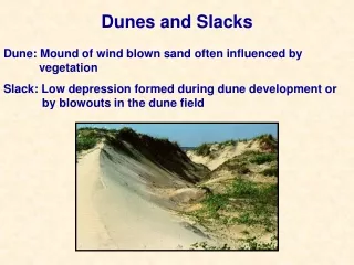
Download
1 / 22
240 likes | 766 Views
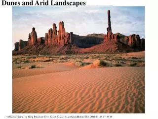
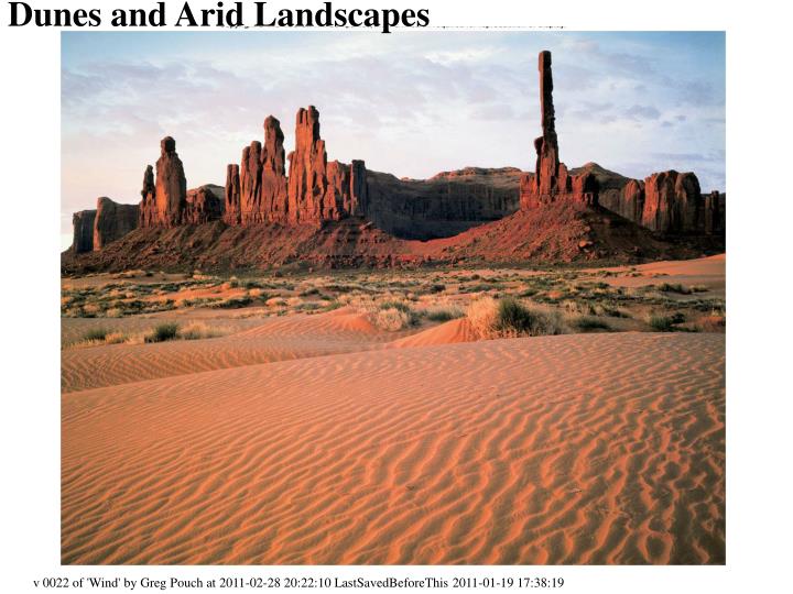
Dunes and Arid Landscapes. v 0022 of 'Wind' by Greg Pouch at 2011-02-28 20:22:10 LastSavedBeforeThis 2011-01-19 17:38:19. Dunes and Arid Landscapes. 3 Wind 4 Eolian Processes 5 Eolian Erosion 6 Eolian Deposition > Fines 7 Eolian Deposition > Sand Dune Types

E N D
Dunes and Arid Landscapes v 0022 of 'Wind' by Greg Pouch at 2011-02-28 20:22:10 LastSavedBeforeThis 2011-01-19 17:38:19
Dunes and Arid Landscapes 3 Wind 4 Eolian Processes 5 Eolian Erosion 6 Eolian Deposition > Fines 7 Eolian Deposition > Sand Dune Types 8 Dune types > Barchans, a.k.a. Crescentic dunes 9 Dune types > Longitudinal Dunes, a.k.a seifs, linear dunes 10 Dune types > Transverse Dunes 11 Dune type > Parabolic Dunes, a.k.a. blowout dunes, hairpin dunes, U-shaped dunes 12 Dune type > Star dunes 14 Deserts and Other Arid Regions 13 (Photo of)Typical Arid Landscape [NOTE REVERSAL OF ORDER IN OUTLINE] 15 Arid Landscapes Processes 16 Arid Landscapes Products 17 Typical Arid Landscape 18 Wadis 19 Plateau, Mesa, and Butte Topography 20 Fault-Block Mountains with Alluvial Fans 21 Bryce Canyon (Badlands) 22 Fajada Butte at Chaco Canyon National Park
Wind • There is not much connection between deserts and eolian features. • Wind, like water, can erode, transport, and deposit sediment. • Eolian (= wind-related processes, also spelled aeolian) processes are most noticeable • where other processes are slow (like stream processes in deserts), • where winds are high and constant and there's lots of sediment (like Indiana Dunes) or • where vegetation is minimal (wind-at-ground is high) • Eolian erosion occurs on the windward side and deposition in the leeward side or other places where wind speed drops, such as in wind shadows leeward of vegetation.
Eolian Processes Like water, wind can carry sediment in suspension or saltation, and very limited “bed load”. • Saltation: hopping motion seen in leaves in wind, sand particles in wind, sand and some gravel in water. • Fine- to very-fine-grained sand can be carried by wind by saltation. • Unlike water, normal winds tend to carry only one size of material: coarser sand is not picked up at all, and finer material is usually held together by water cohesion and inter-particle charges, but very-fine to fine sand is easily carried. As wind speed increases or decreases (up to gales, anyway), it does not start transporting larger or smaller particles, but more or fewer particles. • Wind-transported sand becomes very rounded, very well sorted, and frosted. • Air carries sand usually in only the lower 1 to 1.5 meters. • Don’t lie down on the ground to escape a sandstorm: stand up, and hold onto something, and maybe keep a bandana across your mouth and nose to keep sand out. • Suspension • Very fine particles (clay and silt) can be carried by wind in suspension for great distances. • Silt can often be easily eroded, especially when dry. Clay either gets picked up from a mixture or when it is very, very dry or when they are kicked up by something else. • Airborne silt and clay provide nucleation sites for clouds. • Bedload: At very high speeds, wind can pick up large objects, like trailers.
Eolian Erosion • Under most natural conditions, wind does not account for much erosion, even in deserts. Mainly fine particles are moved by wind (fine grained sand and smaller). • Wind erosion is a ground-level phenomenon, because it is the wind speed at the soil surface that controls the erosion. In forests, the windspeed at groundlevel is very low, in grasslands higher, and in scrublands or barren areas, it can be close to the winds-aloft. Erosion is most likely to occur in unvegetated areas like • freshly-exposed sediments [like beaches or floodplains right after a flood], • burn scars, • freshly-plowed fields (using old-fashioned plowing) or • sparsely vegetated areas (deserts, semi-arid regions, barren spots.) • In clays and silts, dryness is critical, because particles can be held together by water films or by inter-particle charges. Normally, clay tends to adhere to other particles too well to produce much sediment, although once in motion, it stays aloft a long time. • Deflation is removal of fine particles by wind. The resulting hole is a blowout. If coarser material is left behind, it can form (desert) pavement. Deflation can remove a significant amount of sand and silt. • Abrasion: scouring with particles (sand-blasting, silt-blasting…). • Wind abrasion of a rock can result in smooth, angular edges, in which case the rock is known as a ventifact. • Abrasion by wind is usually insignificant. • Water accomplishes most erosion, even in a desert.
Eolian Deposition > Fines • Clay • Clay stays aloft a long time and often deposits uniformly over an area. Eolian clay deposition might be important on land, but it does not leave distinctive deposits, so it is hard to say how significant it is. Eolian clay is a significant source of sediments in deep oceans, where there isn’t much else. • Loess (Silt) • Air-borne silt comes mainly from deserts and from dry riverbeds draining continental glaciers. At continental glaciers, the sediment is largely unweathered, finely ground rock known as rock flour (includes both clay and silt). The airborne silt deposits more in low spots than high spots and rounds/softens the topography. This airborne silt, known by the German word loess, accounts for the fertility of the US Corn Belt, as well as northern Europe and China.
Eolian Deposition >Sand • Dunes (sand) are sub-aerial ripples, and form by the same process: sediment is eroded on the upstream side, moves downstream, and deposits in the leeward, low-velocity zone; as more sediment is deposited, the slope gets too steep and the sediment slides down the slipface. (Leeward side is steep.) • The shape of the dunes is mainly influenced by winds and how constant in direction, supply of sand, and amount of vegetation. • No or sparse vegetation and One prevailing wind direction • Low sand: Barchans (horn shaped, horns on the steep (downwind) side • More sand: Transverse (perpendicular to wind) and barchanoid (think of this as a bunch of merged barchans.) Common on beaches with limited vegetation. • Vegetation common: Vegetation impedes movement of edges, and a parabolic dune, with horns facing upwind results. (Erosion in the middle of the parabola, which is a blowout.) These are common in Northern Indiana and Western Lower Michigan. • Longitudinal (also known as seif) form parallel to the wind, and seem to result from wind blowing from several closely spaced directions. (Think of them as barchans with very long horns and no middle. • Star dunes form where there are several prevailing wind directions and lots of sand
Dune types > Barchans, a.k.a. Crescentic dunes • Basic dune shape. • Erosion (and gentle slope) on upwind/windward side. • Deposition (and steep slope) on downwind/leeward side. • Horns point downwind. • Formed where winds are consistent and sand supply is limited. Often seen alone. In the photo, the wind is coming from upper left to lower right; the dune is propagating towards lower right.
Dune types > Longitudinal Dunes, a.k.a seifs, linear dunes • Dunes run along the direction of the wind. • Barchan horns of great length. • High wind, limited sand. • Usually seen in swarms. • Hard to tell they're longitudinal dunes from ground-level.
Dune types > Transverse Dunes • Transverse to wind. • Forms where there is lots of sand. • Barchans merged left to right (stretched out across wind) • Hard to tell if they're transverse dunes from ground-level.
Dune type > Parabolic Dunes, a.k.a. blowout dunes, hairpin dunes, U-shaped dunes • Center part of dune is moving, anchored at sides, so horns point upwind (away from steep side) • Forms where there's abundant vegetation
Dune type > Star dunes • Pyramid of sand with radiating ridges (multi-arm star-shaped) • Indicates three of more "prevailing" wind directions, often in monsoonal climates and near edge-effects like topographic barriers at edge of a dune area. (Several super-imposed barchans.) • From http://www.nps.gov/archive/grsa/resources/curriculum/mid/dunes/photo_files/star.htm, http://pubs.usgs.gov/gip/deserts/dunes/,
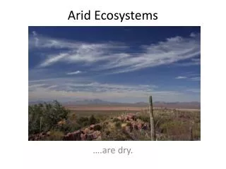
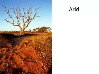
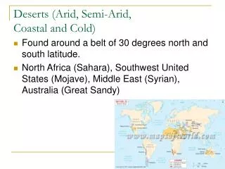
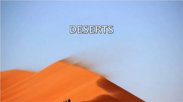
Deserts and Other Arid Regions • Deserts are dry (much more evapotranspiration than precipitation). (Book: average precip/yr<250 mm) • The same features are often found in areas with more average rainfall but with very irregular distribution, or with a climate with strong dry seasons. Deserts, like desserts, are fairly easy to recognize but hard to define. • Deserts occur • in rain shadows leeward of mountains (such as the US Southwest deserts), • where the land is far from any ocean/source-of-water (like the Gobi) or • in zones of descending air, such as the low-latitude deserts like the Sahara • where cold, dry air comes ashore, like Atacama in Chile • Steppes/prairies/savannahs are little bit more wet, and have more grassy vegetation. • Compared to more humid areas, deserts (and desertoids) have • less vegetation, especially less trees • more wind at ground level • more sporadic, torrential rainfall (a few big rains rather than lots of smaller rains) • bigger daily changes in temperature • frequent dew • more physical weathering and erosion relative to chemical weathering • soils with evaporite deposits (caliche)
Arid Landscape>Processes Most desert landscapes are dominated by stream and mass-wasting processes, not eolian. The sporadic rainfall, less water, and vegetation modify "normal" (humid) stream processes in several ways. • Weathering and Erosion • Less chemical weathering occurs: limestones form ridges/cliffs rather than valleys. Soils are thinner and show little weathering and accumulation of organic material; soils retain soluble materials and often form a cement-like layer called caliche that impedes infiltration of water, leading to higher run-off rates. • Sparse vegetation and high diurnal temperature variation cause more physical erosion. • Mass wasting • Most soil/regolith is not saturated, and so is less dense and not as well lubricated; it also lacks roots: soil creep and slumping are less important and slides and falls are more important, giving a much more angular topography in erosional zones, compared to the melted ice cream appearance of humid regions. • Streams • Streams are fewer in number than in humid areas because they have less water. • In desert landscape, a few major streams are fed by groundwater, and many streams are fed entirely by runoff and may lose water to the groundwater system. (In present U.S. SW, water table has been lowered and this is no longer true, but before extensive irrigation it was.) • Major streams are usually very close to the water table and are fed by springs as well as tributaries. • Far upland, there are “normal” gullies cutting headward and downward with steeper valley walls. • Between, there are streams with broad, flat bottoms covered with coarse sediments and steep walled valleys. Such an ephemeral stream is known as a wash, arroyo, wadi, donga, or nullah. They are usually dry and have flash floods (known as gully washers). These flash floods can result from downpours far away and are quite spectacular. Never camp or park in a wadi, and when you are in one, always be ready to run away quickly at the first sign of water, or anything that sounds like running water or thunder. • Playa Lakes Because water is rare, non-integrated drainages are more common, and thus lakes with no outlet to the sea. These only have water for a few days or weeks after a downpour, and often have evaporite deposits.
Arid Landscapes>Products • In areas of flat-lying sediments, this combination of factors gives rise to plateaus->mesas->buttes as more material is removed. • Block-fault mountain ranges can cause arid conditions, and have a somewhat unique development. • Badlands are very rare: they require mudstone with no fissility and a vertical joint set and no vegetation. • Dunes are not all that common in deserts
Ephemeral Streams Wadis Distributary, flashy streams in alluvial fans Perennial stream fed by groundwater Typical Arid Landscape
Wadis • There are streams with broad, flat bottoms covered with coarse sediments and steep walled valleys. Such an ephemeral stream is known as a wash, arroyo, wadi, donga, or nullah. They are usually dry and have flash floods (known as gully washers). These flash floods can result from downpours far away and are quite spectacular. • Never camp or park in a wadi • When in a wadi, always be ready to run away quickly at the first sign of water, or anything that sounds like running water or thunder.