Download
1 / 12
130 likes | 342 Views
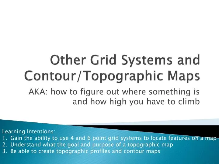
Other Grid Systems and Contour/Topographic Maps. AKA: how to figure out where something is and how high you have to climb. Learning Intentions: Gain the ability to use 4 and 6 point grid systems to locate features on a map Understand what the goal and purpose of a topographic map

E N D
Other Grid Systems and Contour/Topographic Maps AKA: how to figure out where something is and how high you have to climb Learning Intentions: Gain the ability to use 4 and 6 point grid systems to locate features on a map Understand what the goal and purpose of a topographic map Be able to create topographic profiles and contour maps
Other Grid Systems:Grid co-ordinates • When referring to the absolute location we can use a grid with co-ordinates to help us express its location precisely. • Often grids are laid out over a map to help us locate a destination or location. • Think about when you are looking up directions on a road map in the back of the book; it tells you the map page, and then a N/S grid number and a E/W grid number
Grid Systems • Knowing that grid systems are used to locate features on a map, understand that a grid is a series of lines dividing the map into squares. • We have learned about the Earth Grid system using lines of longitude and latitude • The four-figure reference system is often used for military maps, city maps, and maps of relatively local areas.
Four-figure reference system • Each square on the map is located on the map by referring to its southwest corner. Two lines cross here. • The number of the line running north-south is first. • The number of the line running east-west is written second.
What are the co-ordinates for the church? 6901 What are the co-ordinates for Grove Farm? 7099 What are the co-ordinates for Little Plumpton? 6901 - 6902
Six-Figure reference system • As we saw with Little Plumpton and the church, their four-figure locations were the same; which is not overly accurate. • To be more precise, we can use a six-figure reference system. • This system adds in dividing numbers to each larger grid square. It is like looking at your ruler, seeing the centimeters and using the millimeters to be more precise. • BUT THERE ARE NO DECIMAL PLACES!
What is the six-figure reference for the church?Still read from the South-west corner, left to right, bottom to top 696019
Class work • Complete the handout “Grid Maps four and six points” • You have 10 minutes to work on this sheet. • Partners are allowed
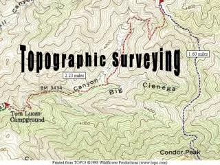
Topographic Mapping • Recall that topographic maps show the height of land formations above sea level using contour lines • Please look at handout “GeoLab 11” • Volunteer to read section 1 • Volunteer to read section 2 • Section 3: Draw in the 100m contour line • Section 4: draw in the 500m contour line • Section 5: draw in the 400, 500, 600m lines • Section 6: draw in 25, 75, 100, and 125m keep the v shape in the contour lines
Topographic profile • A topographic profile is a cross sectional view along a line drawn through a portion of a topographic map. In other words, if you could slice through a portion of the earth, pull away one half, and look at it from the side, the surface would be a topographic profile.
Topographic profile • Turn to Hand Out “Topographic Profiles” • Together we will work though (a) • Label the distance between contour intervals • Use your ruler to draw descending lines from the contour lines from the overhead view to the corresponding contour line on the profile • Draw one line attaching all points on the profile • Complete (b) and (c) on your own
Classwork: on your own • GeoLab12 • Complete questions 4 through 5 • Do Not Do Questions 1,2,3,or 6 • HOMEWORK: • Topographic Map of Vernon – to be marked next class