Download
1 / 19
190 likes | 301 Views
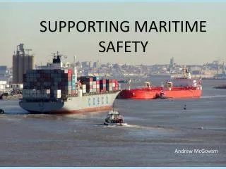
MARITIME USE OF GPS by Mahesh Alimchandani Nautical Advisor Australian Maritime Safety Authority (AMSA). AMSA. A Commonwealth Authority Maritime safety regulator Largely self funded Seven member Board Approximately 200 staff. Primary roles of AMSA.

E N D
MARITIME USE OF GPSbyMahesh Alimchandani Nautical AdvisorAustralian Maritime Safety Authority (AMSA)
AMSA A Commonwealth Authority • Maritime safety regulator • Largely self funded • Seven member Board • Approximately 200 staff
Primary roles of AMSA • Provide for high standards of maritime safety • Prevent and combat ship-sourced marine pollution • Provide infrastructure to support safe navigation in Australian waters • Provide search & rescue services to maritime & aviation sectors
GPS in Search and Rescue (SAR) • Effectiveness and efficiency of SAR operations • Accurate reporting and presentation of SAR information (target location, drift etc.) • Use in GIS • Reduces incident costs
GPS in marine pollution prevention and response Examples: • Location, tracking & mapping of oil & chemical spills at sea and ashore. • Accurate deployment of spill & vessel emergency response equipment.
GPS in marine pollution prevention and response Examples (contd.) : • Determination of jurisdictional responsibility in maritime zones. • Display of spatial data e.g. environmental resources under threat from pollution.
GPS/GIS systems employed • Hand held GPS systems (Palm top IPAQ) • Desktop Geographic Information Systems (ArcView & Arc GIS) • Development of National Oil Spill Response Atlas (GIS) • Satellite tracking of buoys (spill movement) • Airborne & satellite surveillance (investigations and enforcement)
Universal AIS - Basic Features • Automatic and autonomous transmission • exchange of information such as ship name, position, speed and course over ground • VHF maritime band - 2 designated channels • communication in broadcast mode - everybody can “see” each other • based on the’ 4S’ principle - Ship to Ship and Ship to Shore communications, using STDMA (Self Organising Time Division Multiple Access) • High capacity - over 2000 position reports/min
AIS-functional requirements • ship-to-ship mode for collision avoidance • as a means for littoral States to obtain information about a ship and its cargo • as a VTS tool (traffic management)
Navigation Tools Automatic Alarms / Warnings Navigation Record Route Planning / Checking Continuous, Automatic, RouteMonitoring EchoSounder ChartDatabase Real-time Tides GPS/Radio Navaid Weather,IceForecasts ChartUpdates Vessel’s Dimensions and Manoeuvring Characteristics AIS/ VTMS Log Speed Compass Heading Radar: - Video / ARPA 30 40 20 10 50 KTS
ECDIS • Strictly regulated (via SOLAS) • Integrated navigation display • Automatic route monitoring • Uses official electronic charts • Automatic, regular chart updates
Strategic Plan for Navigational Systems in Australian waters • SOLAS obligation • Set with a ten-year outlook • Key elements of the Plan: • Existing network to service current requirements • Develop systems to sustain future performance • Transparency to industry for levies spent
Future systems • Assessed using contemporary risk management practices • Must respond to changes in: • Shipping patterns • Technology • Community expectations
CONCLUSION • Australia’s uniqueness (small population, large coastline, heavily dependent on seaborne trade). • Australia’s on-going challenge: • enhancements in environment protection and safety standards versus the safe and efficient movement of vessels. • Continue to be innovative and seek cost – effective solutions.