Download
1 / 46
460 likes | 613 Views
The Biosphere. Chapter 49. Biogeography. The study of the distribution of organisms and the processes that underlie distribution patterns. Factors that Affect Distribution. Geologic history Topography Climate Species interactions. Biosphere.

E N D
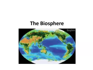
The Biosphere Chapter 49
Biogeography The study of the distribution of organisms and the processes that underlie distribution patterns
Factors that Affect Distribution • Geologic history • Topography • Climate • Species interactions
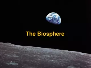
Biosphere • Sum total of the places in which organisms live • Includes portions of the hydrosphere, lithosphere, and atmosphere
Climate • Average weather condition in a region • Affected by: • amount of incoming solar radiation • prevailing winds • elevation
The Atmosphere • Three layers • Outer mesosphere • Middle stratosphere (includes ozone layer) • Inner troposphere (where air is warmed by the greenhouse effect)
Ozone Layer • Region 17 to 27 kilometers above sea level in the stratosphere • Molecules of ozone absorb most layers of ultraviolet light • Protects living organisms from excess exposure to UV light
Warming the Atmosphere • Solar energy warms the atmosphere and sets global air circulation patterns in motion Figure 49.4 Page 890
Rotation and Wind Direction • Earth rotates faster under the air at the equator than it does at the poles • Deflection east and west Figure 49.4 Page 890
Seasonal Variation • Northern end of Earth’s axis tilts toward sun in June and away in December • Difference in tilt causes differences in sunlight intensity and day length • The greater the distance from the equator, the more pronounced the seasonal changes
Ocean Currents • Upper waters move in currents that distribute nutrients and affect regional climates Figure 49.6 Page 892
Rain Shadow • Air rises on the windward side, loses moisture before passing over the mountain Figure 49.7 Page 893
Monsoons • A pattern of wind circulation that changes seasonally • Affect continents north and south of warm-water oceans • Can cause seasonal variation in rains
Coastal Breezes • Breeze blows in direction of warmer region • Direction varies with time of day Night Afternoon Figure 49.8 Page 893
Biogeographic Realms • Six areas in which plants and animals are somewhat similar • Maintain their identity because of climate and physical barriers that tend to maintain isolation between species
Biomes • Regions of land characterized by habitat conditions and community structure • Distinctive biomes prevail at certain latitudes and elevations
Hot Spots • Portions of biomes that show the greatest biodiversity • Conservationists are working to inventory and protect these regions • 24 hot spots hold more than half of all terrestrial species
Ecoregions • Large areas of globally important biomes or water provinces • Currently vulnerable to extinction • Targeted by World Wildlife Fund for special study and conservation efforts
Soil Characteristics • Amount of humus • pH • Degree of aeration • Ability to hold or drain water • Mineral content
Soil Profiles • Layer structure of soil • Soil characteristics determine what plants will grow and how well Rainforest Desert Grassland Figure 49.12 Page 896
Deserts • Less than 10 centimeters annual rainfall, high level of evaporation • Tend to occur at 30 degrees north and south and in rain shadows • One-third of land surface is arid or semiarid
Dry Shrublands and Woodlands • Semiarid regions with cooler, wet winters and hot, dry summers • Tend to occur in western or southern coastal regions between latitudes of 30 and 40 degrees
Forest Biomes Tall trees form a continuous canopy • Evergreen broadleaves in tropical latitudes • Deciduous broadleaves in most temperate latitudes • Evergreen conifers at high temperate elevations and at high latitudes
Arctic Tundra • Occurs at high latitudes • Permafrost lies beneath surface • Nutrient cycling is very slow Do not post on Internet Arctic tundra in Russia in summer Figure 49.19 Page 903
Alpine Tundra • Occurs at high elevations • No underlying permafrost • Plants are low cushions or mats as in Arctic tundra Do not post on Internet Figure 49.19 Page 903
Lakes • Bodies of standing freshwater • Eutrophic: shallow, nutrient-rich, has high primary productivity • Oligotrophic: deep, nutrient-poor, has low primary productivity Lake Zonation LITTORAL LITTORAL LIMNETIC PROFUNDAL Figure 49.21 Page 904
Thermal Layering • In temperate-zone lakes, water can form distinct layers during summer THERMOCLINE Figure 49.22 Page 904
Seasonal Overturn • In spring and fall, temperatures in the lake become more uniform • Oxygen-rich surface waters mix with deeper oxygen-poor layers • Nutrients that accumulated at bottom are brought to the surface
Eutrophication • Enrichment of a body of water with nutrients • Can occur naturally over long time span • Can be triggered by pollutants
Streams • Begin as springs or seeps • Carry nutrients downstream • Solute concentrations influenced by streambed composition and human activities Do not post on Internet Figure 49.23 Page 905
Ocean Provinces neritic zone oceanic zone intertidal zone continental shelf sunlit water "twilight" water 0 200 PELAGIC PROVINCE bathyal shelf BENTHIC PROVINCE sunless water 1,000 2,000 abyssal zone 4,000 hadal zone deep-sea trenches 11,0000 depth (meters) Figure 49.24 Page 906
Phytoplankton • Floating or weakly swimming photoautotrophs; form the base for most oceanic food webs • Ultraplankton are photosynthetic bacteria
Primary Productivity • Primary producers are usually the phytoplankton • Productivity can vary seasonally north temperate north polar tropical Figure 49.25 Page 906
Deep Ocean Food Webs • Regions too dark for photosynthesis • Marine snow supports a detrital food web • Organic matter drifts down from shallower water • Diverse species migrate up and down in water column daily
Hydrothermal Vents • Openings in ocean floor that spew mineral-rich, superheated water • Primary producers are chemoautotrophic bacteria; use sulfides as energy source Do not post on Internet Tube worms at hydrothermal vent Figure 49.26 Page 907
Mangrove Wetlands • Tropical saltwater ecosystem • Form in nutrient-rich tidal flats • Dominant plants are salt-tolerant mangroves • Florida, Southeast Asia
Estuary • Partially enclosed area where saltwater and freshwater mix • Dominated by salt-tolerant plants • Examples are Chesapeake Bay, San Francisco Bay, salt marshes of New England
Estuarine Food Webs • Primary producers are phytoplankton and salt-tolerant plants • Much primary production enters detrital food webs • Detritus feeds bacteria, nematodes, snails, crabs, fish
Intertidal Zones • Littoral zone is submerged only during highest tides of the year • Midlittoral zone is regularly submerged and exposed • Lower littoral is exposed only during lowest tides of the year
Rocky Intertidal • Grazing food webs prevail • Vertical zonation is readily apparent • Diversity is greatest in lower littoral zone Do not post on Internet Figure 49.29 Page 909
Sandy Coastlines • Vertical zonation is less obvious than along rocky shores • Detrital food webs predominate
Upwelling Upward movement of water along a coast; replaces surface waters that move away from shore Figure 49.31 Page 910
ENSO • El Nino Southern Oscillation • Climactic event that involves changes in sea surface temperature and air circulation patterns in the equatorial Pacific Ocean
Between ENSOs • Warm water and heavy rainfall move west across the Pacific • Warm moist air rises in the western Pacific causing storms • Upwelling of cool water along western coasts
During an ENSO • Trade winds weaken and warm water flows east across the Pacific • Sea surface temperatures rise • Upwelling along western coasts ceases • Heavy rainfall occurs along coasts, droughts elsewhere
Cholera Connection • Cholera outbreaks correlate with rises in sea temperature • Copepod population increases when phytoplankton increase in warming seas Do not post on Internet Copepod host of Vibrio cholerae harbors dormant stage Figure 49.34 Page 913