Download
1 / 55
580 likes | 799 Views
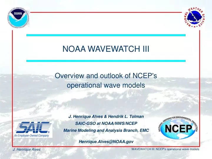
Overview and outlook of NCEP's operational wave models. NOAA WAVEWATCH III. J. Henrique Alves & Hendrik L. Tolman SAIC-GSO at NOAA/NWS/NCEP Marine Modeling and Analysis Branch, EMC Henrique.Alves@NOAA.gov. Outline. Short story of wind waves From birth to breaking, what are they?

E N D
Overview and outlook of NCEP's operational wave models NOAA WAVEWATCH III J. Henrique Alves & Hendrik L. Tolman SAIC-GSO at NOAA/NWS/NCEP Marine Modeling and Analysis Branch, EMC Henrique.Alves@NOAA.gov
Outline • Short story of wind waves • From birth to breaking, what are they? • Representing the sea-state: significant wave and the wave spectrum • Forecasting waves using numerical models • The NCEP ocean wave guidance • Performance evaluations • Recent Changes and Future directions • Maximum wave in hurricane advisories • Tutorial: NCEP operational wave products • What are they? • Grib & grab guide
Wind Waves • What are they? • Always born windseas, sometimes die as swells • How are they generated? • Wind turbulence: resonance • Pressure differences, disturbed field • Many scales are excited • From a cm to a whole km in length • As fast as a crawl, near 100mph • From a mm to 10 stories high • Multiple directions • If you’re out at sea, can’t ignore them L = 1.56 T2 C = L / T C = 1.56 T
Wind Waves • Important parameters describing one wave • Water movements associated with wind waves • Need to be described, and predicted. But how? • How many parameters to describe sea state? • 1ary: Height – Length – Period – Direction • 2ary: Speed - Steepness • Many waves at same time: impossible to have a set of descriptive parameters for each wave individually • Solution: describe sea-state with average measures for wave fields: representative wave, wave spectrum
Wind Waves • 1st approach: single representative wave (1940’s) • Most popular: Significant wave height Hs • Average height of the highest 33% of all waves. • Hs is closely what we see <= smaller waves are dwarfed against the background of larger ones • Theory, empirical data: heights follow a Rayleigh distribution. For Hs = 10m (33ft), one can expect: • 1 in 10 waves to be larger than 10.7m (36ft) • 1 in 100 waves to be larger than 15.1m (51ft) • 1 in 1000 waves to be larger than 18.6m (62ft). • Largest individual wave may be roughly 2 x Hs • Associated parameters: Tp, Tz, p, m • Rayleigh breaks down in growing and mixed seas • In mixed seas, single wave parameter means little
Wave Spectrum • Goal: represent main properties of multiple wave systems • What defines fully a wave? • L or T (dispersion relation) • Direction • Height (wave energy) • Wave spectrum bundles such information for multiple wave systems • Displays distribution of wave energy in “classes” of direction and frequency (period) • Easily represented graphically (sample spectrum at buoy 51004)
Wave Spectrum • WAVEWATCH III Output spectra • Blue: nearly no energy • Pink: maximum energy • Each contour has twice the energy of the previous • Directions show where wave is going to • Frequency range: • Center: f=0.04Hz (T=25s) • Outer: f=0.25Hz (T=4s) • Resolution: • 24 directions • 25 frequencies • 600 “waves” (components)
Wave Spectrum • Wave model spectral data • Red box: wave field traveling toward SE, with Tp~10s. Energy concentrated in f and : regular, organized wave field • Blue box: wave field travels toward SW at lower periods. But more chaotic as energy spreads over wider range in at higher f • Main fields: information in wave spectrum can be summarized • Hs = 0.7m, Tp = 6.6s • Hs = 1.4m, Tp = 15.9s • Hs = 1.4m, Tp = 7.0s • Hs = 0.3m, Tp = 9.9s • Sea state on 06/26/2000 • Buoy 51004 • Single wave scenario • Hs = 2.2m • Tp = 15.9s • Tm = 10s • p = 16o • m = 180o | 26 12 | 2.2 4 | 1.4 15.9 16 | 0.7 6.6 306 | 1.4 7.0 239 | 0.3 9.9 136 |
Wave Field Bulletin | 26 12 | 2.2 4 | 1.4 15.9 16 | 0.7 6.6 306 | 1.4 7.0 239 | 0.3 9.9 136| • Such summary, in tabular format, is the basis of bulletins provided in our web site and in AWIPS • To a forecaster, spectrum provides qualitative information • Bulletins give quantitative info on up to six largest wave fields at a given time in the fcst horizon
AWIPS : feet, dir. from http://polar.ncep.noaa.gov/waves/pres/primer Wave Field Bulletin • Sample bulletin • 1st column: date and hour • 2nd column: overall Hs and number of identified individual wave fields • Next six columns (only two shown): height, period and direction of individual wave fields
NOAA WAVEWATCH III (NWW3) Model bathymetry & coast line Full spectral wave field FCST WAVEWATCH III MODEL 10m winds, SST, Tair, [ice] • Reduced Output • local spectra • mean/integral field parameters • Model Physics • growth (wind input) • decay (whitecapping) • wave-wave interaction • Wave Propagation • great circle • refraction • dispersion
GFDL March 2004 Operational NWW3 Model Suite (NCEP Guidance) NOAA WAVEWATCH III: Version 2.22: operational since Aug. 2002 • NOAA WAVEWATCH III: Version 1.18 replaced all previous operational models at NCEP, March 2000. • NWW3: Global, 1.25x1o, 168h, 3-hourly GFS winds • WNA: W North Atlantic, 0.25x0.25o, 168h, 3h GFS winds • NAH: Hurricane version of WNA, 0.25x0.25o, 72h, 1h GFS+GFDL winds • ENP: E North Pacific, 0.25x0.25o, 168h, 3h GFS winds • NPH: Hurricane version of ENP, 0.25x0.25o, 72h, 1h GFS+GFDL winds • AKW: Alaskan Waters, 0.5x0.25o, 168h, 3h GFS winds • All models: 24 directions, 25 frequencies, 4 daily cycles (00z, 06z, 12z, 18z) with 6h hindcasts for continuity 180h 180h 180h 180h
NCEP Guidance: The Global Model Domain • Global Model Domain • March 2000
NCEP Guidance: The WNA Model Domain • Operational WNA Model Domain implemented since March 2000 • Also serving NAH Model since July 2001 • Previous ECG WAM Model Domain (Operational at NCEP till March 2000, red square)
NCEP Guidance: The ENP and AKW Model Domains • ENP Model Domain implemented June 2002 • Also serving NPH Model since Aug 2003 • AKW Model Domain implemented on March 2000
http://polar.ncep.noaa.gov/waves/validation.html NCEP Guidance: General Quality Evaluation • Validation statistics per month/season vs. buoy or satellite data. • Since February 1997 for Global model. • Since August 2000 for Regional models. • Six-month comparison with old operational global wave model (WAM). Strong points: • Good overall performance (rms errors ~10-20% of mean measured Hs). • Improved max and min storm Hs relative to previous global model (WAM). • Comprehensive coverage of areas of interest by regional models
NCEP Guidance: General Quality Evaluation (Winds) • Weak points of external forcing affecting wave models: • Wave models, only be as good as its driving forces. • For our models (deep water): Wind! • Most important problems, GFS and GFDL resolutions: • Temporal output resolution, of GFS GFDL is much coarser than internal model time step: • Interpolation smears small systems with strong winds => underestimation of extremes. • Solutions: shorter output step for surface fields • Spatial resolution in GFS and GFDL, constrained by economical considerations (more difficult): • Problems with prediction of small-scale systems (frontal system moving offshore GMex and EC). • Poor land-sea (boundary layer) transition: problem for wave growth within systems moving offshore.
NCEP Guidance: General Quality Evaluation (Winds) • Weak points of the present wave models. • Resolution: • Spectral resolution is “borderline” enough, lacking for swell dispersion • Spatial resolution could locally be better for islands (partially solved) and hurricanes when GFDL winds are available • Shelf bathymetry not well resolved nearshore: problem for propagation of waves generated offshore • Physics (secondary, fine tuning): • Slow initial growth, but good predictions of peak and waning stages of storm. • Errors in spectral shape near peak make swell front arrival gradual and slightly late (DIA + numerical).
NCEP Guidance: Why Have Special Hurricane Models? • Why do we need a special Hurricane version (NAH, NPH) of regional models (WNA, ENP). • Wave model can only be as good as the winds that drive it. • Hurricane winds are not done particularly well by the GFS due to resolution problems and due to limitations of the model physics. • Better results expected when higher resolution models are used such as the GFDL model. • Need for blended GFS/GFDL winds.
NCEP Guidance: Why Have Special Hurricane Models? AVN AVN+GDFL What got us started: Floyd and Gert Sept. 1999
NCEP Guidance: Why Have Special Hurricane Models? Debby peak wave period (s) 2000/08/23 12z ( + 36 h) AVN winds AVN + GFDL winds
NCEP Guidance: Why Have Special Hurricane Models? AVN winds AVN + GFDL winds
NCEP Guidance:NAH vs. WNA during Hurricane Isabel (2003) Isabel’s track and locations with buoy observations
NCEP Guidance:NAH vs. WNA during Hurricane Isabel (2003) 9/13/2003: Isabel is small and poorly resolved by GFS 9/17/2003: Isabel is larger and well resolved by GFS WNA and NAH hindcasts of Isabel collocated with Jason-1 data.
NCEP Guidance:NAH vs. WNA during Hurricane Isabel (2003) Hindcast at buoys near track • Maximum wave heights very well represented. • Initial swell arrivals underestimated. Swells generated when Isabel was cat. 5 hurricane (wind errors). • Do we believe last observation of 41025. Buoy in surf zone !
NCEP Guidance:NAH vs. WNA during Hurricane Isabel (2003) Hindcast at buoys south of track • For buoys at the Atlantic seaboard in shallow water, swells are overdone, most likely because shallow water processes are not well resolved yet. • Some tidal influence to be seen in data (not in model yet).
NCEP Guidance:NAH vs. WNA during Hurricane Isabel (2003) • Many features as in previous time series. • Swells from NAH systematically higher. • Highest wave heights from WNA larger due to weaker winds over larger areas • Last two points also clear in previous slides. Hindcast at buoys north of track
WNA and NAH similar WNA misses Isabel, swells NCEP Guidance:NAH vs. WNA during Hurricane Isabel (2003)
NCEP Guidance:NAH vs. WNA during Hurricane Isabel (2003) • This is an hourly animation of Isabel wave heights from hindcasts. • Note the pulsating nature of the wave height fields, which has to do with the hourly wind fields. • Possible reasons • Nature • GFDL peculiarities • Garden Sprinkler Effect for swells.
NCEP Guidance:NAH vs. WNA during Hurricane Isabel (2003) NAH forecast envelope Buoy 95% confidence interval Ranges of wave heights in 72h forecasts
12 h forecast 48 h forecast 24 h forecast nowcast Max Hs > 45 ft Max Hs > 50 ft Max Hs > 55 ft Max Hs > 50 ft NCEP Guidance:NAH vs. WNA during Hurricane Isabel (2003) Forecast wave heights very consistent and verify well against buoy and altimeter data Timing is the biggest issue in the forecast, with NAH (GFDL) being a little fast. WNA (GFS) with similar patterns, being a little slow in bringing Isabel to the shore. NAH, 18/9/2003 12:00 UTC
Maximum Hurricane Wave Height:Parametric Model for Advisory • Parametric model of Young (1988) [modified by Wu] basis of estimation of maximum Hs for TPC advisory • Relates maximum Hs and an equivalent fetch • Basis of Young’s approach: • 2G wave model data using idealized hurricane winds • Relates max(Hs) and equivalent fetch (XEQ) using JONSWAP parametric formula • XEQ is assumed a function of Vf and Umax • O(2) polynomial in Vf & Umax is fit to JONSWAP formula, given model maximum Hs, providing XEQ • Given Vf, Umax and Rmax (nonlinear scaling factor), model estimates maximum Hs • EMC: Testing sensitivity to tuning data (wave model Hs) and to assumptions behind XEQ
Effect of changing model only • Same parameterization of XEQ Maximum Hurricane Wave Height:Sensitivity of Parametric Model • New tests: WAVEWATCH III • Over 100 model runs, several Vf, Umax and Rmax • New XEQ, f(Rmax), adjusted by Vf, scaled by Umax • Scatter reduced O(100) • Highly sensitive to base wave model • New form of XEQ: higher accuracy (model independent?) • WAVEWATCH III, widely tested in real cases: better?
Recent upgrades • The following changes and of the model suite were made in the past two years: • Upgrade of blending scheme for NAH winds and upgrade time resolution of NAH wind fields to 1 hour (start of 2002 Hurricane season). • Second release of WAVEWATCH III code (Islands)... • Four cycles, eight-day forecast for all non-hurricane models. • North Pacific Hurricane (NPH) wave model. • Continuous upgrades to output points. New buoys and new requests added. West coast temporary output points removed from global model. http://polar.ncep.noaa.gov/waves/changes.html
Two eyes of hurricane at the off hour due to rapid movement of Michelle, no consistency in wave fields. Michelle with single eye at off hour, much more consistent and higher waves. Recent upgrades:Hourly Winds in Hurricane Models Michelle at 11/04/2001 15z wind speeds wave heights every 6 hours every 6 hours every 1 hour every 1 hour
Recent upgrades:Island Blocking bias without obstructions bias with obstructions Unresolved islands have been included in version 2.22 of WAVEWATCH III as obstructions in the grid. Even in the high resolution (25 km) WNA model this can have a major impact on local biases, as is shown here with model biases against the ERS-2 altimeter for the year 2001.
Recent upgrades:Data Assimilation • Data assimilation is not essential in wave modeling, due to the forced and damped nature of the problem. • There is grossly insufficient data for making a data-dominated analysis • Benefit in using data in hindcast and short term fcst shown at NCEP (WAM), as well as in other centers. • Objective: assimilate wave data into global wave model: • Buoy data from fixed platforms. • Altimeter wave data from ERS2 satellite. • Data expected in the near future: GFO and Jason-1 • Observations assimilated using variational method as in, for instance, SST analysis. • Observations provide Hs, model works with E(f,). • Model spectra adjusted for corrections in Hs by rescaling. Operational, Mar 2, 2004
Recent upgrades:Data Assimilation • Data assimilation of buoy and ERS2 data: systematically positive impact on the quality of the hindcasts and the short term wave forecast in the global NWW3 wave model. • Implementing this data assimilation scheme will put us in an excellent position to rapidly test and add other altimeter wave data source, with expected additional incremental improvement to hindcast & short term forecast
The future • The next step in expanding the functionality of WAVEWATCH III is to generate a multi-scale version of this model : • Regional models have a spatial resolution of 25km. In the next decade, we expect to be able to increase the near-coast resolution to 5-10km, using multi-scale technology • Two-way nesting of models with different scales that run simultaneously. • Moving nests follow features of interest, particularly hurricanes. • Hurricane nests plus coastal nests remove the need for running separate large regional models. • Selective application of highest resolution nests makes ensemble wave forecasting more feasible. coupling with WRF
The Future Deep ocean model resolution dictated by GFS model Higher coastal model resolution dictated by model economy Highest model resolution in areas of special intest Hurricane nests moving with storm(s) like GFDL and WRF
The future • At the moment we are not looking at adding regional models, or at increasing the spatial resolution of the existing model. Instead, the focus will be on new products: • Adding one or more steepness measures to the model output • Safety issue for (small) ships • Input from field appreciated (NCEP/OMB) • Doing separation of individual wave systems for all grid points, not just for output points. • Identify each individual swell field in space and time. Ideal for IFPS • Collabotation with Jeff Hanson (JHU). • Looking for funding • Bulletins in spreadsheets (Jeff Lorens, WR) (USACE)
The future • Further efforts have been focused on physics of the model, to improve general behavior: • Improved nonlinear interactions for more realistic directional spreading in wind seas, and crisper swell arrival. • Improve particularly dissipation to prepare for later coupling with ocean models. • Improve stress calculations and hence growth rates for extreme (hurricane) conditions. Collaboration with Univ. of Rhode Island and Univ. of Miami. • These are all long term (multi-year) projects.
Products • Mean wave parameters in GRIB format • Overall significant wave height. • Mean direction and period. • Peak direction and period. • Wind sea direction and period. • NOT AVAILABLE : mean swell height and direction (see next slides). • Text bulletins with different wave systems for output locations
Products • There is rarely just one swell field. • What is the meaning of "the" swell height and the mean swell period and direction? • Up to nine swell fields can be identified in the spectral plots on the right!
Wind seas Swell ? Products significant wave height (m)
Wind seas ? Swell ? Swell ! Products mean wave period (s) and direction
Swell ! Swell ! Products peak wave period (s) and direction
Wind seas Wind sea ! Products wind sea wave period (s) and direction