Download
1 / 2
20 likes | 116 Views
Assessment of Clallam County Shoreline Features. Michael Anderson 1 Chaeli Judd 1 Cathy Lear 2. ABSTRACT. STUDY AREA.

E N D
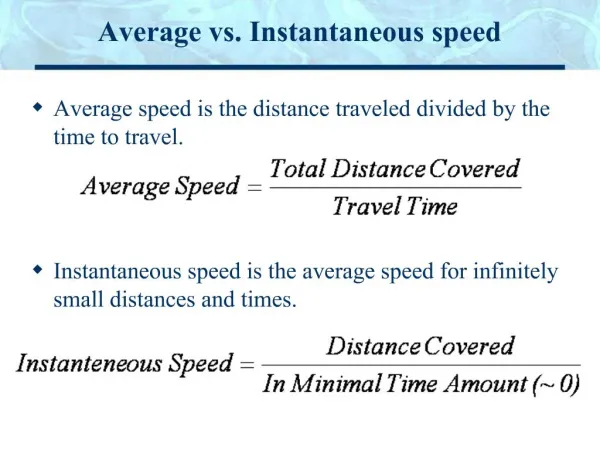
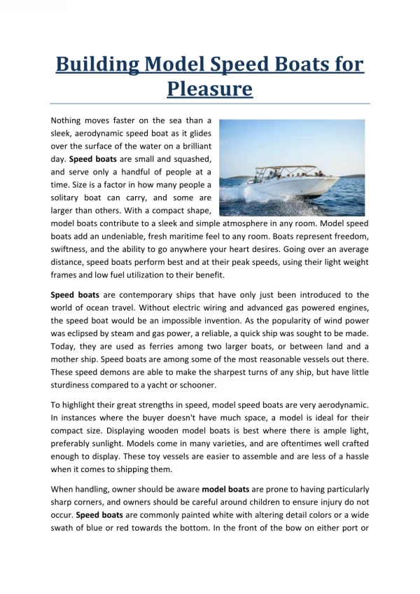
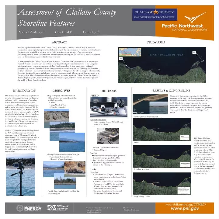
Assessment of Clallam County Shoreline Features Michael Anderson1 Chaeli Judd1 Cathy Lear2 ABSTRACT STUDY AREA The vast expanse of coastline within Clallam County, Washington, contains a diverse array of shoreline features that are ecologically important to the functioning of the adjacent marine ecosystem. Shoreline feature documentation is valuable to resource managers for assessing the current state of the environment, prioritizing potential sites for conservation, restoration or monitoring, and for establishing baseline conditions used for determining changes to the shoreline over time. A pilot project for the Clallam County Marine Resources Committee (MRC) was conducted to inventory 44 miles of shoreline from the west end of Freshwater Bay to the lighthouse at the east end of the Dungeness spit by employing a video mapping system by Red Hen Systems, Inc. A boat-based survey collected georeferenced video of shoreline features along transects that were mapped in ArcGIS using the GeoVideo software extension. This innovative nearshore assessment tool improves the value of mapped information by displaying features of interest, and allowing a user to examine recorded video anywhere along a transect or at discrete points. The information can be used to evaluate nearshore features in Clallam County for Shoreline Master Program updates, and will help planners, resource managers, and other entities that want to preserve the health of Puget Sound shorelines. INTRODUCTION OBJECTIVES RESULTS & CONCLUSIONS METHODS FIELD This project focused on the development and use of a video mapping system for the rapid collection and documentation of shoreline feature information in a spatially explicit manner that could then be incorporated into a Geographic Information System (GIS) for further analysis. Briefly, the Red Hen System consists of a video camera coupled to a GPS encoder/decoder hardware device that allows the collection of video information from a moving vessel travelling along the shoreline, the classification of features of interest, and the ultimate display and analysis of the information in a GIS system. On July 22, 2008 a boat-based survey aboard the R/V Strait Science was performed capturing a total of 6 hours and 8 min of video-footage. The video footage was used to create two products: (a) original shoreline video, clipped into segments for each shorezone unit in the study area, and (b) mapped areas and underlying GIS datasets for bluffs, shoreline armoring and large woody debris. • Map ecologically relevant aspects of Clallam County not easily identified in aerial photographs • Bluffs • Large Woody Debris • Shoreline Armoring • Example of feature mapping using the GeoVideo extension in ArcMap. The dotted yellow line represents the boat track and associated video collected in the field. The displayed image represents the picture captured from the boat at that point along the dotted yellow line. After the video was reviewed the green line was added to show the distribution of large woody debris. The Geographic Distribution of…… • System Components • Video Mapping System (VMS 300 unit) with feature trigger. • Canon Digital Video Camcorder • Standard Tripod • This data will help to identify areas that need • special attention, protection and/or restoration, and provide a baseline for future monitoring efforts. This detailed shoreline inventory may also offer clues to terrestrial processes that affect a specific area of the nearrshore. Ultimately, the results of the inventory will help to further understand our shorelines and the issues that confront today’s decision makers. Bluffs • Procedure • Ran boat approximately 100 yds. parallel to shore at an average speed of 5.3 kts. • Shot video in a 16:9 aspect ratio • Used feature trigger to record features of interest to the video tape. • Supply valuable shoreline information for: • Curent nearshore conditions • Diversity of shoreline features LAB Shoreline Armoring • Procedure • Converted tapes to digital DVD format using video converter and software (Ulead Video Studio) • Used Red Hen GeoVideo extension in ArcMap to upload DVD file (add Media Wizard. This produces a shapefile of transect and associated video) • Reviewed shapefiles and documented distribution of shoreline features. • Provide data for Clallam County Shoreline Master Program Large Woody Debris www.clallammrc.org/CCMRC/ 1Pacific Northwest National Laboratory 2Clallam County mg.anderson@pnl.gov Clear@co.clallam.wa.us chaeil.judd@pnl.gov
About the author: Mr. Michael Anderson is a research scientist with the Coastal Assessment and Restoration group at the Battelle Marine Sciences Laboratory in Sequim, Washington. His background in fisheries and marine resource management stems from his education at Oregon State University and fellowship and volunteer positions that he has held with the Environmental Protection Agency (EPA), the Pacific Northwest National Laboratory (PNNL), and the Oregon Department of Fish and Wildlife (ODFW). These opportunities have allowed him to participate in applied research in estuaries of the Pacific Northwest. His areas of expertise include ecological field surveys/evaluations, technical writing, acoustic imagery and video post-processing, development of ecological conceptual models, and designing adaptive management plans. Biographical Info