Download
1 / 73
760 likes | 996 Views
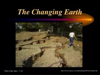
The Changing Earth. Early on, it was recognized that the layers in geological strata represent periods in the earth’s history and contain fossils of organisms characteristic of that time.

E N D
Early on, it was recognized that the layers in geological strata represent periods in the earth’s history and contain fossils of organisms characteristic of that time. Some of the fossils were widespread, and could be used to relate widely separated strata. These are called index or guide fossils. Some index fossils
Initially, fossil correlations could provide only relative estimates of ages. Initially, the earth was thought to be only a few thousand years old (based on Biblical doctrine). Alfred Russel Wallace estimate the age at some 400 million years. It took radioactive dating techniques to provide more accurate ages for rock layers. For example, the radioactive breakdown of 40K19 to the more stable 40Ca20 and the intert gas 40Ar18 occurs with a half-life of 1.31 billion years. This technique is very useful for extremely old rocks.
For slightly younger rocks, the Rubidium/Strontium method is preferred. The decay of 87Rb to 86Sr is useful for rocks older than 100 million years. For very recent material, radiocarbon dating is widely used. Carbon 14 decays to stable Carbon 12 rapidly, with a half life of approximately 5730 years. This can be used for carbon-containing materials less than 50,000 years old.
Many trees form an annual ring during the growing season. This allows the use of tree growth rings (in temperate latitudes) as a means of dating fossils formed with the last 10,000 years. Tree rings can be used to calibrate radiocarbon dating techniques. The values match very closely.
A combination of these methods has been used to produce estimates of the major geological events in the history of the earth. We call this the geological time scale. The time scale is hierarchical, with eons divided into eras, eras divided into periods, and periods divided into epochs. Each transition corresponds to a transition in the geological strata and associated fossils. There is always some debate about the exact timing of transitions. Don’t be surprised if you see other time scales with different ages.
The theory of continental drift has probably had more impact on the science of biogeography than any other set of ideas. In its simplest form, the theory states that the continents have been carried across the surface of the planet by the movement of the mantle beneath the crustal plates. In recent years, the science of plate tectonics has developed which explains the mechanisms of plate movement.
The theory probably originated with early scholars who noted the close match between the Americas and Africa. These included Abraham Ortelius and Sir Francis Bacon. Even Benjamin Franklin speculated that the Earth’s crust was shell-like and floated on a fluid interior.
In 1912, Alfred Wegener presented the idea of continental drift. He spent the next two decades developing the ideas. Wegener integrated ideas from geology, geophysics, paleoclimatology, paleontology, and biogeography. Initially, Wegener’s ideas were ignored or ridiculed. With subsequent publications, the ideas became more widely known. Alfred Wegener
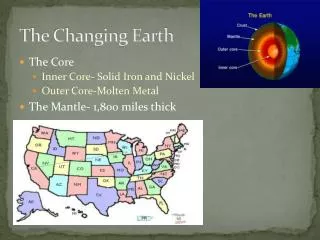
Wegener’s Basic Conclusions: • Continental rocks (sial – consisting of largely silicon and aluminum) are fundamentally different from oceanic rocks (sima – composed largely of silicon and magnesium). They are less dense, thicker, and less magnetized. The lighter sialic blocks (continents) float on a layer of fluid mantle. • The major landmasses were once united as a single supercontinent (which he called Pangaea). Pangaea broke into smaller continental blocks, which moved apart as they floated on the mantle. The breakup began in the Mesozoic Era. • The breakup began as a rift valley, which gradually widened into an ocean. The mid-oceanic ridges mark the places where the continents were once joined. • The continental blocks have retained their basic shape. • Rates of movement of the blocks range from 0.3 to 36 meters per year. • Radioactive heating in the mantle may be a cause of block movement, but other factors may be involved.
The Evidence Examination of the submarine contours of the continental shelves showed an even better fit for the existing continents. Topgraphic features (mountains, oceanic ridges, and island chains), rock strata, and fossil deposits were found to be aligned along Wegener’s hypothesized connections. Paleoclimatic evidence is also in line. For example, evidence of glacial movement corresponds to what would be predicted by the Wegener model. Paleontological evidence – Evidence indicates that Glossopteris (a fossil gymnosperm) was likely associated with glacial margins. Fossils of Glossopteris are consistent with Gondwanaland reconstructions. Disjunct distributions of some living taxa suggest an ancestral radiation across Gondwanaland.
Glacial movement as suggested by current distribution of Glossopteris fossils.
Glacial movement as suggested by Glossopteris fossils using a Gondwanaland reconstruction.
The disjunct distribution of the Southern temperate beetles of the tribe Megadopini of the family Carabidae…. …and fishes of the superfamily Galaxioidea, which are restricted to warm nontropical waters in the Southern Hemisphere.
Disjunct distribution of the plant family Proteaceae, found on all of the southern continents but barely reaching the Northern Hemisphere.
Disjunct distribution of the clawed aquatic frogs of the family Pipidae. The family is composed of two subfamilies, the Pipinae in tropical South America and the Xenopipinae in tropical Africa. This suggests an ancestor once distributed in western Gondwanaland.
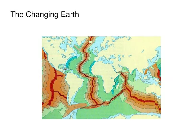
The global system of mid-ocean ridges, which are the sites of seafloor spreading.
The earth acts like a giant magnet. Latitudinal position can be read as declination in a compass needle. The same phenomenon influences the orientation of crystals during the formation of magnetically active rock. Such information can be used to reconstruct the positions of the continents at the time of rock formation.
Studies of paleomagnetism revealed shifts in the orientation and latitudinal position of Africa and Australia over the last 200 million years. The paleomagnetism seen in the rocks can only be explained as the result of these movements. movements
At the beginning of the 20th Century, Bernard Bruhnes discovered magnetic reversals when he found lavas in which the magnetic orientation was opposite that in newly formed lavas. This indicates reversals in the Earth’s magnetic field which occur a periods ranging from 10,000 to 1,000,000 years. These changes appear to result from changes in magma flows through the mantle. On the ocean floor, alternating patterns of normal and reversed magnetized basalt form “magnetic stripes”.
Marine geologists discovered that: • Basaltic rocks at the edge of the midocean ridge have normal field magnetic properties. • Widths of the magnetic stripes on opposite sides of the ridge are usually symmetrical, and the stripes are generally parallel to the axis of the midocean ridge. • The banding pattern of one ocean matches that of others.
The current model proposes that crustal blocks are moved about on the mantle. • Three forces have been suggested to drive the motion: • Ridge push, the force generated by molten rock rising through the mantle • Mantle drag, the tendency of the crust to ride the mantle because of friction. • Slab pull, the force generated by the subduction (downward flow) pulling the trailing crust behind it.
Currently, 16 major plates are recognized. They range in size from the relatively small Gorda Plate (about 750 km2) to the Pacific Plate (> 100 million km2). Rates of movement are also highly variable. Portions of the Pacific Plate move as rapidly as 5 cm per year. • Plate boundaries can take three basic forms: • Spreading zones. • Collision zones. • Transform zones.
Midoceanic ridges are the sites were two plates are drifting apart. Because of this, the age of islands tends to increase with increasing distance from the ridge.
Midocean ridges, however, are not the only locations where spreading is taking place. On continents, plates can also diverge at rift zones. Such areas have resulted in the formation of the Red Sea, Lake Baikal, and the East African Rift Valley.
The collision of the Indian Plate with the Eurasian Plate led to the uplift of the Himalayas. On the other sides of the plates, away from the spreading zone, the leading edge will typically collide with another plate. If they are of equal density, this will lead to uplift and mountain building.
More commonly, dense oceanic plates collide and sink beneath lighter continental plates to form a subduction zone. The result is a deep oceanic trench. Subduction zones are marked with parallel bands of earthquakes and volcanism near their active edges, and mountain ranges and accumulations of marine sediments, or terranes, which increase in age as we move upstream from the active zone.
The deepest spot in the world ocean, the Marianas Trench, is the result of such a subduction zone. The Challenger Deep in the Marianas Trench is 10,923 m below the ocean’s surface.
Terranes mark the locations of former subduction zones along the west coast of North America. These are accumulations of marine sediments, progressively older as we move inland.
The Earth’s Tectonic History These processes have been occurring throughout the earth’s history, and will continue to occur. The movement of the crustal plates has played a major role in the distribution of the earth’s organisms. By moving quickly through the next few slides, you can follow the movement of the continents from the Pre-Cambrian (some 660 ma) to the present day, and even a projection into the future.
Things to watch: Pangaea – a “supercontinent” which occupied 1/3 of the earth’s surface during the late Paleozoic and early Mesozoic (the best slide to look at is D (Earliest Triassic) Laurasia – the northern “half” of Pangaea made up of what would ultimate become North America, Europe, and northern Asia. Gondwanaland – the southern portion of Pangaea, which would become South America, Africa, Australia, and southern parts of Asia. Also note the separation of South America from Africa and that of North America from Europe. Watch the transition in Slides F - I. Read the discussion on the tectonic history of the continents (p. 256-262), and relate that to the diagrams on the following slides.