Download
1 / 30
300 likes | 448 Views
ESRM 250 Introduction to Geographic Information Systems in Forest Resources Peter Schiess Tue Thurs Classes: 2:30 - 3:20 MGH 231 Lab: 3:30 – 5:50 MGH 030. Why are you here?. hopefully. To learn as much about Geographic Information Systems (GIS) as you can in 1 quarter.

E N D
ESRM 250 Introduction to Geographic Information Systems in Forest Resources Peter Schiess Tue Thurs Classes: 2:30 - 3:20 MGH 231 Lab: 3:30 – 5:50 MGH 030
Why are you here? hopefully... To learn as much about Geographic Information Systems (GIS) as you can in 1 quarter
Note taking & printing… • Only take notes if you feel the need • All presented materials (slide shows, lecture notes, lesson notes) are on the web http://courses.washington.edu/gis250/ • If you must print lecture or lesson notes, wait until the last possible minute, because…… • Materials are always under development_
Why learn about GIS? • This is a “required” course • You want a job when you finish school • Your research will use GIS • GIS is the current standard for storage & analysis of environmental data _
Course objectives • Instructors • Getting help • Required skills – before you start • Course structure • Grading and evaluation • Disability? • Required media • Photos • Course web page_ • Course Sample Data Overview
Introduction to technical use of GIS • Use of current software & hardware • Use of real-world data sets • Understanding of GIS data sets • Understanding of GIS analysis • Ability to use GIS for solving problems • Limited treatment of cartographic skills (see Geog 360) • Limited treatment of analytical theory (see Geog 460)_ Course objectives
Peter Schiess – schiess@u.washington.edu • Akira Kato – akiran@u.washington.edu • PhD candidate, College of Forest Resources • Office Hours by appointment only (send e-mail) • for “nuts & bolts – Akira Kato • for general questions, use, application of GIS • – Peter Schiess Instructional team
Discussion Board on ePost Getting help
Getting Help • Send all technical & administrative questions to ePost • List will be read by instructors & students • Response will be to ePost, rather than individuals • Benefit to everyone!!! • Board is archived & available on the web • Use descriptive “Subject:” lines in your messages to keep archive readable
Required skills – before you start (by the end of week 1) • Basic familiarity with a word processor and spreadsheet • Comfortable with the Windows • hierarchical file structures and the Windows Explorer • Cut-and-paste images from applications to the word processor • Basic working knowledge of algebra, trigonometry, and coordinate geometry • Basic familiarity with maps and map reading
Required skills – before you start (by the end of week 1) • Account on one of the UW mail computers • Save a document in Adobe PDF format • Create Zip files with zip, WinZip, or PKZip • Unzip files with zip, WinZip, or PKZip • Use a Web browser, including file downloading • Basic computing skills courses are available at UW C&C
Paired lecture and lab sessions • Topics introduced in lecture are explored in lab sessions • Lab sessions are guided by detailed web pages • Labs exercises can be done in on any computer with ArcGIS 9, CD, USB, and web access • Periodic assignments (1 per week) • Short C/NC paper or project (for graduate credit only) Course structure
8 assignments through the quarter • Your answers will be saved as Acrobat PDF, zipped, and uploaded to Catalyst E-submit • Double-space all materials • Late assignments will not be accepted • Answer keys are posted as soon as all assignments are submitted through E-Submit • Cumulative grades are posted after each assignment is scored_ Assignments
Grades assigned by scores on assignments • Final grade = average score from assignments • No extra credit available • Grades are assigned in accordance with UW Grading Policy • Percent to GP calculation: • 50% = 0.7 • >95% = 4.0_ Grading and evaluation
Disability? • The University of Washington is committed to providing access, equal opportunity and reasonable accommodation in its services, programs, activities, education and employment for individuals with disabilities. For information or to request disability accommodation contact: Disabled Student Services (Seattle campus) at (206) 543-8924/V, (206) 543-8925/TTY, (206) 616-8379 (FAX), or e-mail at uwdss@u.washington.edu. If you have a letter from the Disability Services Office indicating you have a disability that requires academic accommodations, please present the letter to me so we can discuss the accommodations you might need for the class.
Required: • Access to computers running ArcGIS 9 • (not ArcView 3.x or ArcView 9) • Access to WWW • 1 recordable CD, with course data copied onto it • USB drives (pen drive or removable hard drive) • Recommended Reading • Chrisman, Nicholas. 1997. Exploring Geographic Information Systems. New York: John Wiley & Sons. 320 p. • Ormsby, Tim, Eileen Napoleon, Robert Burke, Laura Feaster, and Carolyn Groessl. 2004. Getting to Know ArcGIS Desktop, Second Edition. ESRI Press. To get the best price, order directly from Amazon.com or ESRI. ISBN: 1879102463_ Media
This course will use ArcGIS Version 9. The software is installed at various locations around the UW campus, but if you want to run the software at home, there are 4 options: • Option 1: Use ArcGIS on computers at the UW_ Software (4 options)
Option 2: ArcGIS ArcView 9 with extensions • 1 year license $100 • Full-time and part-time students • one-year time-out copy of ArcView 9 with ArcGIS Spatial Analyst, ArcGIS 3D Analyst, and ArcGIS Geostatistical Analyst. • Does not include data sets, hardcopy books, or technical support, which should be available to them through their course work, online, or on the media CDs (PDFs of books). Software (4 options)
Option 3: ArcGIS ArcView 9 without extensions • Single Use License $250 • ESRI provides full-time and part-time students an option to purchase ArcGIS 9 or ArcView 3.3 at a one-time cost of $250. • Extensions are sold separately at an addition $150 each. • Includes data sets and hardcopy books. • This license does not time-out • Software (4 options)
Option 4: ArcGIS 9 Workbook • 180-day Trial version • Students purchase Getting to Know ArcGIS Desktop, a workbook that includes a 180-day trial version of ArcGIS 9 on CD and a data CD for exercises • ~ $40 • Available online through ESRI, Amazon.com, or another book store. • WARNING: Not tested by instructors_ • Software (4 options)
To make a purchase of software, call ESRI Telebusiness at 1-800-447-9778._ • Software purchasing
Photos • Photos will be submitted with your first assignment • Photos will be password protected • Photo will not be posted by request • Will allow us to get to know each other by face and name • Links to e-mail addresses and home pages • Also password protected
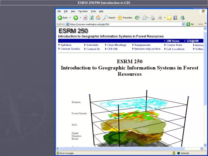
Course WWW Page • http://courses.washington.edu/gis250/
Course Sample Data • Course CD contains • Pack Forest data • ESRI Data • Sample ArcView 3.x extensions • Ghostscript/Ghostview • UN*X-like utilities
Course Sample Data • Pack Forest GIS database • Complete set of spatial data for the UW’s Experimental Forest • Original data sources • Legacy maps • USGS digital line graphs • DNR data • GPS surveys • Digital orthophoto interpretation_
Forest stands Streams Roads, trails Soils Elevation contours Culverts Forest inventory data Digital orthophotos Digital elevation model and more … Course Sample Data • Pack Forest GIS database • CD directory packgis
Course Sample Data • Pack Forest GIS database projection & coordinate definition • Unless otherwise specified, • Projection: STATEPLANE Washington South Zone (State Plane 5626 or FIPS Zone 4602) • Datum: HPGN (a.k.a. NAD83/91) • Units: FEET • Spheroid: GRS1980_
Worldwide data sets cities countries major lakes major rivers United States data states counties cities rivers roads Canada Mexico_ Course Sample Data • ESRI Sample Data • CD directory esridata