Download
1 / 17
170 likes | 363 Views
Sub-Saharan African Geography. West, Central, East, South Africa (not North Africa – which has a Mediterranean Culture and influence). How big is Africa?. African Geography - Vegetation. North Africa. West Africa - Geography. West Africa – Important geographic features.

E N D
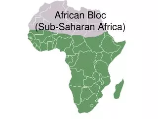
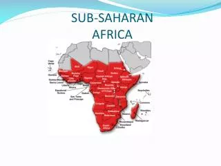
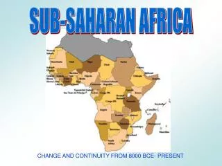
Sub-Saharan African Geography • West, Central, East, South Africa (not North Africa – which has a Mediterranean Culture and influence)
West Africa – Important geographic features • Sahel – savannas (grasslands) with diverse animal population • Niger River – river that at parts is non-navigable, will be home to main Western African classical cities like Timbuktu, mouth of the river is a delta where today much oil is produced • Forests - by the coasts • Climate – tropical • Natural Resources: Salt, Gold, Oil • Few geographic barriers allow for large empires to develop
East Africa – Important geographic features • Ethiopian Highlands and Ahmar Mountains – isolates coastline from inland, independent city states develop instead of unified large empires, difficult planting – unfertile soil, cause Nile River to exist • Indian Ocean and Red Sea – coastal trade and cultural diffusion comes from the east and other Indian Ocean cultures, postclassical trade occurs with Arabian Peninsula directly and indirectly with India, Southeast Asia and even China, city-states are rich because of this trading • White Nile and Blue Nile Rivers - connects Interior East Africa (Nubia, Sudan, etc.) with Egypt and North Africa • Climate – Tropical - Monsoons – affect directional trading because of winds, Postclassical East Africa could trade with Arabian Peninsula up to city-state Kilwa (and later the island of Zanzibar as technology increased) in 1 monsoon season, On highlands weather is cooler
Central Africa – Important geographic features • Jungle (Congo) – few people live in jungle and those who do are not exposed to much cultural diffusion, it is a cultural barrier between East and West Africa, and West and Southern Africa • Congo River – non-navigable river • Climate – tropical
Southern Africa – stronger connection with East Africa than West Africa • Rivers: Zambeizi, Limpopo, Orange – populations can be supported with food, too far away for 1 monsoon season of trade with Arabian Peninsula and India • Kalahari Desert, Victorian Falls, Cape of Good Hope (Connects Atlantic and Indian Oceans), Drakensberg Mountains – barriers make unifying to large empires difficult so small kingdoms and city-states emerge • Climate: Mediterranean • Natural Resources: Gold, Diamonds