Download
1 / 32
330 likes | 483 Views
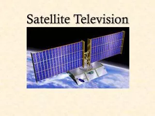
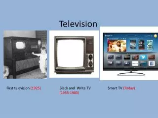
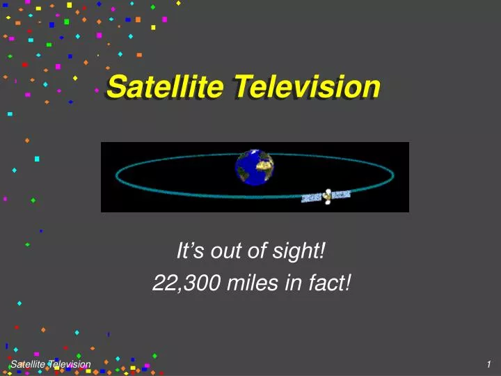
Satellite Television. It’s out of sight! 22,300 miles in fact!. From How Stuff Works. 20 + Commercial Satellites. In Geo-Stationary Orbit 22,300 miles away.... All in a band over the Equator They have a revolution of once per day. Just like us!... That makes them geo-stationary.

E N D
Satellite Television It’s out of sight! 22,300 miles in fact!
20 + Commercial Satellites • In Geo-Stationary Orbit 22,300 miles away.... • All in a band over the Equator • They have a revolution of once per day. • Just like us!... That makes them geo-stationary. • They have a useful life of 10 years.
Forces at work • A satellite spins around the planet • What holds these satellites in place ? • Gravity will try to pull the mass back to earth • The force of a centrifuge pushes the satellite out into space ..
Geo-stationary Orbits • The force of gravity, Fg, is equal to • The centripetal force, Fc • AT 22,300 miles, Fg = Fc if the velocity is one revolution per day ! • This was first proposed byArthur C. Clarke...
The Clarke Belt • These satellites appear to be in the same position in the sky at all times. • They are directly over the equator but not directly over us. • They are in a line that starts 14 degrees above our Western Horizon. • And rises to 42 degrees elevation in the South
Original figure from Clarke's article in the October 1945 edition of Wireless World
Elevation and Azimuth • The Elevation is the number of degrees above the horizontal... • The Azimuth is a degree reading with North being 0 and 360 degrees, East being 90, South at 180, and West at 270. • Degree readings are allways ‘True’ and not ‘Magnetic’
Uplink antenna Elevation and Azimuth are adjusted to point to the satellite
24 Channels on a Satellite • Numbered 1 to 24 • Odd Number Channels are often Vertically Polarized... • Even Number Channels are often Horizontally Polarized. • The antenna must line up with the polarization..
C Band and Ku Band • The C Band uses 4 GHz for the down link and 6 GHz for the up link. • The Ku Band uses 12 GHz for the down link and 14 GHz for the up link. • A ground station monitors each satellite 24 hours a day. • Friction tends to move them from their orbit ! (Magnetic friction..)
A ‘downlink’ Much less expensive than the uplink ..
Analog vs Digital • The largest commercial system is an Analog system, subject to noise and signal strength. • The newer Digital dishes can easily remove the nose and can produce crystal clear pictures with weak signals. • The Digital dishes are smaller..
A digital dish .. MPEG2 is used as a format for the data stream ..
A satellite uses 300 Watts • Which must come from solar power • This power is distributed over 24 small transmitters... • The surface area of the US is 3,000,000 Square Miles. • That’s 100 Micro Watts per square mile • But only 5 Micro Watts per channel...
The signals are very very weak. • A large ‘dish’ is used to focus the power received onto a small 1.5 CM antenna.. • A 12 Foot dish, has an area of Pi X R2 or 108 Sq Feet. • Calculate the power the dish receives from a 300 Watt Satellite....
An 18” Digital Dish... • Has a much smaller surface area • Receives a much smaller amount of power... • But delivers a better signal due to the cleanliness of ‘bits’ !
Satellite ‘Sighting’ • We point the dish at specific azimuths and elevations to find a satellite. • From 14 Degrees Elevation and 270 Degrees Azimuth (W) • To 42 Degrees Elevation and 180 Degrees Azimuth (S) • A set of tables lets us find the data for a particular satellite.
Latitude and Longitude • Binghamton... • Is at 70 Degrees E Longitude and 42 Degrees N Latitude • East of Grenich, and North of the Equator • The calculations for finding a satellite 22,300 miles over the equator are complex
A recent copy of ORBIT • Shows us the longitude of the various satellites. • They are spaced 3 to 6 degrees apart • Their longitude, entered into an equation gives us Elevation and Azimuth.
The Satellite RECEIVER • The signal is collected by the ‘dish’ • Focused on the ‘Feed Horn’ Assembly • Amplified by a Low Noise Amplifier • Converted to a much lower frequency • Carried by shielded cable to the receiver • And delivered to your TV set..
The ‘Polarotor’ • A small motor turns the antenna to accomodate the ‘polarization’ of the signal. • The ‘plane’ of the signal ‘skews’ as we point the dish to the west • The ‘polarotor’ must compensate for this skew
Satellites • Are also used for ‘Pager Service’ • Cellular Telephone • Other types of communication including the monitoring of vehicles like Federal Express • Global Positioning ( GPS)